DOWNLOAD MY NEW FREE JOESTRADAMUS WEATHER APP FOR ALL DEVICES
THE APP IS ABSOLUTELY FREE TO ALL BUT CONSIDERING SUBSCRIBING TO PATREON FOR A WEATHER EXPERIENCE FREE OF ADS, EXCLUSIVE VIDEOS FOR MEMBERS ONLY AND MUCH MORE…STARTS AT $2 A MONTH..MESSAGE ME AT ANY TIME
Gusty Winds Clouds Saturday Clouds Chilly Rain Sunday

We are done with yesterday’s rains which wound up being rather substantial on the order of an inch to an inch and a half in most places. This has turned into a very active month from the standpoint of thunderstorms in the Northeast and specifically for our area from Eastern Pennsylvania to Southern New England. Having 2 lines of thunderstorms coming directly into a marine layer usually causes those storms to weaken. The second line did as they moved across New Jersey but then fired up again once offshore and those impacted Long Island and Connecticut. That storm system is up in Eastern Canada churning away with this morning with the cold front offshore. Gusty winds have taken over and so will cloud cover as they are swinging down from the north.
SATELLITE

REGIONAL RADAR

Upstate NY is seeing some rain and some snow on the backside of this low as heavy rains today move through Eastern Maine. An isolated shower can’t be ruled out this afternoon as an upper trough swings by. Temperatures are in the 50s to near 60 for highs this afternoon. We should clear out this evening before clouds roll in late tonight as the next storm system moves in from the Midwest. That low is actually producing snow for places like Milwaukee, Chicago, and Detroit today and tonight. Rare April Winter Storm Warnings are posted for some areas in the Great Lakes.
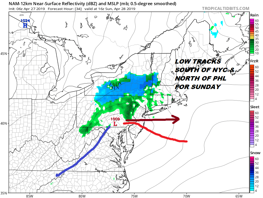
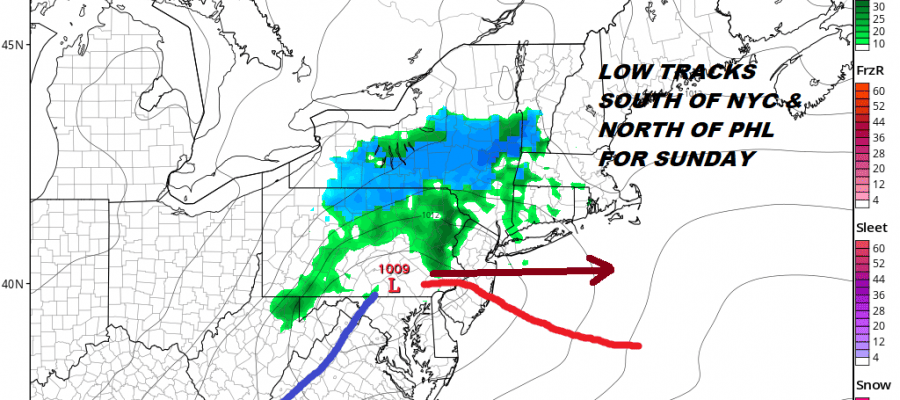
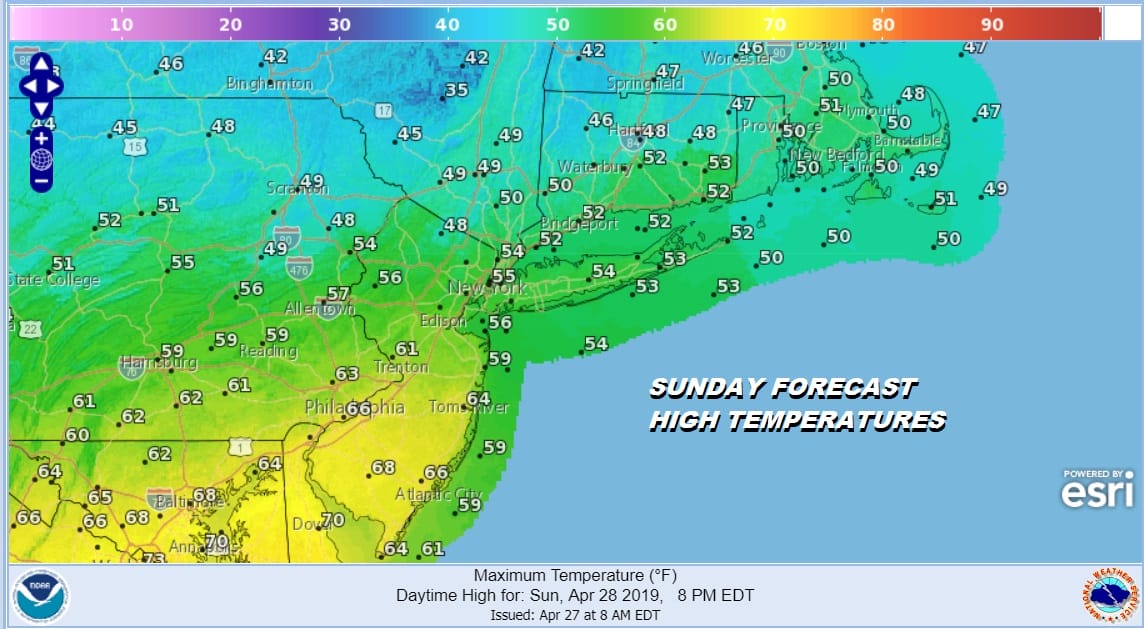
Sunday this weak low tracks across Southern Pennsylvania and then heads across New Jersey to just offshore south of Long Island. This makes the temperature forecast difficult because to the south of the low track which conceivably could be Central, South Jersey, Southeast Pennsylvania, temperatures could reach into the 60s with clouds and some breaks of sun. To the north of the low track it will be cloudy and dreary with a period of rain from mid morning to mid afternoon. Highs there will reach into just the lower 50s and while it is raining it will be in the 40s.
The low moves out late Sunday afternoon and we could clear out rather quickly from west to east late in the day. That sets up for a chilly night into Monday morning with lows in the 30s to lower 40s. Monday may be the one day this coming week where we have little to worry about with sunshine and some late day arriving clouds. Highs Monday will be in the 50s to near 60.

By Monday night however we will be in clouds with another frontal boundary setting up to our south across Northern Maryland and the Delmarva peninsula. That boundary will be there much of this week occasionally buckling northward as lows approach only to drop southward again as lows go by. Later Monday night into Tuesday we look for some showers and in fact it is likely that we will see chances for showers Tuesday through Friday though it doesn’t rain all the time. When it is not raining we will likely have lots of clouds with temperatures are going to be in the 50s and 60s at best. Sunshine is going to be rather limited next week until we can get this mess out of here and that may not happen unttil Friday!
MANY THANKS TO TROPICAL TIDBITS FOR THE USE OF MAPS
Please note that with regards to any tropical storms or hurricanes, should a storm be threatening, please consult your local National Weather Service office or your local government officials about what action you should be taking to protect life and property.


