Great Weekend Ahead No Rain Until Wednesday Tropical Storm Watch South Florida

Weather in 5/Joe & Joe Weather Show Latest Podcast
Great Weekend Ahead No Rain Until Wednesday Tropical Storm Watch South Florida
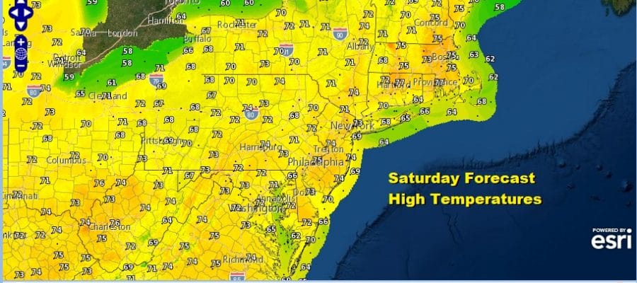
This is about as nice a stretch of weather as you can get this time of year. It is certainly nice payback for the two weeks of misery we had during October. Other than a few areas waking up to some low clouds and a little fog, for the vast majority of the time and for the vast majority of people it is a day of lots of sunshine and highs reaching the low and middle 70s.
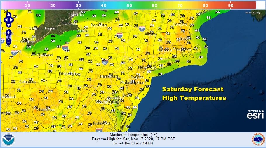
Many areas could see temperatures approach record highs today. What keeps things pleasant is the west wind and the means dew points won’t get high enough where you get that sticky feeling. The satellite is virtually cloud free in the Northeast and Middle Atlantic states and we could see cloud free conditions all day long, a rarity in these parts. Radars obviously have nothing to do for the next several days.
SATELLITE

REGIONAL RADAR

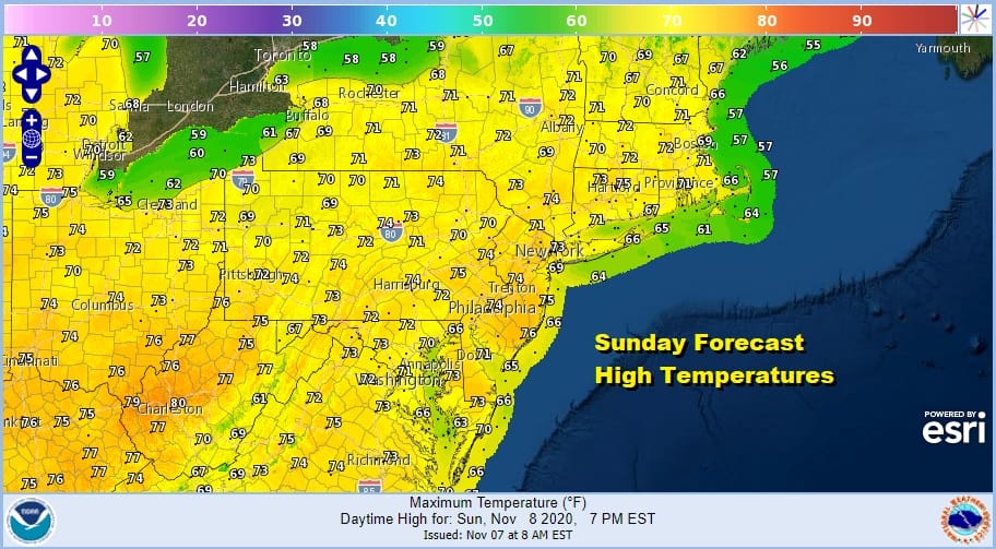
Not much happens tonight with clear skies unless we see some low clouds and fog develop in some areas. Most lows will be in the 40s inland and 50s coast and warmer urban centers. Sunday is a repeat performance of today. Lots of sunshine with highs in the low to mid 70s, and we will see a chance for record highs in some places.
It appears that we will carry this along for one more day as Monday looks to be another day of lots of sunshine, a minimal ocean wind and highs in the low to mid 70s. High pressure is in a much better place now centered to the south of us and inland across the Mid Atlantic states. This not only cuts off the marine layer but it keeps us in a dry west wind. That changes next Tuesday as the high move out to the east and we turn the wind to south and southeast.
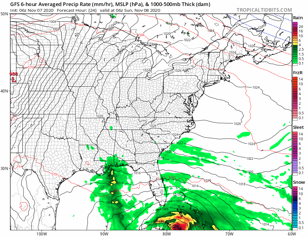
That means the high gets “dirty” as the air stagnates. We also have a cold front approaching and we have moisture from what should be Tropical Storm Eta moving up the coast. Look for clouds to increase on Tuesday and we will see our first rain in over week on Wednesday. This could be a solid rain producer of a couple of inches provided enough tropical moisture gets involved.
TROPICAL STORM WATCHES FOR SOUTH FLORIDA

During the day we will see Tropical Depression Eta strengthen to a tropical storm. Tropical Storm Watches are posted for a large area of coastline in South Florida on both the east and west coast.
Sebastian Inlet southward around the Florida peninsula to Bonita Beach including Lake Okeechobee, Florida Keys, and Florida Bay.

Eta is tilted to one side because of strong southwest winds aloft producing about 20 to 30 knots of wind shear. The somewhat hostile environment aloft is offset by warm Caribbean Waters. Eta should eventually become a high end tropical storm as it spreads heavy rain and gales across South Florida during Sunday.
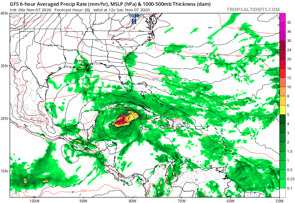
Rain will be the big issue here as this is going to be a slow moving long duration event. If you follow the loop of the latest GFS, Eta will turn northward up the West Coast of Florida next week at a slow methodical pace.
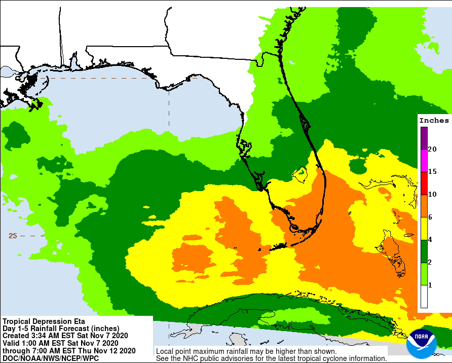
Rainfall of 5 to 10 inches at least will be commonplace in South Florida inside the tropical storm watch area. Amounts may need to be increased in areas north of there should Eta become a bit stronger or the amount of tropical moisture is underestimated (and it often is).
BE SURE TO DOWNLOAD THE FREE METEOROLOGIST JOE CIOFFI WEATHER APP &
ANGRY BEN’S FREE WEATHER APP “THE ANGRY WEATHERMAN!
MANY THANKS TO TROPICAL TIDBITS FOR THE USE OF MAPS
Please note that with regards to any severe weather, tropical storms, or hurricanes, should a storm be threatening, please consult your local National Weather Service office or your local government officials about what action you should be taking to protect life and property.


