Great Lakes Storm Moving East Showers Mild
Great Lakes Storm Moving East Showers Mild
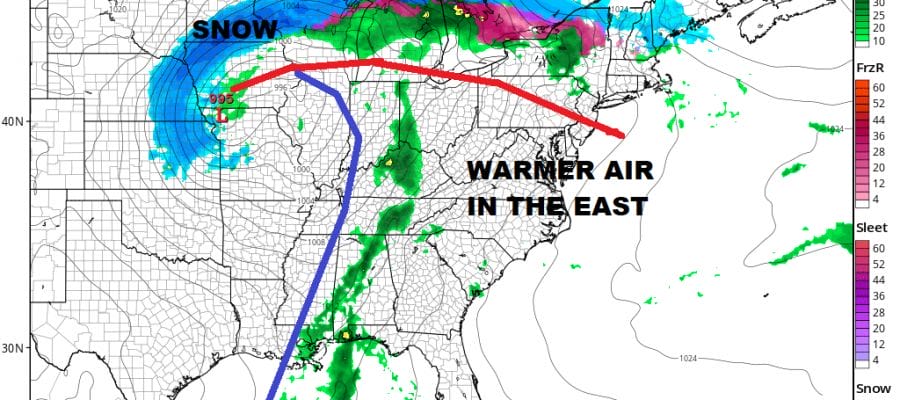
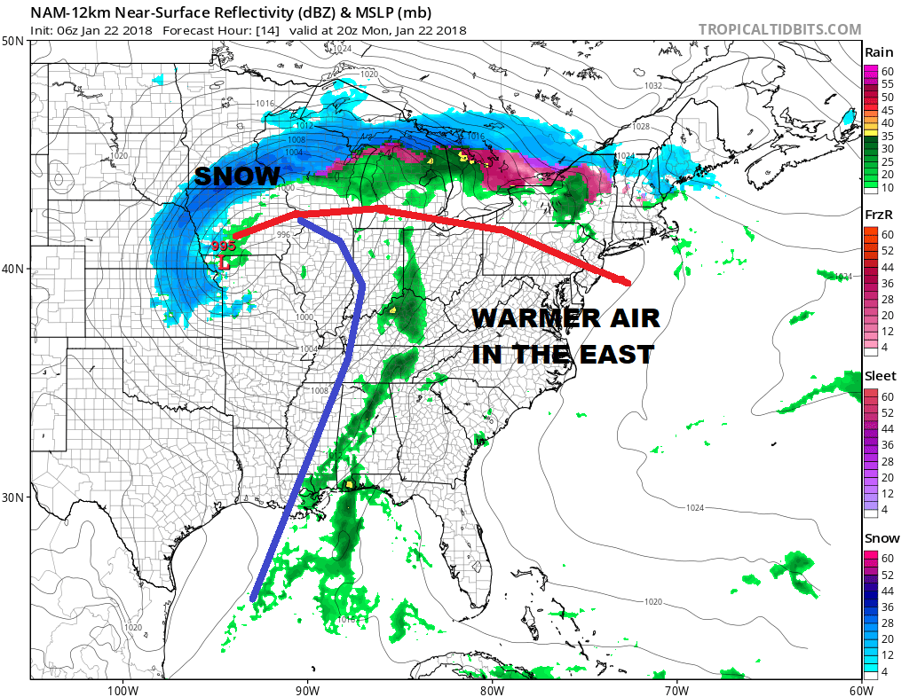
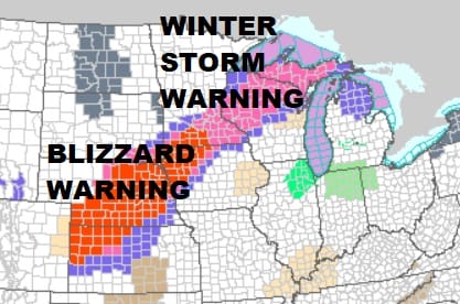
We are seeing a storm this morning moving out of the Central Plains and heading for the Great Lakes. We still have a slew of Blizzard Warnings and Winter Storm Warnings from Kansas to Wisconsin. This storm track attempts to bring warmer air into the Eastern US.
The storm is evident by the large comma shaped swirl on the US satellite picture this morning. Clouds ahead of the warm front are socked in over us and we do see some scattered showers moving through on the radar. This will be the story today with occasional showers passing through from time to time and from place to place with most highs in the 40s.
US SATELLITE

REGIONAL RADAR

LOCAL RADAR NEW YORK CITY

LOCAL RADAR PHILADELPHIA


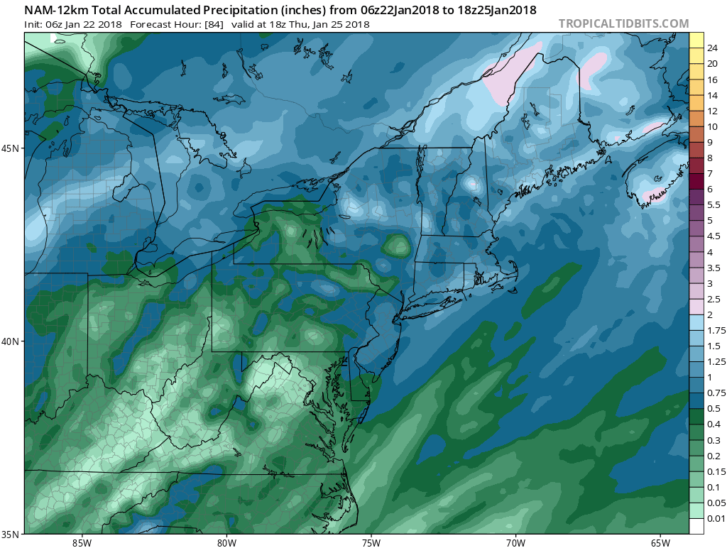
Some more scattered showers are likely tonight and then showers will become more numerous late tonight into Tuesday afternoon. Temperatures overnight will hold in the 40s in most places and we should reach into the 50s Tuesday. Rainfall amounts in general will be on the order of 1/2 and inch to an inch in some places.
GREAT LAKES STORM NAM RAINFALL AMOUNTS
Rain should end later in the Tuesday and then colder dry air arrives for the rest of the week with sunshine and near seasonal temperatures.
Clues continue to appear in the long range suggesting that this pattern breakdown we have seen is only temporary and that a colder wintry pattern will return in February at some point. We will examine the long range possibilities later today.
 GET JOE A CIGAR IF YOU LIKE

FiOS1 News Weather Forecast For Long Island
FiOS1 News Weather Forecast For New Jersey
FiOS1 News Weather Forecast For Hudson Valley


