ONSHORE FLOW CLOUDS CONTINUE TODAY INTO TUESDAY
WARM FRONT COLD FRONT BRINGS SHOWERS THUNDERSTORMS
TUESDAY NIGHT/WEDNESDAY
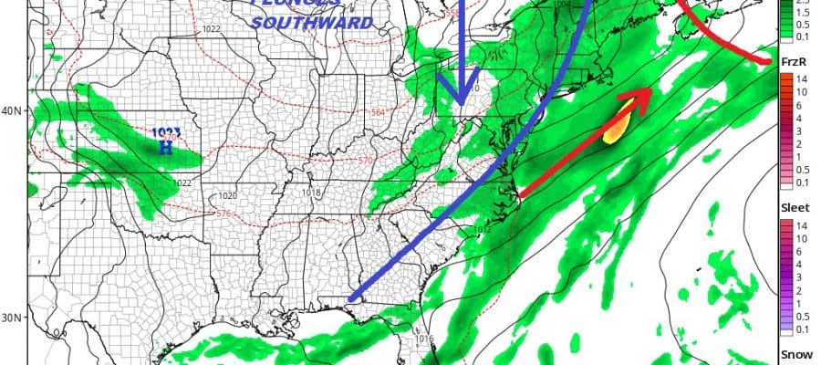
DRY COOLER CANADIAN AIR ARRIVES WEDNESDAY NIGHT THROUGH SATURDAY
We went to bed last night with an onshore flow and clouds and we wake up this morning to an onshore flow and clouds. Skies could brighten up today in some places and not in others especially at the coast where clouds cold tend to be rather stubborn.Temperatures could move into the 70s for highs. Saturday’s cold front is stalled out across Virginia/North Carolina where we are seeing showers and thunderstorms blossoming out on the radar.
EASTERN SATELLITE

REGIONAL RADAR

Yesterday we did see some showers develop during the afternoon in a few places. The rain was mostly light. It is possible that we could see a patch or two of rain or just drizzle show up on the radar later on but if it happens it should not last long.
LOCAL RADAR NEW YORK CITY

LOCAL RADAR PHILADELPHIA


Tuesday we will continue with an ocean flow and now a warm front to the south starts to move northward. Temperatures and humidity are likely to rise somewhat as the warm front approaches. Though no showers are forecast during the day, some will likely arrive Tuesday night as the warm front attempts to make a pass through. Temperatures Tuesday will be in the 70s to near 80..
Great Hair Weather Arrives Later This Week
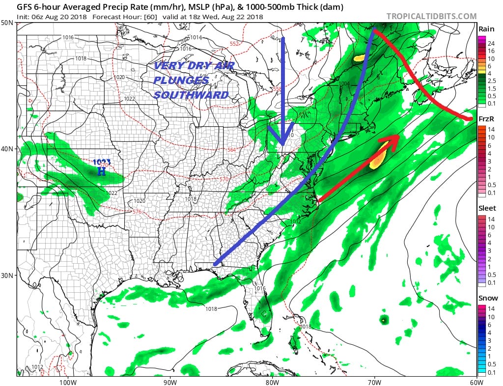
The cold front comes through on Wednesday with showers thunderstorms and temperatures into the 80s but then behind the front comes a robust cool dry Canadian air mass that will be with us Thursday through Saturday.
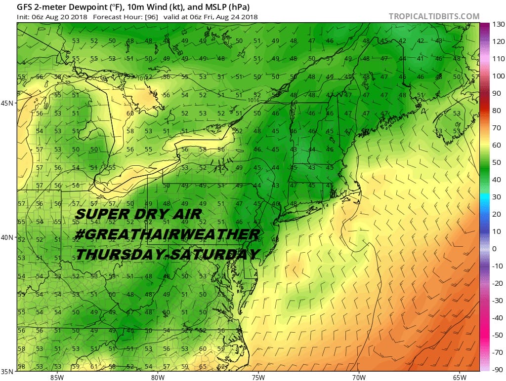
Sunshine returns Thursday and look for a big plunge in the dew points which will drop into the 40s by Friday morning. This means relative humidity levels will be very low and the comfortable conditions Thursday through Saturday. Humidity may start to climb on Sunday but we will deal with that when we get there. #Greathairweather returns.
MANY THANKS TO TROPICAL TIDBITS FOR THE USE OF MAPS
Last night’s You Tube Livestream focused on Hurricane Lane & the threat to Hawaii & the long range outlook for our weather.
Please note that with regards to any tropical storms or hurricanes, should a storm be threatening, please consult your local National Weather Service office or your local government officials about what action you should be taking to protect life and property.
LATEST JOESTRADAMUS ON THE LONG RANGE


