Gloom & Doom Rain Chance For Thunderstorms Tonight, Better Day Sunday
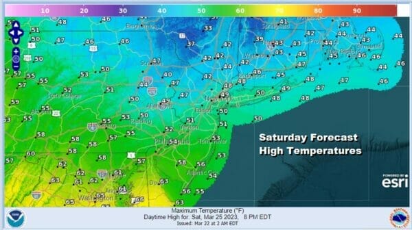
Our Saturday of gloom and doom continues this afternoon. We have seen the rain spread northward and some areas did see some sleet this morning thanks to colder air aloft. Now it is about the warm front to the south which will try to move northward but it may not have much in the way of success. Temperatures in Southern New Jersey, Southern Pennsylvania, and points southward might make it well into the 50s and even some lower 60s but that may not happen until late today into this evening. To the north from NYC North and Northeast we will stay in the 40s this afternoon and then perhaps edge up a bit tonight. A cold front will move through overnight and there could be showers and perhaps a thunderstorm as it goes by.
SATELLITE

WEATHER RADAR

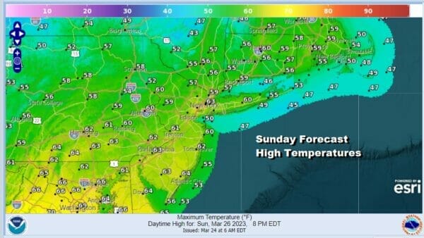
Once the front passes later tonight we should see improving weather conditions toward morning with lows in the 40s. Sunday will definitely be a much better day. It will be a bit on the breezy side but we should see increasing amounts of sunshine. It will also be on the warm side with most highs in the upper 50s and lower 60s. No rain is forecast for Sunday.
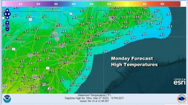
Looking ahead to next week we have a couple of weather systems to deal with and they look to be on the weak side. Low pressure will move across the Ohio Valley Monday and then redevelop offshore Monday night into Tuesday morning. The dayside Monday we will see sunshine giving way to some arriving clouds.will develope in Eastern Pennsylvania and points south in the afternoon and will spread to the coast late in the day or certinaly by evening. Highs will be in the 50s
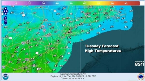
There could be some rain Monday night into Tuesday morning. There isn’t much room for this system to develop so we aren’t too concerned about any surprises. Skies will be cloudy through the dayside Tuesday and most highs will be in the low to mid 50s. Rainfall amounts will be about a quarter of an inch or so in most places.
A second low will move across the Lower Ohio Valley and also redevelop offshore. This system also will be on the weak side. Clouds will be around Tuesday night and Wednesday and there is the chance for a period of rain though there is a chance we might see the bulk of the rain passing to the south. Highs will be in the low to mid 50s.
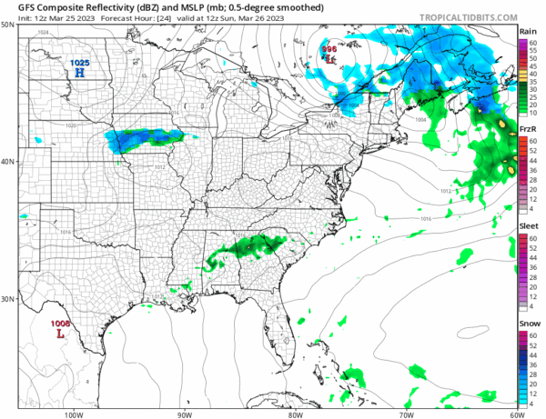
The GFS shows both system Timing is a bit of an issue for both these system as the GFS model is faster than the others. I leaned toward the GFS faster speed but slowed it down a bit in the forecast outlook. Also note both systems are rather closet to each other and that there doesn’t seem to be much room for either system to develop into something meaningful. Weather conditions might actually improve Wednesday with returning sunshine and highs in the 50. Thursday and Friday look nice dry and seasonal.
BE SURE TO DOWNLOAD THE FREE METEOROLOGIST JOE CIOFFI WEATHER APP &
ANGRY BEN’S FREE WEATHER APP “THE ANGRY WEATHERMAN!
MANY THANKS TO TROPICAL TIDBITS & F5 WEATHER FOR THE USE OF MAPS
Please note that with regards to any severe weather, tropical storms, or hurricanes, should a storm be threatening, please consult your local National Weather Service office or your local government officials about what action you should be taking to protect life and property.