
Gloom & Doom Lingers, Sunshine Friday,
Major Storm Develops Over the Weekend, Rain Thunderstorms & Wind

Gloom & Doom Lingers, Sunshine Friday,
Major Storm Develops Over the Weekend, Rain Thunderstorms & Wind
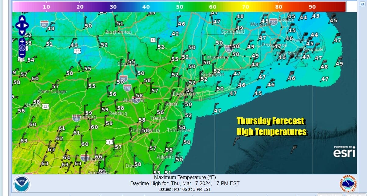
The storm system that brought heavy rain yesterday and last night is sitting off the coast of New Jersey and south of Long Island and crawling east north eastward. Most of the rain has shifted northward into New England but we still will have lots of clouds to deal with today thanks to the onshore flow. We will need to wait for winds to shift to the north in order to scour out the bottom of the atmosphere. In the meantime it is a gloom and doom type of day with lots of clouds and the chance for some leftover light rain or drizzle. Temperatures will be in the low to mid 50s for highs.
SATELLITE WITH LIGHTNING STRIKES

WEATHER RADAR

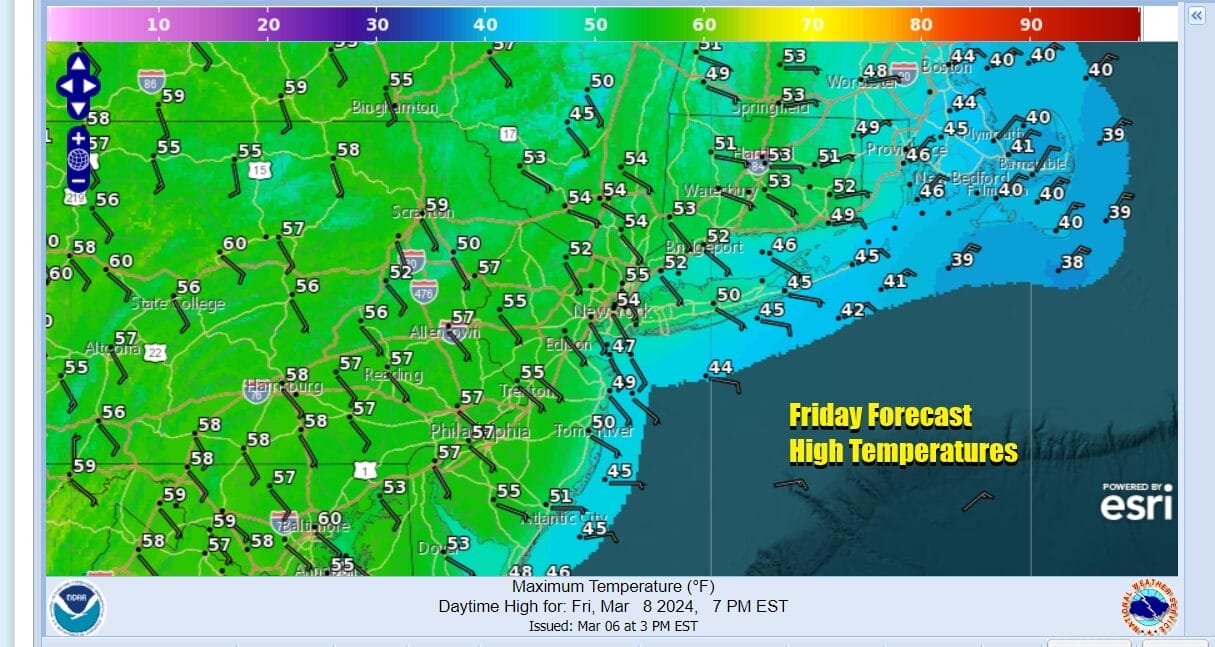
We will finally see some real improvement tonight across much of the Northern Mid Atlantic states to Southern New England as skies finally clear out tonight. Most lows will be in the 30s coast with some 20s in colder inland areas. Friday will be a nice day with sunshine from start to finish. Friday highs will reach the 50s in most places. Finally a dry day to prove to us that the sun is still there.
We have seen 3 storms in the last 6 days and the ground is saturated. Most areas have seen anywhere from 4 to 6 inches of rain from these storms. We have yet another storm system to deal with for the weekend. California energy moves into the Southern Plains today where a low develops. This low will gain a head of steam tonight and Friday as it heads northeastward. Severe weather will be an issue across the Southern Plains and Texas today and along the Central Gulf Coast Friday.

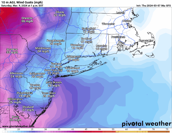
This storm system heads for the Great Lakes Friday night and Saturday and will eventually redevelop in the Gulf of Maine Sunday. Rain and thunderstorms will sweep eastward from the Ohio Valley and Deep South to the East Coast Saturday, though the rain for Eastern Pennsylvania to Southern New England holds off until late in the Saturday into Saturday evening. Winds will be picking up Saturday up and highs will be in the 50s

Saturday night will be rough with strengthening winds and heavy rains up and down the East Coast. Severe weather will spread across much of the Southern Mid Atlantic & Southeast States with elevated tornado risk. We could see a thunderstorm or 2 in the mix before the front passes offshore Sunday morning. Winds could gust to 40 mph or so ahead of the front Saturday night.
Later Sunday as the storm reforms in the Gulf of Maine and strengthens into a major storm, Winds will become an issue. While weather conditions should improve Sunday winds will be picking up and become strong northwest Sunday night and lasting probably into Tuesday of next week. 40 mph wind gusts will be common and we would expect wind advisories to go up. Temperatures will be in the 40s to near 50 Sunday. One piece of good news is that this storm system is the last one of the latest series and we should see drier conditions develop Sunday and last through much of next week.
BE SURE TO DOWNLOAD THE FREE METEOROLOGIST JOE CIOFFI WEATHER APP &
ANGRY BEN’S FREE WEATHER APP “THE ANGRY WEATHERMAN!
MANY THANKS TO TROPICAL TIDBITS FOR THE USE OF MAPS
Please note that with regards to any severe weather, tropical storms, or hurricanes, should a storm be threatening, please consult your local National Weather Service office or your local government officials about what action you should be taking to protect life and property.
(Amazon is an affilate of Meteorologist Joe Cioffi & earns commissions on sales.)


