Cold Front Brings More Rain Late Saturday Into Sunday,
Strong Winds Follow Sunday Night Into Tuesday

Cold Front Brings More Rain Late Saturday Into Sunday,
Strong Winds Follow Sunday Night Into Tuesday
Before we deal with the 4th and final storm system in the latest 8 day parade of storms, we actually have a nice day to finish off what has been a gloom and doom week. The storm system offshore is moving away and to the west we begin to see the clouds of the weather system for the weekend. At least today it is nice and dry with some sunshine and highs that will reach the 50s in most places. Radars are nice and quiet with no precipitation forecast for Eastern Pennsylvania to Southern New England through Saturday dayside.
SATELLITE WITH LIGHTNING STRIKES

WEATHER RADAR

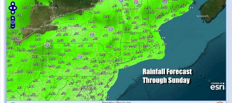
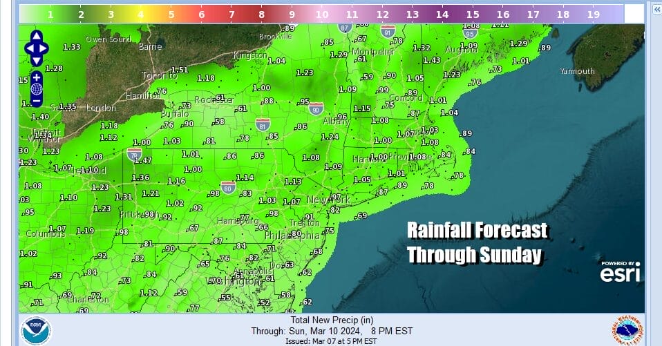
The next low is coming out of the Southern Plains and headed for the Great Lakes. A strong flow from the Gulf of Mexico sets up for severe weather across much of the Deep South today with elevated tornado risk as well as flooding risks for heavy rain. The risk area shifts to the Southern Mid Atlantic and Southeast to Florida Saturday as the storm continues its move to the Saint Lawrence Valley. The trailing cold front will sweep through the Eastern States and we will see heavy rain and thunderstorms as the front passes.

Fortunately this is a fast moving front so we are talking about 8 to 10 hours of rain. This will limit the amount of rain to 3/4 inch to an inch or so. The 4 storm systems over the last 8 days have produced nearly double the normal rainfall for the entire month of March and we have only gone through the first ten days!
We do not expect wind to be a big issue ahead of the front though we could see gusts of 20 to 30 mph from the south. The real test as far as wind goes will come late Sunday on the backside of the storm. The pressure gradient will tighten considerably Sunday night and northwest winds will increase to 20 to 30 mph with gusts over 40 mph Sunday night and during the day Monday. We expect to see wind advisories go up for much of the Northeast and Northern Mid Atlantic.

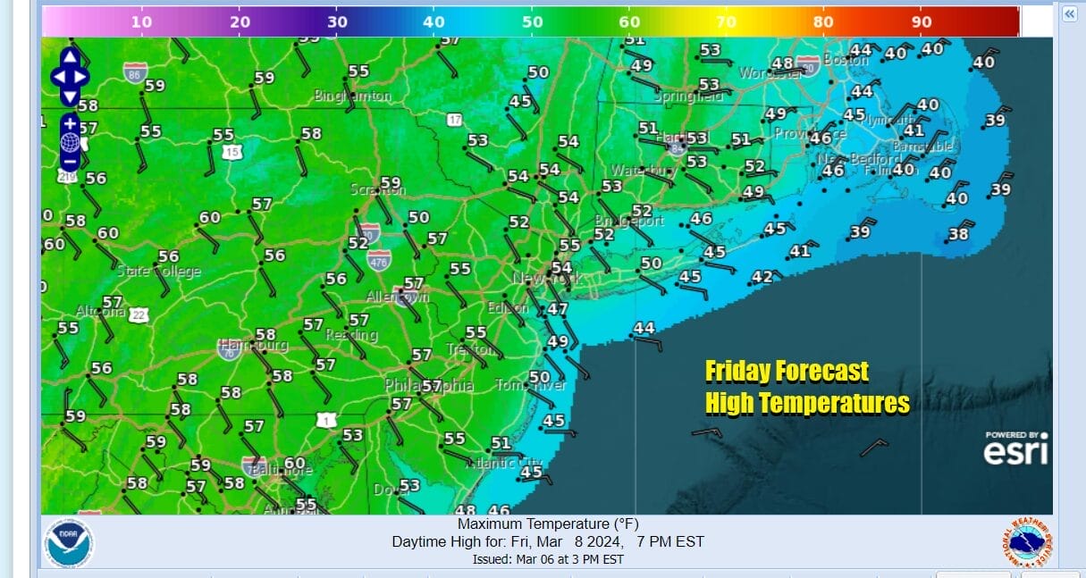
Sunday we will see leftover clouds with temperatures hovering in the mid 40s to lower 50s from north to south. Skies should partially clear out at night with most lows in the low to mid 30s. Monday will be windy and chilly with temperatures in the 40s to around 50. Look for clouds and some sunshine. Windy conditions will last into Tuesday before we see the winds ease. Next week overall looks to be dry through at least Thursday.
BE SURE TO DOWNLOAD THE FREE METEOROLOGIST JOE CIOFFI WEATHER APP &
ANGRY BEN’S FREE WEATHER APP “THE ANGRY WEATHERMAN!
MANY THANKS TO TROPICAL TIDBITS FOR THE USE OF MAPS
Please note that with regards to any severe weather, tropical storms, or hurricanes, should a storm be threatening, please consult your local National Weather Service office or your local government officials about what action you should be taking to protect life and property.
(Amazon is an affilate of Meteorologist Joe Cioffi & earns commissions on sales.)


