Flood Watch Heavy Rain Late Today Into Tonight,
Howling March Winds Develop Sunday & Monday

Flood Watch Heavy Rain Late Today Into Tonight,
Howling March Winds Develop Sunday & Monday
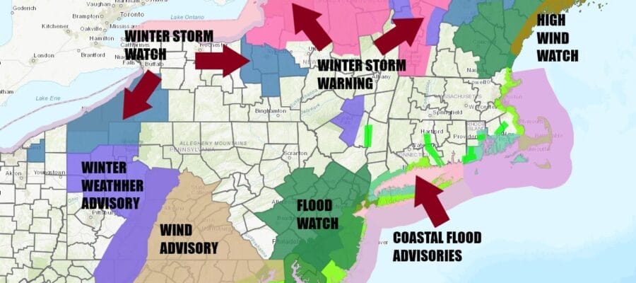
The watches warnings and advisories map looks like a Christmas tree today and there will likely be some additions to this map later today and tonight. Flood Watches are up for Eastern Pennsylvania, much of New Jersey and a small portion of the Hudson Valley. We have Coastal flood advisories and coastal flood watches up for the coast from Eastern New England to Southern New England, Long Island, New Jersey to Delaware and the Delmarva Peninsula. Elevation driven snow as well as lake effect snows have seen Winter Storm Watches and Warnings go up for Northern New York and Northern New England.
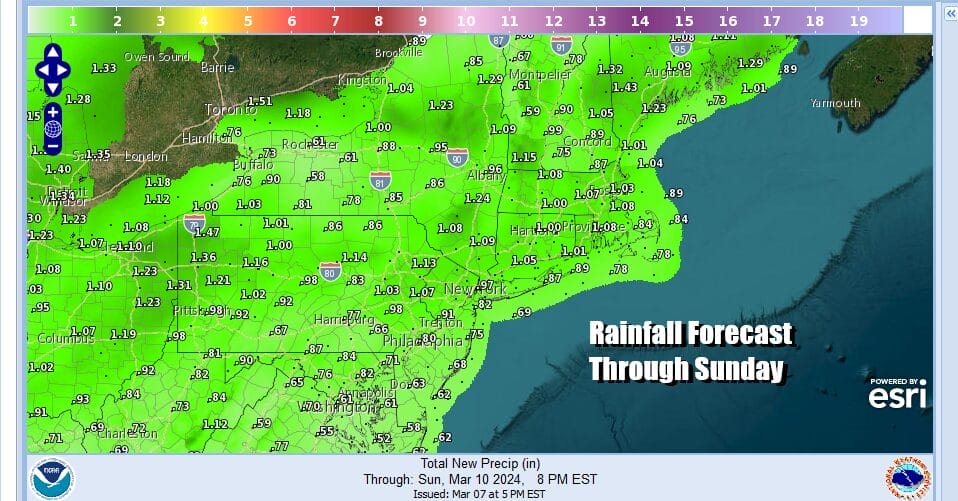
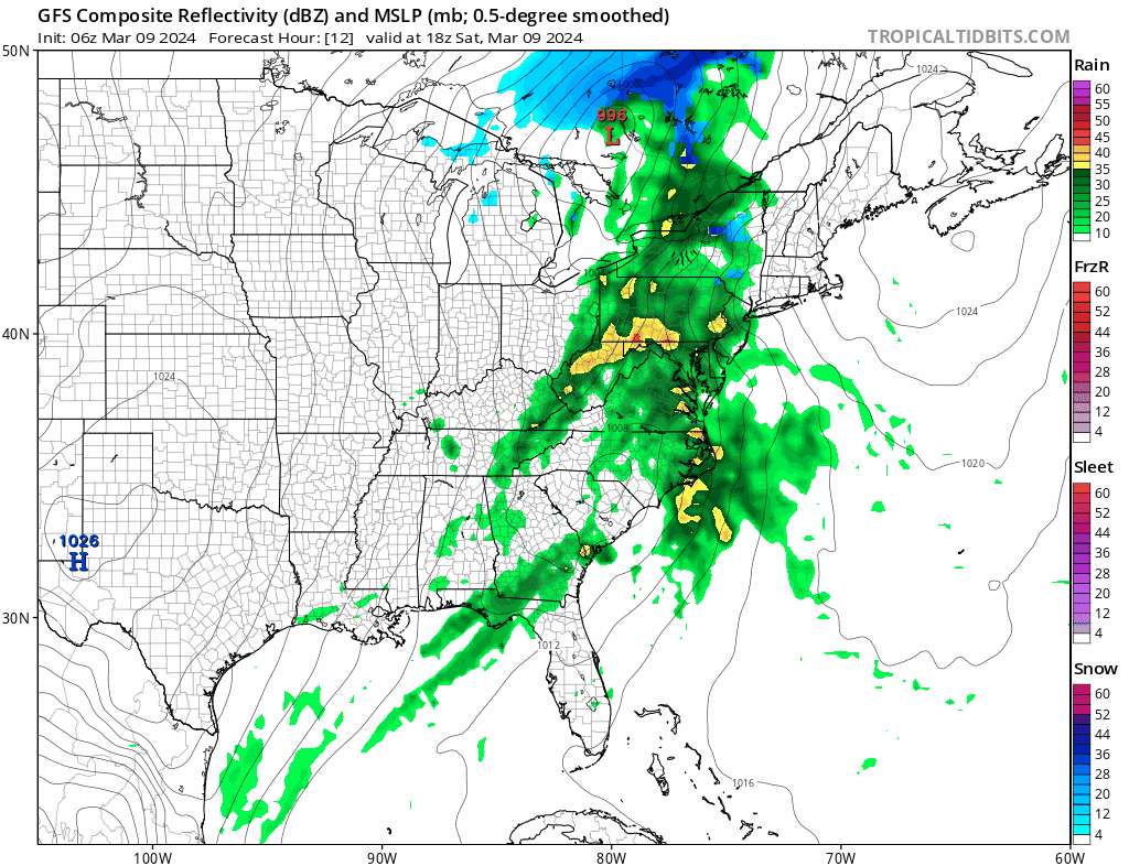
First things first today will be rain that is coming up from the south. It looks as if the rain gets in faster and as a result gets out faster. Look for rain to develop from southwest to northeast this afternoon and become heavy at times into tonight. There might even be a thunderstorm or two in the mix. Rainfall amounts will likely be on the order of 3/4 inch to 1.50 inches which normally would not be an issue. However the ground is saturated by nearly half a foot of rain that has fallen since last Saturday with this parade of storms began.
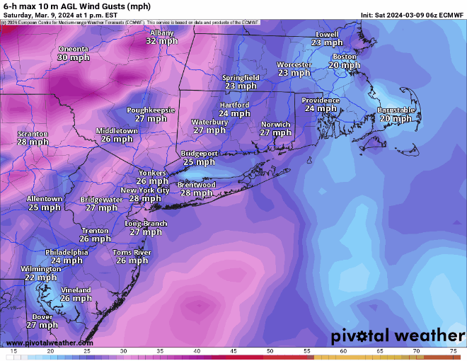
The issue with winds come in two bursts. During this evening and tonight we will see gusty winds on the order of 20 to 30 mph with gusts to 40 or so especially along the coast. The wind direction will be mostly from the south which is why we have elevated coastal flooding issues possible for south and east facing shorelines from Delmarva to New England. The second burst of wind will come after the front passes on the back side. It will be gusty across the Northeast and Northern Mid Atlantic Sunday but the strongest winds will come later Sunday and through Monday evening and we could see frequent gusts of 40 to 50 mph or more. The softened ground from the heavy rain will make trees vulnerable to the strong wind gusts.
SATELLITE WITH LIGHTNING STRIKES

WEATHER RADAR

Satellite and radar show the rain is spreading northeastward. The heaviest rain will be from 7pm to 1am across the Northern Mid Atlantic and Northeast. Temperatures today will eventually find their way back into the 50s. Rain will end from west to east tonight and should be mostly gone by the early morning hours. In Southeastern New England, the rain could last until daybreak.
Sunday will be a breezy and colder day with clouds and only limited breaks ofs sunshine. An upper trough moving through could bring some scattered rain or even snow showers through. Temperatures will be in the 40s. Sunday night through Monday night will be very windy. Monday should be partly sunny with highs in the mid 40s to some lower 50s. By Tuesday we will see winds easing. The week ahead will be mostly dry until late week when low pressure and a cold front will bring rain chances for late Friday into Saturday.
BE SURE TO DOWNLOAD THE FREE METEOROLOGIST JOE CIOFFI WEATHER APP &
ANGRY BEN’S FREE WEATHER APP “THE ANGRY WEATHERMAN!
MANY THANKS TO TROPICAL TIDBITS FOR THE USE OF MAPS
Please note that with regards to any severe weather, tropical storms, or hurricanes, should a storm be threatening, please consult your local National Weather Service office or your local government officials about what action you should be taking to protect life and property.
(Amazon is an affilate of Meteorologist Joe Cioffi & earns commissions on sales.)


