Gloom & Doom Breaks Chance for Snow Later Sunday Into Early Monday
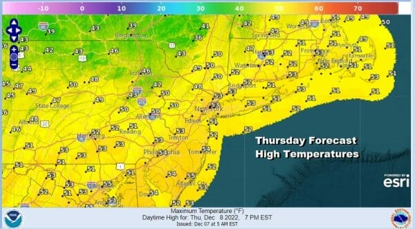
We can say goodbye to doom and gloom and enjoy some better weather conditions today. There will be a bit of a breeze from the northwest and we will have some sunshine and passing clouds. We still have a little bit of the warm air leftover from yesterday but temperatures will not go far and hover pretty much in the upper 40s to lower 50s in most places. This is still about 5 degrees or so above average for most. The chill down will continue in stairstep fashion over the next few days.
SATELLITE

WEATHER RADAR

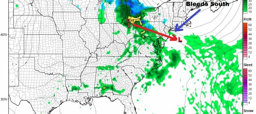
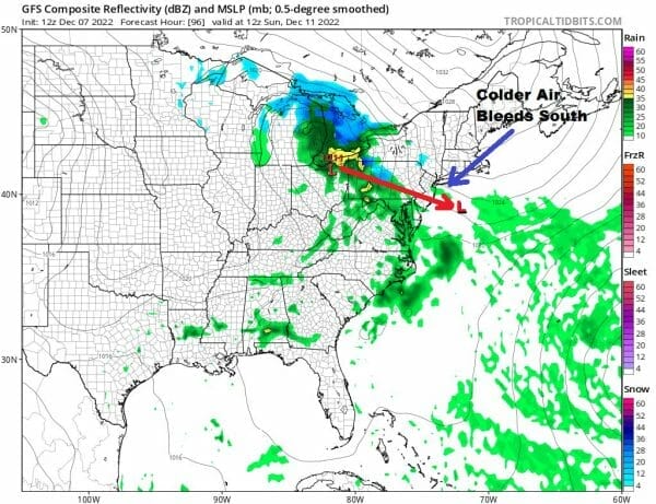
The blocking pattern in the atmosphere is causing a strong high to build in Northeastern Canada and more importantly, it isn’t moving. Cold air is going to slowly bleed southward over the next several days and the block will also hold the key to a chance for snow later Sunday into Monday morning.
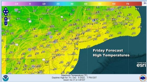
In the meantime skies will clear out tonight. Lows will be in the upper 20s to lower 30s. Friday we will see some sunshine and a north wind so there will be a colder feel to things outside. Highs will be in the low to middle 40s. Then it is back down to the 20s inland and lower 30s Friday night into Saturday morning.
Two lows are coming out of the Southern Plains. The first Friday night into Saturday moves northeast into the Appalachians and just falls apart. There is an ocean storm offshore and that leaves no room for a second system to develop so close by. Other than clouds there are no issues for Friday night into Saturday morning. The weekend starts with some sunshine Saturday with most highs in the lower 40s.
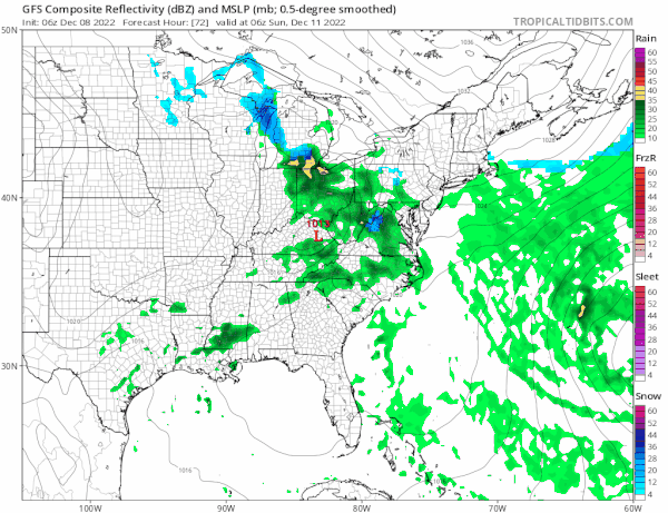
The ocean storm gets out of the way Sunday as it moves southeast and east away from Bermuda and this allows room for the next system to hold together. It moves southeast from the Great Lakes to a low off the NJ Coast Monday morning. The upper feature here may be more important for the outcome for snow as it could help to cool the atmosphere further from the top down.
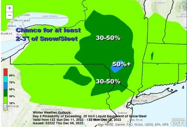
The Weather Prediction Center in its long range outlookf for Sunday now has an area of 30 to 50% chance for at least 2 to 3 inches of snow/sleet mainly west of I-87 in NY and north of Route 80 in NJ with a 10 to 30 percent chance further south. This is an increase from what they were showing yesterday. Look for increasing clouds Sunday with some rain developing later in the day which changes to wet snow in the evening and at night. Along the coast rain might change to snow before it ends early Monday morning. Overall this looks to be a light event with the potential for several inches in some inland areas and less along the southern flank of this. One thing we will be watching closely is the upper feature because that sometimes can cause a surprise. This should be all done before daybreak Monday.
Additonal Winter Weather Coverage is available at my weather platform on Patren.
BE SURE TO DOWNLOAD THE FREE METEOROLOGIST JOE CIOFFI WEATHER APP &
ANGRY BEN’S FREE WEATHER APP “THE ANGRY WEATHERMAN!
MANY THANKS TO TROPICAL TIDBITS & F5 WEATHER FOR THE USE OF MAPS
Please note that with regards to any severe weather, tropical storms, or hurricanes, should a storm be threatening, please consult your local National Weather Service office or your local government officials about what action you should be taking to protect life and property.


