Another Gloom & Doom Day Drying Out Thursday Unsettled Through the Weekend
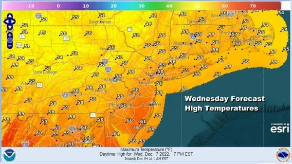
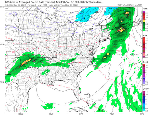
Gloom & Doom as I like to call it continues today as we wait for a cold front to pass. The front is moving slowly thanks to a ridge off the East Coast and a traffic jam in the Atlantic which is holding progress across North America of weather systems. This leaves us in another day of clouds, warm weather conditions and the risk for some showers though I think the bulk of the rain is now in Southeastern New England and moving away. Showers to the south and west should start to weaken as they move northeasward. Temperatures this afternoon will be in the sticky upper 50s and lower 60s.
SATELLITE

WEATHER RADAR

Once the front passes we should see some partial clearing of skies overnight with lows mostly in the 40s. The next few days we will see a slow downtrend in temperatures as high pressure builds across the Great Lakes and Southeastern Canada. This will allow a colder flow at lower levels of the atmosphere to gain a foot hold in the Northeast and Northern Mid Atlantic.

Some of the mild temperatures of today will be leftover on Thursday. Most highs will be in the low to mid 50s but this will likely be achieved by midday and then temperatures will just hold or ease slightly in the afternoon. We should see some sunshine on Thursday and by Friday morning lows will be in the upper 20s to middle 30s.
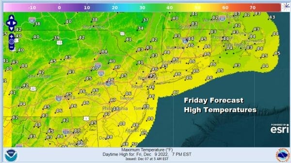
High pressure in Southeastern Canada wedeges itself in between a developing low well offshore and an approaching system from the Great Lakes Friday. Given that there isn’t much upper air support for that system, the block to the north forces lower pressures to our south and east and we don’t expect much from this other than some clouds on Friday mixed with sun, and some clouds Friday night into Saturday. Friday highs will be in the 40s.
That high to the north will be holding all weekend and another low will approach Sunday night into Monday with some precipitation. This low could meet the same fate as the low for Friday night into Saturday morning though there could be more support for clouds and some precipitation later Sunday into Monday. For now we will go with the idea of some sun Saturday and increasing clouds Sunday with highs both days just into the 40s.
BE SURE TO DOWNLOAD THE FREE METEOROLOGIST JOE CIOFFI WEATHER APP &
ANGRY BEN’S FREE WEATHER APP “THE ANGRY WEATHERMAN!
MANY THANKS TO TROPICAL TIDBITS & F5 WEATHER FOR THE USE OF MAPS
Please note that with regards to any severe weather, tropical storms, or hurricanes, should a storm be threatening, please consult your local National Weather Service office or your local government officials about what action you should be taking to protect life and property.


