Chance for Snow Late Sunday into Monday
Blocking Pattern Continues All Next Week
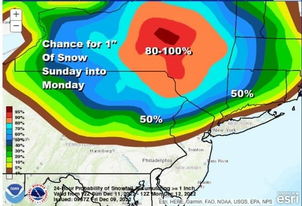
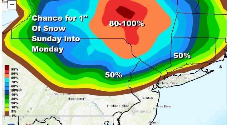
We are looking at the chance for snow Sunday night into early Monday morning. The best chance for any accumulation will be on a line from north of Route 80 in New Jersey and west of Route 87 and north of Route 84 in the Hudson Valley, at least that is based on what I’m seeing at the moment. We could see the coating line drop to Route 78 to about NYC and Long Island if the atmosphere is about a degree or too colder. More on this in a moment but first we have today’s weather.
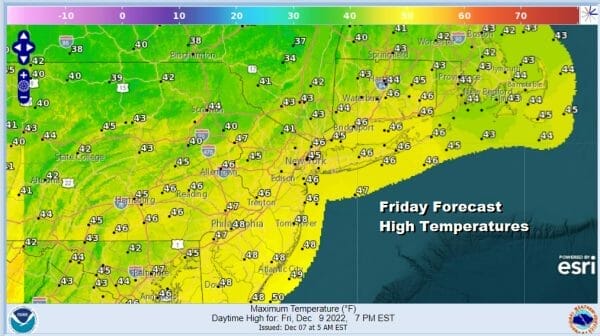
We are seeing a slow stair step down in temperatures today and through the weekend as a cold high builds to the north. The satellite shows a nice weather day overall with sunshine. A dying disturbance to the west will move east this afternoon and tonight. Precipitation in the Midwest with this disturbance will fall apart as it moves east because there is no room in the atmosphere for it to develop or even hold together. We have the strong high to the north and a storm developing southeast of Nova Scotia which leaves no room for another system, even a weak one. Highs today with some sunshine will be mostly in the 40s.
SATELLITE

WEATHER RADAR

Other than some patchy clouds tonight we will see skies partially clear overnight with lows in the upper 20s to lower 30s. Saturday will be a nice day but chilly with sunshine. Highs will be in the upper 30s to mid 40s and then back down to the 20s and lower 30s by Sunday morning.
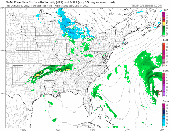
The next low approaches Sunday. This time around there will be a little more room for this system to survive. An ocean storm to the east moves southeast and away from the coast. This low weakens as it moves into the blocking high and reforms off the coast Sunday night and Monday morning. There will be an area of snow with this inland and rain along the coast. There isn’t room for much upside here. Areas that see snnow will get a quick coating to a couple of inches. If the upper low associalted with this is a little stronger there could be some localized upside surprises. The upper low could help to cool that atmosphere down an extra degree or two.

Sunday highs with increasing clouds will be in the upper 30s and lower 40s. Snow arrives from west to east in the late afternoon and evening and it ends Monday morning plus or minus a couple of hours of daybreak from west to east. Lows will be in the upper 20s and lower 30s. For Central and South Jersey and Southeastern Pennsylvania this is mostly a cold rain event.
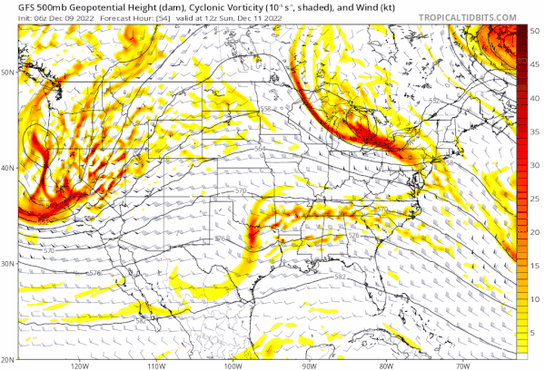
This system for Sunday becomes a very important factor for the pattern developing for next week. The blocking pattern continues across Canada and is quite strong. A major storm develops in the Plains early next week but instead of moving toward Canada, that low will eventually redevelop in the Eastern US as it is forced to track more to the east and south rather than to north. Colder weather will come in Monday and Tuesday. The first half of the week will be cold and dry. Tuesday and Wednesday will be the coldest weather we have seen in quite a while with temperatures struggling in the 30s during the day and lower than that north and northeast of the coast. We will be watching this pattern very closely for later next week.
BE SURE TO DOWNLOAD THE FREE METEOROLOGIST JOE CIOFFI WEATHER APP &
ANGRY BEN’S FREE WEATHER APP “THE ANGRY WEATHERMAN!
MANY THANKS TO TROPICAL TIDBITS & F5 WEATHER FOR THE USE OF MAPS
Please note that with regards to any severe weather, tropical storms, or hurricanes, should a storm be threatening, please consult your local National Weather Service office or your local government officials about what action you should be taking to protect life and property.


