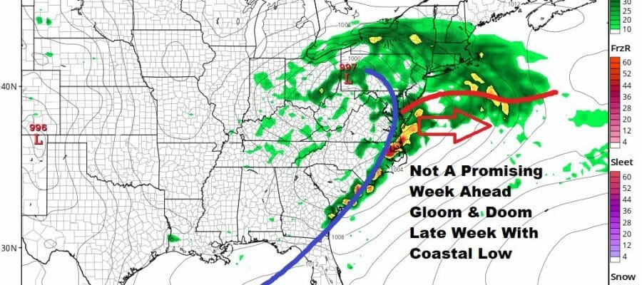
Gloom And Doom Week Ahead Coastal Low Friday Into Sunday

Gloom And Doom Week Ahead Coastal Low Friday Into Sunday
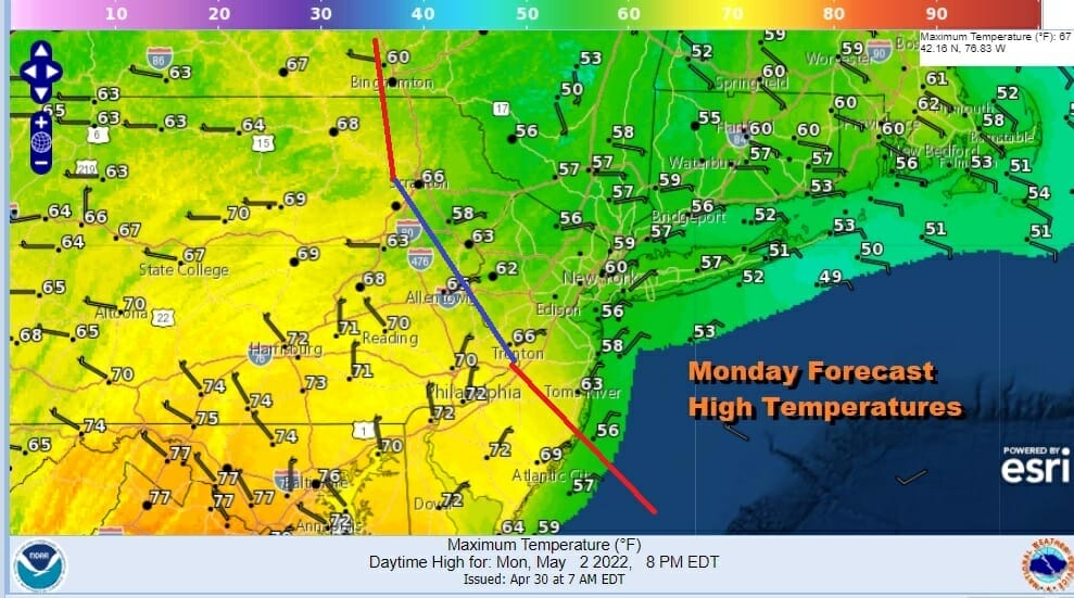
The first of 3 weather systems is wrapping up today and we have lots of clouds around. Overnight showers moved through and there were one or two thunderstorms in the mix across NYC and parts of Long Island. We will be fighting clouds for the rest of the day. There will still be some showers around mainly from NYC north and east today though it should not rain all day. As for highs it will be in the 50s to around 60 north and rest of the stalled frontal boundary line.
SATELLITE

It is a bit of a different story south and west of NYC where winds from the northwest will help to dry things out this afternoon and allow for some sun to break through the clouds. The showers for this area are done for the day. Temperatures from Central and Southern New Jersey south and west should reach upper 60s to some middle 70s in some places.
WEATHER RADAR

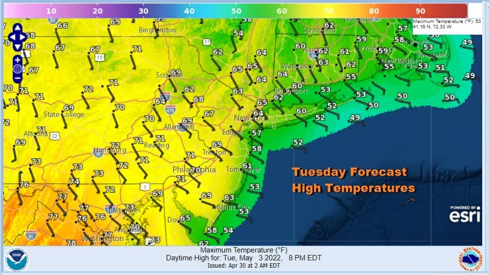
Tonight a northeast wind takes over with clouds around and lows in the 40s. Tuesday we catch a break with dry conditions during the day for the most part. However the wind will be off the ocean all day. We might get some sunshine early especially inland. Once again cooler temperatures will occur from coastal New Jersey north and east across Southern New England with highs in the 50s to lower 60s. Inland western New Jersey westward will see upper 60s to lower 70s.
The next weather system takes aim for Tuesday night into Wednesday. Showery rains are likely as a low moves from the Ohio Valley and weakly redevelops off the Maryland coast. This makes temperature forecasts tricky for Wednesday. It looks somewhat like today where areas south and west of NYC could reach into the 70s while north and east it will be mostly in the 50s.

We should see some sky improvement Wednesday night into at least part of Thursday but it won’t last as the next system heads east across the Ohio Valley and redevelops along the Mid Atlantic coast. This is being forced under the block in the North Atlantic and we will likely see rain come in later Thursday night or early Friday depending one time. Then it is gloom and doom clouds wind and rain Friday and Satuday. it might possibly last into Sunday as the block forces the low to drift south rather than east. There is a chance that this could get suppressed a little further south depending on the block. We will be focusing are attention on how the block forms but even if it does, we will still see some rain and wind and the rest of the time will be raw and damp. We will get into the details as we draw closer in the coming days.
BE SURE TO DOWNLOAD THE FREE METEOROLOGIST JOE CIOFFI WEATHER APP &
ANGRY BEN’S FREE WEATHER APP “THE ANGRY WEATHERMAN!
MANY THANKS TO TROPICAL TIDBITS & F5 WEATHER FOR THE USE OF MAPS
Please note that with regards to any severe weather, tropical storms, or hurricanes, should a storm be threatening, please consult your local National Weather Service office or your local government officials about what action you should be taking to protect life and property.


