Gloom And Doom Continues Through Sunday
Very Slow Improvement Next Week Possible

Gloom And Doom Continues Through Sunday
Very Slow Improvement Next Week Possible
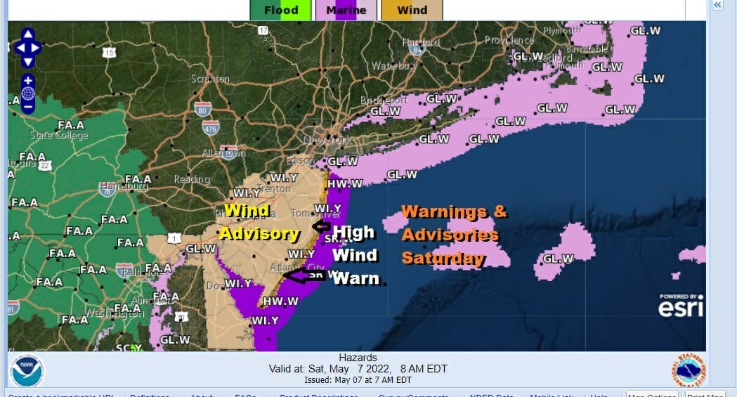
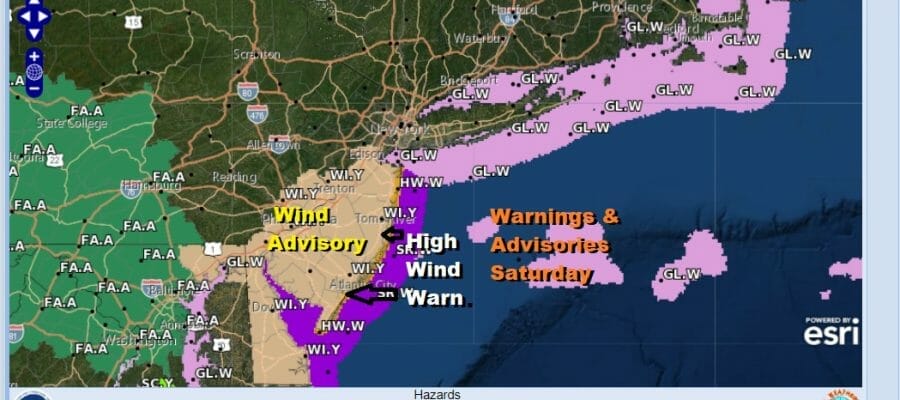
The weekend is underway and it is no surprise we are in the land of doom and gloom. Winds are becoming an issue today along the coast. We have High Wind Warnings up for the New Jersey coast and Wind Advisories inland for Central and Southern New Jersey south into Delaware. Storm warnings are in effect for the coastal waters from New Jersey south while gale warnings are posted for the waters around Long island into Southeastern New England. Rain is going to continue today but since it has been basically spread out over 36 hours, flooding is not a concern. Coastal flooding however could occur at today’s high tides though fortunately we are at the lower part of the lunar tide cycle. Temperatures are in the upper 40s and lower 50s and will remain there all day long.
SATELLITE

WEATHER RADAR

Low pressure is parking itself off the Delmarva Peninsula and is not able to exit to the east thanks to blocking so it will be sitting there through Sunday only slowly beginning a southerly drift afterwards. Rain should taper off this evening from west to east and also from north to south. There still could be some light rain or drizzle around tonight with temperatures in the 40s.

Sunday Mother’s Day we continue with doom and gloom cloud cover. There is the chance that some light rain comes in from the east during the day Sunday so this needs to be watched. Otherwise it is a miserable day with no sun and highs into the 50s. For Monday. improvement rests on whether we can get the low far enough south so that the onshore flow begins to relax a bit. That could allow dry air to filter down from the northeast. For now we will call it changeable skies Monday. Maybe there could be a break or two of sun well inland. Highs will be in the upper 50s to around or just over 60. Slow improvement could continue during the week and with it a slow uptrend in temperatures. We could start reaching 70 or better inland beginning Wednesday. However all this hinges on the storm offshore and the upper low that goes with it.
BE SURE TO DOWNLOAD THE FREE METEOROLOGIST JOE CIOFFI WEATHER APP &
ANGRY BEN’S FREE WEATHER APP “THE ANGRY WEATHERMAN!
MANY THANKS TO TROPICAL TIDBITS & F5 WEATHER FOR THE USE OF MAPS
Please note that with regards to any severe weather, tropical storms, or hurricanes, should a storm be threatening, please consult your local National Weather Service office or your local government officials about what action you should be taking to protect life and property.


