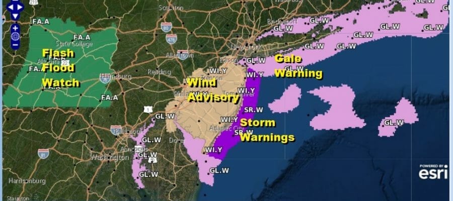
Wind Advisory Central And South Jersey Storm Warnings Coastal NJ
Gale Warnings Long Island

Wind Advisory Central And South Jersey Storm Warnings Coastal NJ
Gale Warnings Long Island

Some updates and changes regarding some advisories and warnings. For New Jersey we have storm warnings in effect for the coastal waters and wind advisories are posted inland for Central and Southern New Jersey. The storm warning goes into effect at 6am Saturday and last until 6am Sunday. Gale warnings are up overnight and also we have gale warnings for Long Island. Winds will gust past 50 knots in the storm warning area and 30 to 40 knots in the gale warning area. For the wind advisory area we could see justs to 40 mph and that is in effect from 8am Saturday until 5am Sunday.
SATELLITE

WEATHER RADAR

While we still expect rain totals of 1 to 2 inches in most places with some local amounts close to 3 inches in parts of Southeast and South Central Pennsylvania, it is spread out over a long period of time so other than the usual suspect spots, we don’t expect widespread flash flooding. There are flash flood watches in Central Pennsylvania mostly west of Harrisburg.
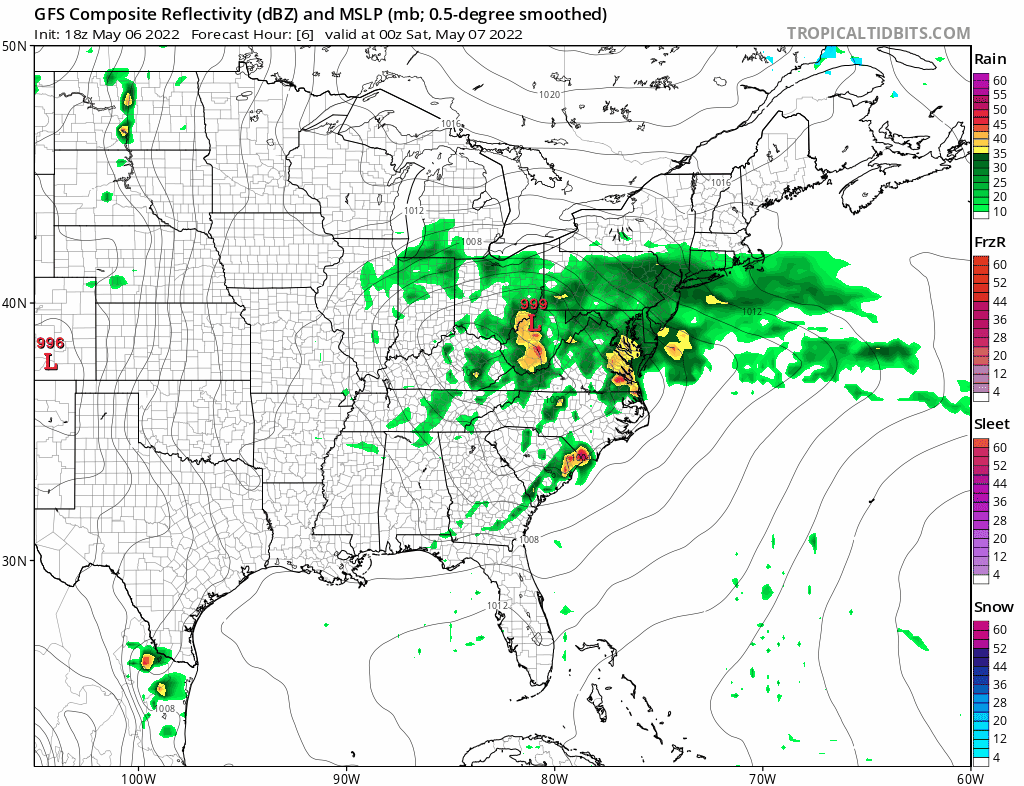
Not much has changed on the models this afternoon and evening. You can see the low moves off the coast Saturday setting up the tight pressure gradient. The rain will start to slow taper off from north to south Saturday night. Temperatures will stay mostly in the low to mid 50s throughout with upper 40s at night. Sunday’s problem remains the same. I think much of the area will be in cloud cover all day and we will need to watch and see whether rain from from the ocean low pivots back westward into the coast. Models seem to be taking turns showing this so we will leave in this possibility. Once the low begins its course to the south that should allow for some slow improvement in sky conditions Monday with highs back into the 60s. Tuesday should be better again assuming that the low offshore doesn’t create low cloud issues with the onshore flow.
BE SURE TO DOWNLOAD THE FREE METEOROLOGIST JOE CIOFFI WEATHER APP &
ANGRY BEN’S FREE WEATHER APP “THE ANGRY WEATHERMAN!
MANY THANKS TO TROPICAL TIDBITS & F5 WEATHER FOR THE USE OF MAPS
Please note that with regards to any severe weather, tropical storms, or hurricanes, should a storm be threatening, please consult your local National Weather Service office or your local government officials about what action you should be taking to protect life and property.


