DOWNLOAD MY NEW FREE JOESTRADAMUS WEATHER APP FOR ANDROID

ANOTHER STORM BRINGS RAIN MONDAY & MONDAY NIGHT
FLOOD WATCH SOUTHEAST PA, NEW JERSEY, NYC, HUDSON VALLEY
COLDER AIR FOLLOWS MIDWEEK
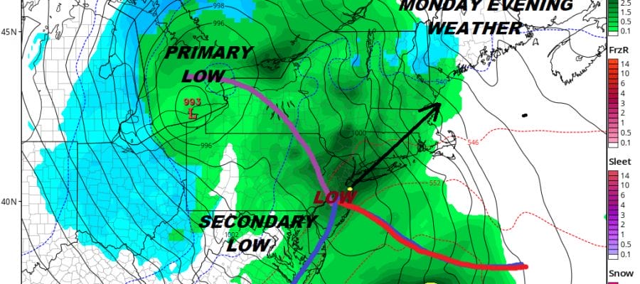
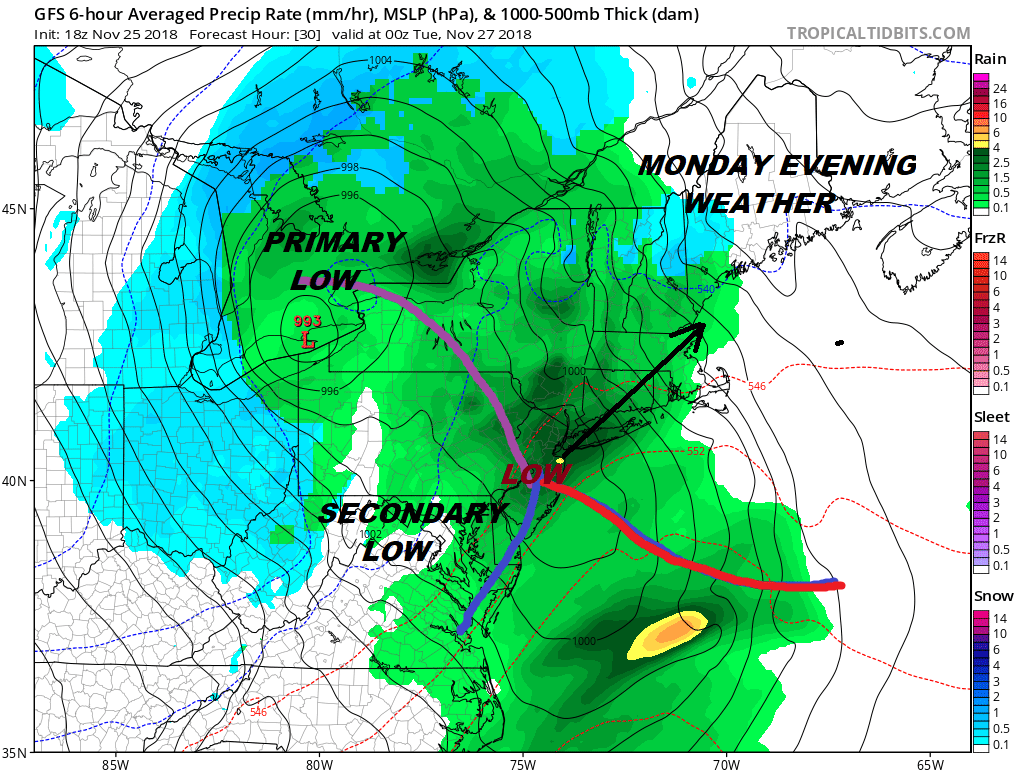
Saturday night’s coastal low blew up at the last minute and dumped heavy rain from New Jersey to Southern New England. We squeezed in a decent Sunday with some sunshine and temperatures in the 50s. Now comes a second storm that is heading from the Central Plains to the Lower Great Lakes. Blizzard Warnings are up tonight from the Middle Mississippi Valley to the Lower Western Great Lakes including the city of Chicago. The track of the low brings another primary low to the lakes, secondary low developing in our back yard. More rain is forecast developing from west to east later Monday Morning and lasting into Monday night.
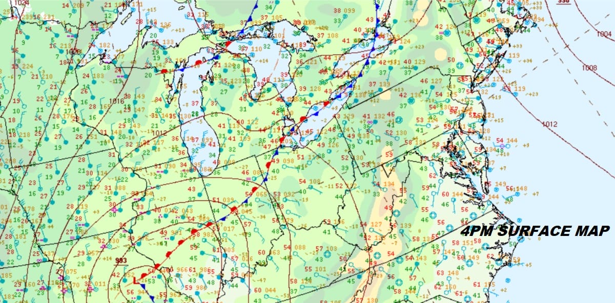
EASTERN SATELLITE

Satellite and radar loops this evening show rather calm quiet conditions. HIgh clouds are still to our south and west and the regional radar is silent for now except for some back edge snow in Eastern Maine. Late tonight we should see the lead area of rain appear on the western (left) edge of the radar.
REGIONAL RADAR

Even though we have another case where the primary low is tracking to our west that primary is going to hold on to its energy much longer. The secondary low forms in our back yard rather than much further south like Saturday’s. Though this will mean rain, the heaviest rain will likely be more for Southeastern New England this time around though we will see a steady rain with some heavy downpours into Monday night.
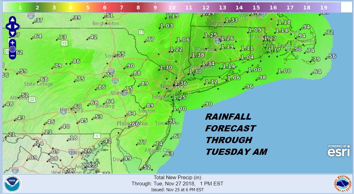
Flood Watches are posted for Southeastern Pennsylvania, all of New Jersey, NYC, & the Lower Hudson Valley. This system comes on the heels of last night’s 2 to 3 inch rain producer. This one should be along the lines of about an inch or so on average. This might not normally be a problem except for the fact that the ground is soaked from Saturday night’s rain so the threshold for flooding is rather low. Rivers and streams are running high. We still have flood advisories this evening leftover from last night’s rain.
Weather conditions improve Tuesday through Thursday with colder air returning but not like what we saw on Thanksgiving. Highs each day through midweek will be in the low to mid 40s with nighttime lows in the 20s to lower 30s.
SUBSCRIBE TO PATREON FOR A WEATHER EXPERIENCE FREE OF ADS, EXCLUSIVE VIDEOS FOR MEMBERS ONLY AND MUCH MORE…STARTS AT $2 A MONTH..MESSAGE ME AT ANY TIME

MANY THANKS TO TROPICAL TIDBITS FOR THE USE OF MAPS
Please note that with regards to any tropical storms or hurricanes, should a storm be threatening, please consult your local National Weather Service office or your local government officials about what action you should be taking to protect life and property.

