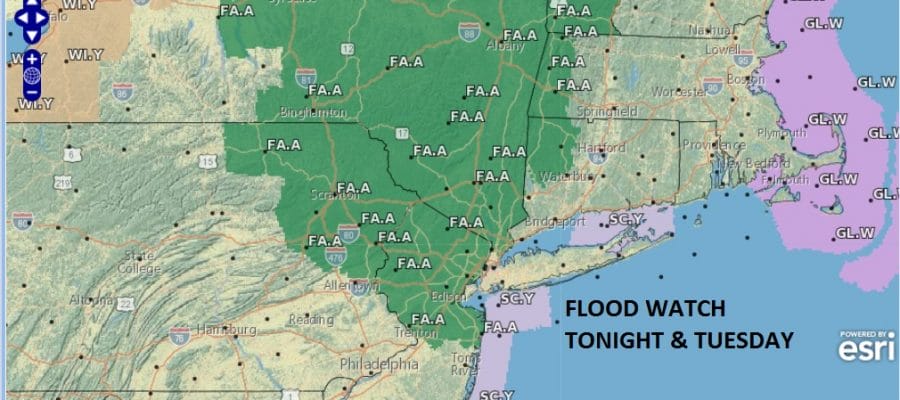
Flood Watch New Jersey Hudson Valley
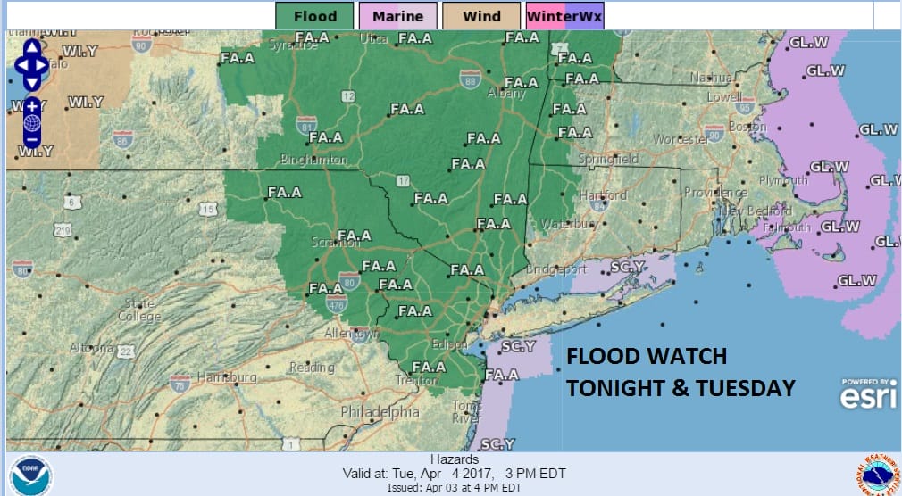
Flood Watch New Jersey Hudson Valley
Thanks to the rainfall and snow melt of recent week the ground is like a sponge at the moment and saturated so it won’t take much rain to cause some localized flooding. In particular is the fact that the first round of rain late tonight and tomorrow morning could produce a quick inch or more of rain in just a few hours time. Give yourself some extra time for the Tuesday morning commute in areas around the flood watch zone.
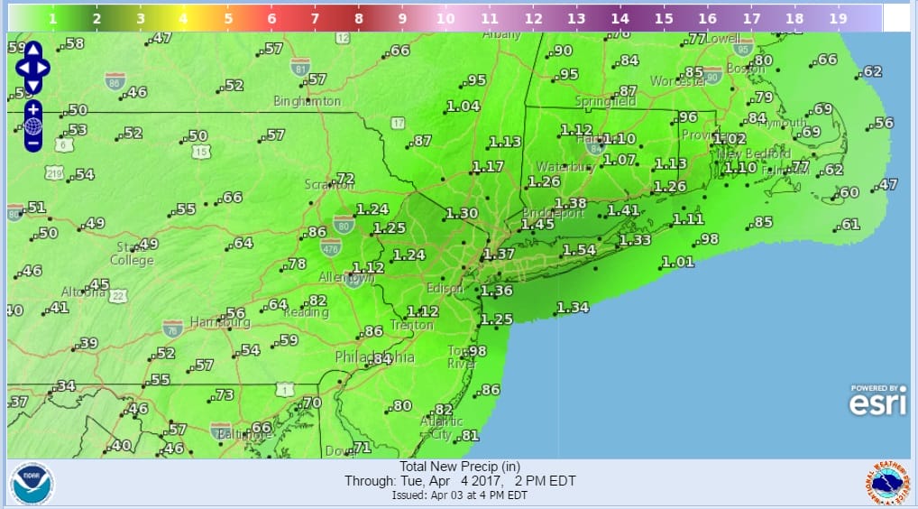
FLOOD WATCH RAINFALL FORECAST THROUGH TUESDAY AFTERNOON
The satellite loop this evening shows clouds developing and moving northeastward ahead of low pressure heading for the Lower Great Lakes. Heavy rains are coming up from the south as evidenced by the regional radar below. They are now beginning to come into range.
SATELLITE LOOP

REGIONAL RADAR

LOCAL RADAR NEW YORK CITY

LOCAL RADAR PHILADELPHIA


Look for local radars to start to become busy as the rain moves this evening from southwest to northeast. The heaviest will fall from late tonight into Tuesday morning with more rain in areas like the Northern half of New Jersey and New York City north and northeast into the Hudson Valley, Long Island and Connecticut. Less will fall in Central and Southern New Jersey and Southeastern Pennsylvania.
After the first surge of rain we could see some sunshine try and break through the clouds on Tuesday but that could trigger off some downpours and thunderstorms in the afternoon and evening but no severe weather is expected. Temperatures tonight will be in the mid 40s to l;ower 50s. Thursday’s highs will be in the 60s however 70s are possible from Central New Jersey south and west into Southeastern Pennsylvania.
Dry air returns on Wednesday before a stronger storm system heads our way on Thursday. with more heavy rain and some wind along with the threat for severe weather. JOESTRADAMUS has more on this and the warmer longer range outlook next week.
 GET JOE A CIGAR IF YOU LIKE

LANDSCAPE COMPANIES FOR YOUR NEEDS
LONG ISLAND ROCKLAND COUNTY Connecticut

![]()

ROCKLAND COUNTY TRI STATE SNOW REMOVAL JOHNSTOWN PA


FiOS1 News Weather Forecast For Long Island
FiOS1 News Weather Forecast For New Jersey
FiOS1 News Weather Forecast For Hudson Valley
NATIONAL WEATHER SERVICE SNOW FORECASTS
LATEST JOESTRADAMUS ON THE LONG RANGE
Weather App

Don’t be without Meteorologist Joe Cioffi’s weather app. It is really a meteorologist app because you get my forecasts and my analysis and not some automated computer generated forecast based on the GFS model. This is why your app forecast changes every 6 hours. It is model driven with no human input at all. It gives you an icon, a temperature and no insight whatsoever.
It is a complete weather app to suit your forecast needs. All the weather information you need is right on your phone. Android or I-phone, use it to keep track of all the latest weather information and forecasts. This weather app is also free of advertising so you don’t have to worry about security issues with your device. An accurate forecast and no worries that your device is being compromised.
Use it in conjunction with my website and my facebook and twitter and you have complete weather coverage of all the latest weather and the long range outlook. The website has been redone and upgraded. Its easy to use and everything is archived so you can see how well Joe does or doesn’t do when it comes to forecasts and outlooks.
Just click on the google play button or the apple store button on the sidebar for my app which is on My Weather Concierge. Download the app for free. Subscribe to my forecasts on an ad free environment for just 99 cents a month.
Get my forecasts in the palm of your hand for less than the cost of a cup of Joe!


