Storm Thursday Looks Potent Heavy Rain Wind

Storm Thursday Looks Potent Heavy Rain Wind
Once Tuesday’s system plays through Wednesday is shaping up to be a dry day with sunshine. However the second storm system heading toward the east coast for Thursday and Friday appears to be a bit of a powerhouse as weather models all forecast a rather intense surface storm to develop.
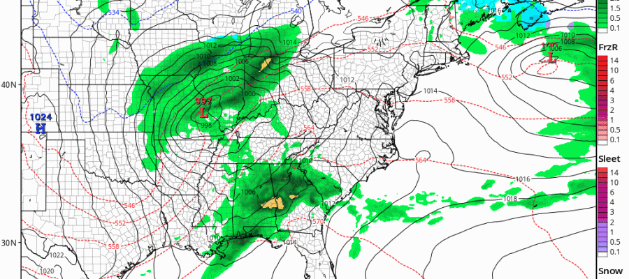
GFS FORECAST FOR WEDNESDAY THROUGH FRIDAY INTENSE STORM DEVELOPS
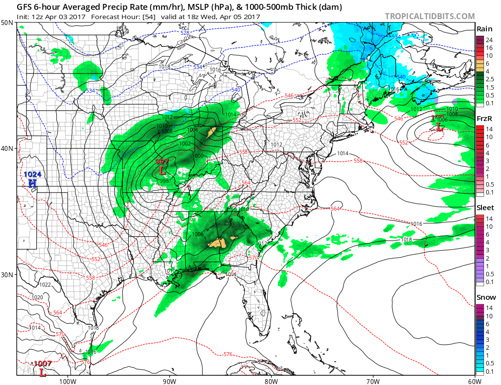
Antother (and it appears to be the last) in this series of storms will be coming out of the Southern Plains and heading for Western Pennsylvania/ Western NY as show on the GFS model sequence above (click to animate). This system has a tremendous amount of upper air support as the feature aloft strengthens as it moves eastward. It looks to be another 1 to 2 inch rain producer combined with a strong southeast wind along the coast. Thankfully for south facing shore lines we are in between important moon phases so coastal flooding is not going to be a big issue. However as far as rain goes with an increasingly saturated ground, localized flooding could be an issue. The upper air storm may take a couple of days to get out of the way so genuine improvement may not happen until Saturday
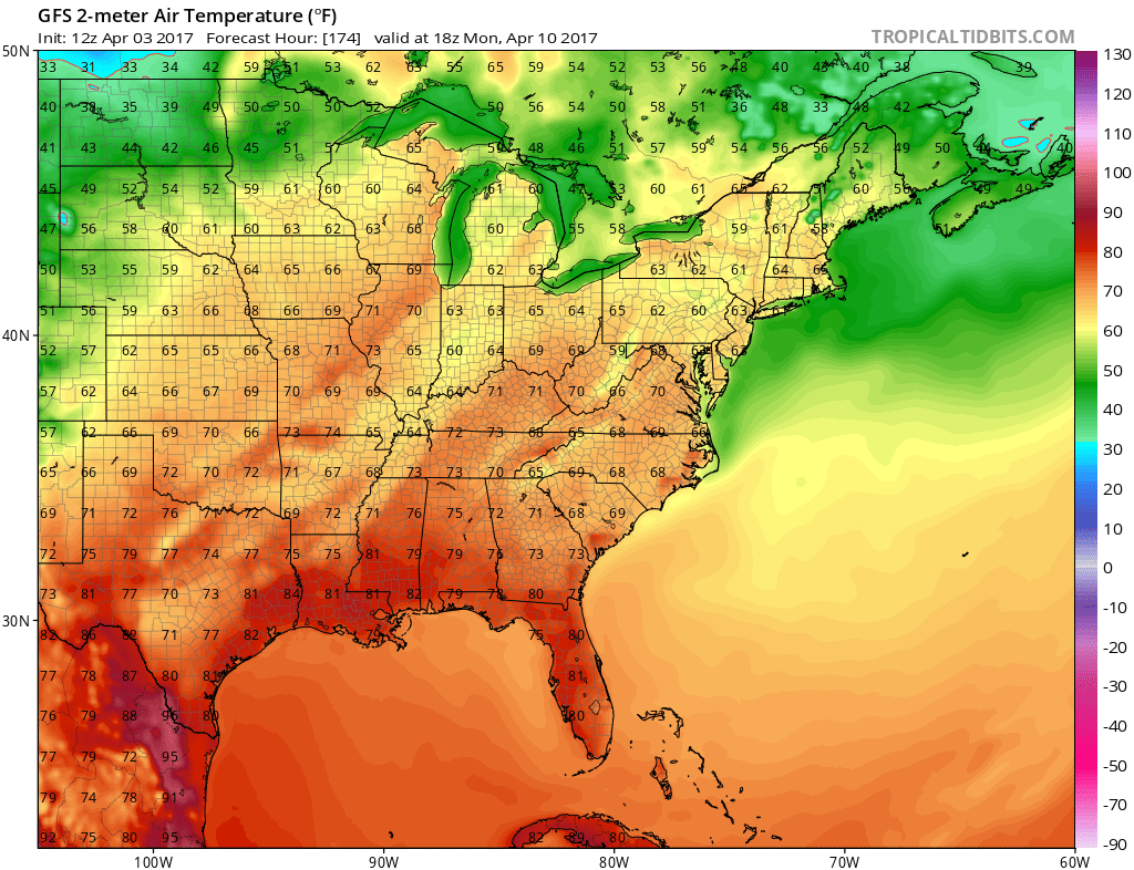
Once the upper air feature pulls out off the east coast, a large ridge is forecast to build in the east. This is going to set us up for 3 warm days beginning on Monday and lasting into Wednesday. Typically the models don’t warm up fast enough so we could be in the 70s both Monday and Tuesday.
We will go into the warming trend in a bit more detail later today and in the next coming days.
MANY THANKS TO TROPICAL TIDBITS FOR THE WONDERFUL USE OF THE MAPS

GET JOE A CIGAR IF YOU LIKE!
LANDSCAPE COMPANIES FOR YOUR SPRING SUMMER FALL NEEDS
LONG ISLAND ROCKLAND COUNTY Connecticut

![]()

ROCKLAND COUNTY TRI STATE SNOW REMOVAL JOHNSTOWN PA


FiOS1 News Weather Forecast For Long Island
FiOS1 News Weather Forecast For New Jersey
FiOS1 News Weather Forecast For Hudson Valley
NATIONAL WEATHER SERVICE SNOW FORECASTS
LATEST JOESTRADAMUS ON THE LONG RANGE
Weather App

Don’t be without Meteorologist Joe Cioffi’s weather app. It is really a meteorologist app because you get my forecasts and my analysis and not some automated computer generated forecast based on the GFS model. This is why your app forecast changes every 6 hours. It is model driven with no human input at all. It gives you an icon, a temperature and no insight whatsoever.
It is a complete weather app to suit your forecast needs. All the weather information you need is right on your phone. Android or I-phone, use it to keep track of all the latest weather information and forecasts. This weather app is also free of advertising so you don’t have to worry about security issues with your device. An accurate forecast and no worries that your device is being compromised.
Use it in conjunction with my website and my facebook and twitter and you have complete weather coverage of all the latest weather and the long range outlook. The website has been redone and upgraded. Its easy to use and everything is archived so you can see how well Joe does or doesn’t do when it comes to forecasts and outlooks.
Just click on the google play button or the apple store button on the sidebar for my app which is on My Weather Concierge. Download the app for free. Subscribe to my forecasts on an ad free environment for just 99 cents a month.
Get my forecasts in the palm of your hand for less than the cost of a cup of Joe!
![]()
