
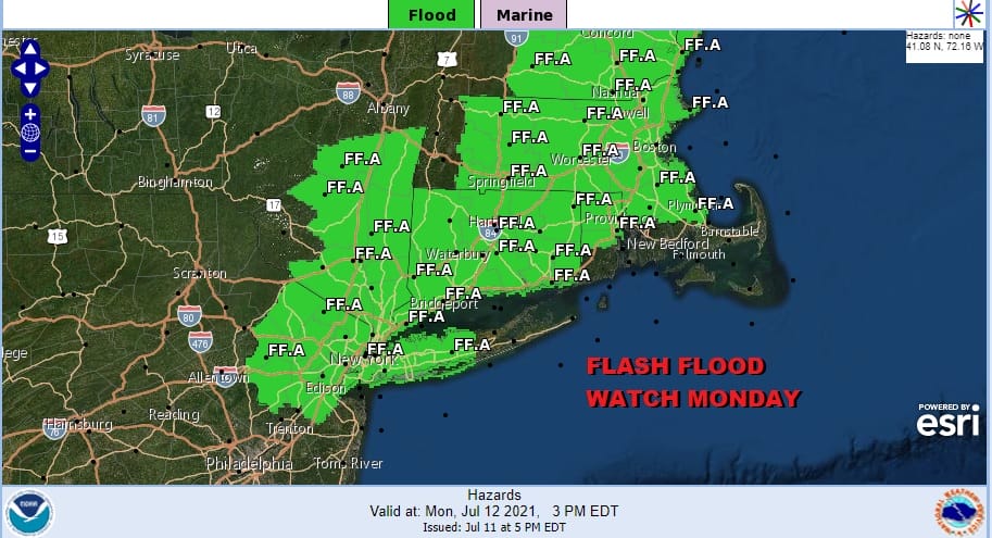
Flash Flood Watch Severe Weather Risk Monday

Weather in 5/Joe & Joe Weather Show Latest Podcast
Flash Flood Watch Severe Weather Risk Monday
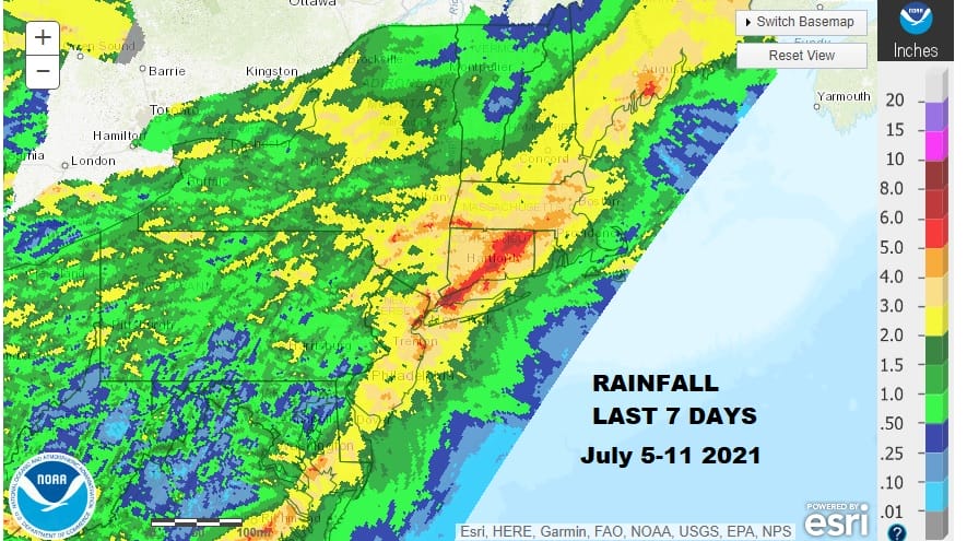
All the significant rainfall today is occurring in upstate NY mainly from the Pennsylvania NY state line northward. Flash Flood Watches are up for much of that region tonight but for areas to the south there has been very little activity shower wise though some severe weather is moving across Western and Central Pennsylvania. That should all fall apart before it reaches here so it will be a mainly quiet night and a humid night ahead with most lows in the mid 60s to lower 70s.
Monday the action shifts southward with a frontal boundary lying just to our north and an impulse moving along it will likely lead to showers and thunderstorms late in the day Monday into Monday night. Remember that last week much of the area saw 4 to 6 inches or more of rain thanks to 3 rounds of severe weather and Tropical Storm Elsa.
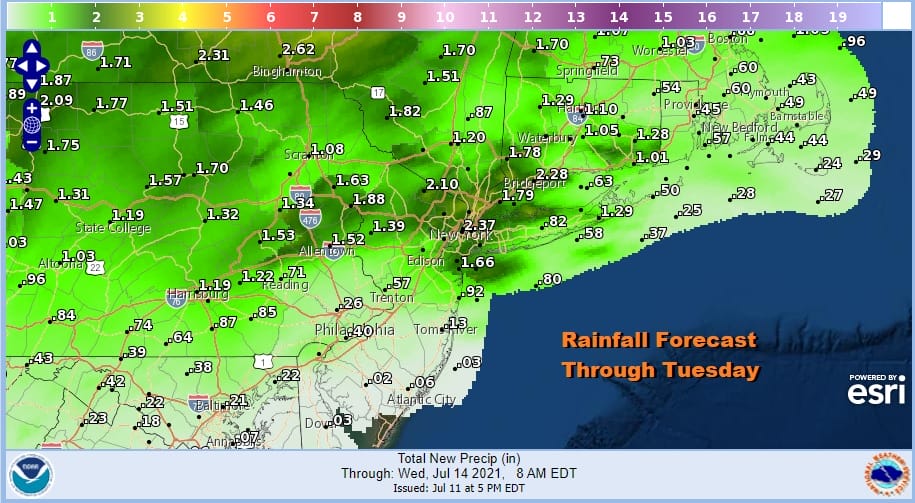
Being that we spent the weekend more in clouds than in sun, and the fact that it was humid all weekend, the ground remains wet and saturated so it won’t take much to set off flash flooding in stronger storms late Monday. Another couple of inches is possible in areas that are under the flash flood watch.
Now let us throw in the chance for some of those storms to be strong or severe and the Storm Prediction Center has us in a marginal risk for severe weather. Daytime heating tomorrow will be a critical factor in thunderstorm strength so keep an eye on clouds in the morning. If those clouds break up quickly we could be in for a rough round of storms.

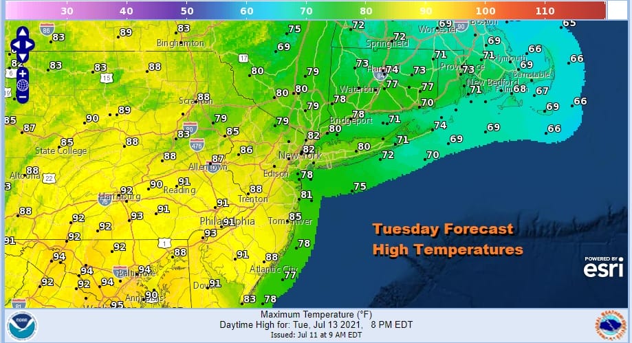
Most highs Monday will be in the mid 80s with warm spots approaching or even hitting 90 degrees. Tuesday is going to be a day with a frontal boundary lying across NYC from northwest to southeast so that keeps areas south of that boundary hot and humid with highs reaching into the 90s while north and east temperatures will be in the 70s. This could open the door for severe weather risk along and south of the frontal boundary.
Our logic for the rest of the week remains the same. In fact it will turn hot with highs upper 80s and lower 90s Wednesday and low to mid 90s Thursday and Friday with sunshine all three days. Again all three days will have the chance for pop up showers and thunderstorms.
BE SURE TO DOWNLOAD THE FREE METEOROLOGIST JOE CIOFFI WEATHER APP &
ANGRY BEN’S FREE WEATHER APP “THE ANGRY WEATHERMAN!

MANY THANKS TO TROPICAL TIDBITS & F5 WEATHER FOR THE USE OF MAPS
Please note that with regards to any severe weather, tropical storms, or hurricanes, should a storm be threatening, please consult your local National Weather Service office or your local government officials about what action you should be taking to protect life and property.


