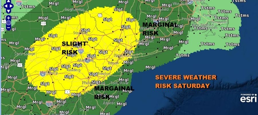
Flash Flood Watch Severe Weather Risk Late Today Tonight
Heat Humidity Ahead of Thunderstorms

Weather in 5/Joe & Joe Weather Show Latest Podcast
Flash Flood Watch Severe Weather Risk Late Today Tonight
Heat Humidity Ahead of Thunderstorms
This is going to turn out to be a busy day ahead of an upper trough and cold front that will be approaching this evening. Heat and humidity will take temperatures into the upper 80s and lower 90s. Dew points are going to reach into the 70s. This is going to mean a very unstable atmosphere and that leads to severe weather risk mainly after 5pm inland and after 6 or 7pm near the coast.
Since the ground remains saturated from the rains of the last 2 weeks (6 inches or more in some places) it won’t take much to set off flash flooding and we do have flash flood watches posted for a large portion of the forecast area.

Clouds are mostly to the north in upstate NY and west into Western Pennsylvania which leaves skies wide open into this afternoon for sunshine and ample daytime heating. We don’t expect any thunderstorm activity (other than the odd pop up) well into this afternoon so if you have outdoor activities go ahead with them but keep an eye to the sky of threaten weather as we head into the late afternoon and evening hours.
SATELLITE

WEATHER RADAR


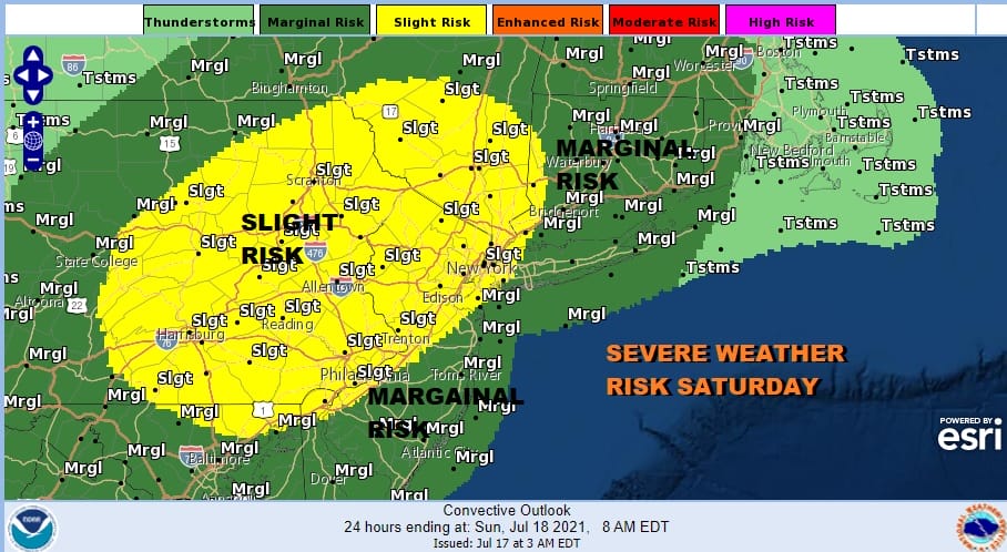
Going it this evening thunderstorms will be moving from west to east. Weather models are all showing development of a broken line of nasty thunderstorms crossing Pennsylvania and reaching Western New Jersey between 5 and 7pm and reaching the coast between 7 and 8pm.

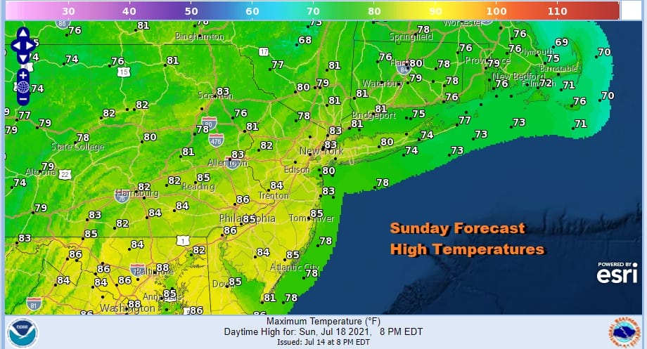
Once the storms move offshore weather conditions will improve later tonight but the cold front will reamin stalled out over the area on Sunday leaving us on the warm and humid side but temperatures will be lower than today with highs in the 80s.
Since the front will be hanging nearby, the risk for scattered thunderstorms remains for Sunday though they should be scattered in nature and that means some of you see them and some of you don’t. Next week will be another week where we see cold fronts an upper troughs come in from the northwest which means there is thunderstorm risk just about every day with Thursday perhaps the one day where do not see risk at this time.
BE SURE TO DOWNLOAD THE FREE METEOROLOGIST JOE CIOFFI WEATHER APP &
ANGRY BEN’S FREE WEATHER APP “THE ANGRY WEATHERMAN!

MANY THANKS TO TROPICAL TIDBITS & F5 WEATHER FOR THE USE OF MAPS
Please note that with regards to any severe weather, tropical storms, or hurricanes, should a storm be threatening, please consult your local National Weather Service office or your local government officials about what action you should be taking to protect life and property.


