WEATHER IN 5, 5 DAYS IN 5 MINUTES
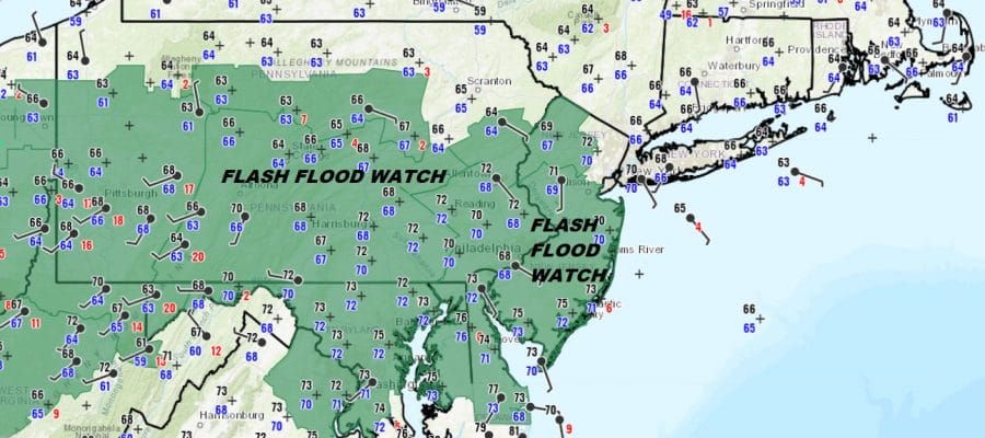
Flash Flood Watch New Jersey Pennsylvania South, Rain Into This Afternoon
It is all about the frontal boundary stalled out to the south and waves of low pressure moving along it. We have one such wave moving through this morning and it is producing some moderate to heavy rain in some places. This wave is impacting areas from the Northern half of Pennsylvania to Northern New Jersey east to the Hudson Valley, Long Island and Southern New England. Flash Flood Watches have been expanded a bit since last night to push it further northwest in New Jersey as well as Northern Pennsylvania.
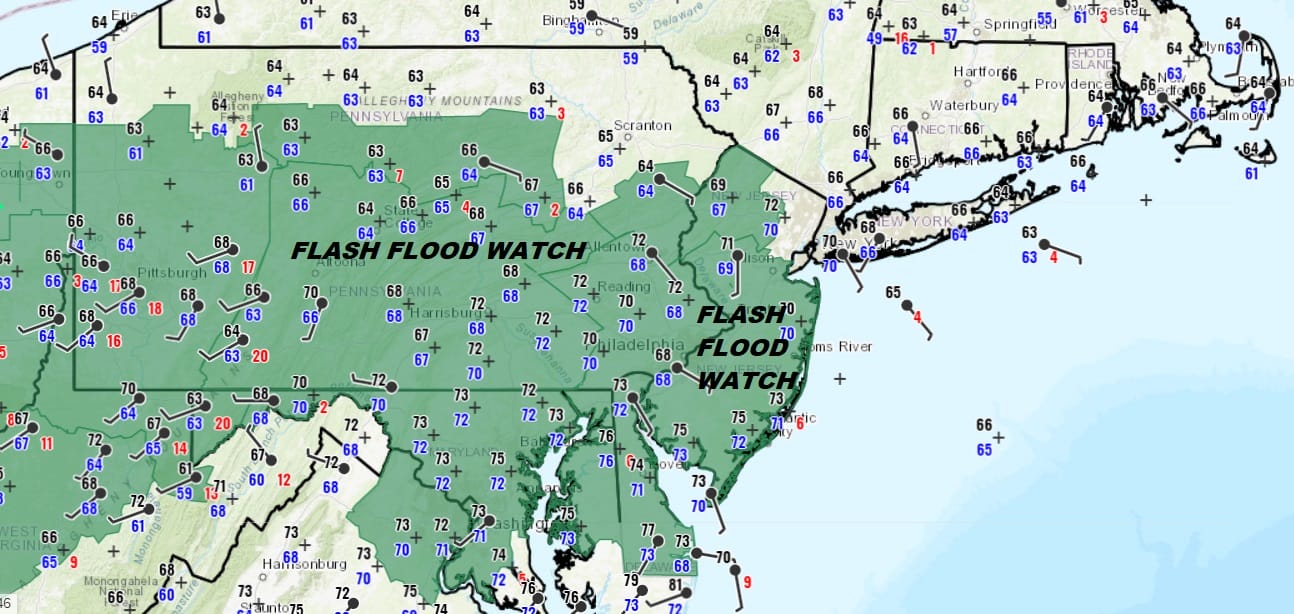
Our satellite picture shows the issue of being in the wrong location. The boundary between cooler air to the north and warm tropical air to the south continues to sit from just south of Long Island west across Southern New Jersey and through Southern Pennsylvania. The areas to the south of the frontal boundary are seeing little rain from the first wave but most areas to the north are getting a soaking rain. Through all of this temperatures today will be struggling in the mid 60s to lower 70s though some areas in South Jersey and Southern Pennsylvania southward we could see highs reaching into the 80s if the sun breaks through the clouds.
SATELLITE

REGIONAL RADAR

Radar shows the rain moving eastward with the heavier rains showing up in the darker greens and yellows. So far we do not see any thunderstorms in the mix here. The area is shifting eastward. Clearly the further south you go, the less rain you get. The northern part of this shield makes it to about i-90 in upstate NY. SouThern New England and Long Island should see a nice soaking into this afternoon.
LOCAL RADAR NEW YORK CITY

LOCAL RADAR PHILADELPHIA


After this wave plays through we are left with the same dilemma over the next few days. Waves of low pressure will move along the frontal boundary. This means opportunities for showers tonight into Wednesday night. Some places get them, some won’t. It will be all about timing and location.

The above loop is the GFS from 8pm tonight through 8pm Thursday. Tonight’s rain will be more to the south with some evening thunderstorms. Wednesday actually shows some clusters of showers and thunderstorms coming and going. Thursday is the day I would pay attention to as a cold front finally comes through. This could create thunderstorms late in the day Thursday that could be strong or even severe. The Storm Prediction Center already indicates some severe weather risk for our area.

Once the front clears the coast Friday morning weather conditions finally improve with decreasing clouds and increasing amounts of sunshine as we go through the day. It will also turn rather windy at times with gusty northwest winds and temperatures in the upper 70s to lower 80s. This carries over into the weekend. Right now we will another sunny Saturday with highs in the 70s to near 80 with low humidity. Sunday we will see sunshine give way to arriving clouds as another warm front starts to head our way. Right now we will keep the mention of showers out of the forecast for Sunday. This weekend is the first one of the summer season and there will be no summer heat or humidity around nor do we see any in the medium range outlook.
MANY THANKS TO TROPICAL TIDBITS FOR THE USE OF MAPS
Please note that with regards to any tropical storms or hurricanes, should a storm be threatening, please consult your local National Weather Service office or your local government officials about what action you should be taking to protect life and property.


