
FiOS1 News Weather Forecast New Jersey
Meteorologist Brian Fitzgerald tells the weather story for this Thanksgiving week.
Today looks good with sunshine but temperatures are going to have a tough time with highs just in the low to mid 40s at best and then another cold night for Monday night with Tuesday morning lows repeating the Monday morning lows. One thing about Monday is that it will be rather breezy with winds from the northwest at 15 to 25 mph with some higher gusts so it will make the 40s feel like it is closer to 30.
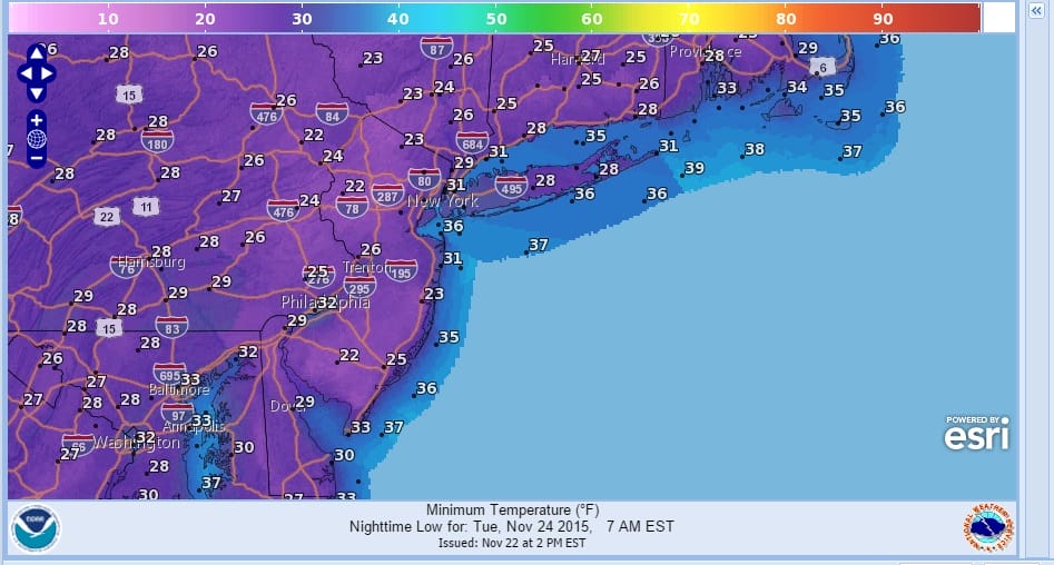
Tuesday afternoon we should see temperatures moderate to the middle and upper 40s. Tuesday night will be a clear sky light wind kind of night so that could send temperatures down again but we should see some recovery Wednesday with some sunshine and highs back into the 50s. Thanksgiving day looks decent with clouds and some sun and highs in the 50s to near 60.

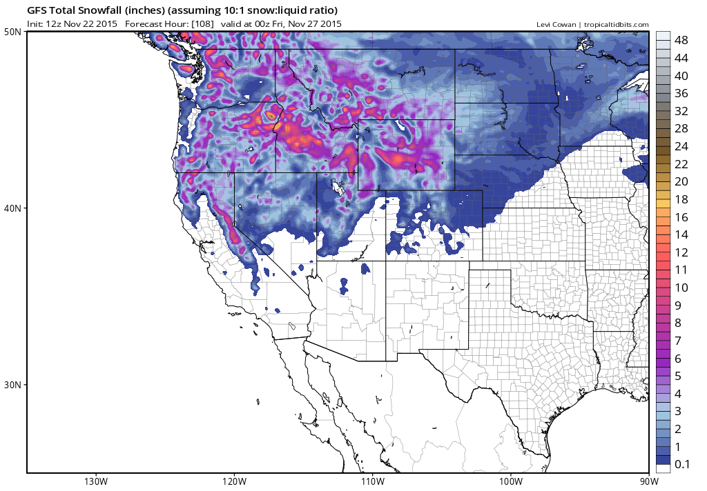
If you are travelling anywhere on Wednesday the forecast map for Wednesday evening is up and you can see that the weather over much of the country east of the Rockies is fine. From the Rockies west there are going to be snow issues as a very cold air mass drops out of Canada and combines with low pressure developing in Western Colorado so snow is likely for the northern Rockies and then moving into the Northern Plains on Thursday. For Thanksgiving ski holidays, the west will be best with lots of snow forecast.
I will be on this evening beginning at 5pm and I will be touching upon the long range outlook. Looks like the split flow may produce a threat here early next week for either rain or snow or both.
JOESTRADAMUS VIDEO ANALYSIS OF LONG RANGE MODELS FROM THIS MORNING
JOESTRADAMUS VIDEO ANALYSIS OF LONG RANGE FROM SUNDAY’S MODELS