Drying Out Over the Weekend, Next Storm System Later Next Week

Drying Out Over the Weekend, Next Storm System Later Next Week

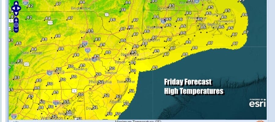
Improvement seems to be rather elusive at the moment as we still have the old storm system to the east and and upper low to the rest that is dropping southeast and weakening. The day is starting out in a state of mist and fog but we could see some areas go mostly cloudy to partly sunny this afternoon. It will still be a midl day with temperatures above average. Highs will reach the upper 40s and lower 50s. The radars appears to be relatively quiet but there are some leftover scattered showers across some areas inland. Tonight there could be a little light rain or drizzle with lows in the 30s with readings near 40 in warmer urban centers.
SATELLITE WITH LIGHTNING STRIKES

WEATHER RADAR

The weekend will see gradual improvement and like Christmas weekend, the departure of the old year and the arrival of the new one will come with no significant weather issues. Saturday looks to be a day of developing sunshine as clouds thin out. Afternoon highs will be trending a little lower as colder air (such as it is) will be heading in on northwest winds. Highs will be in the low to middle 40s.

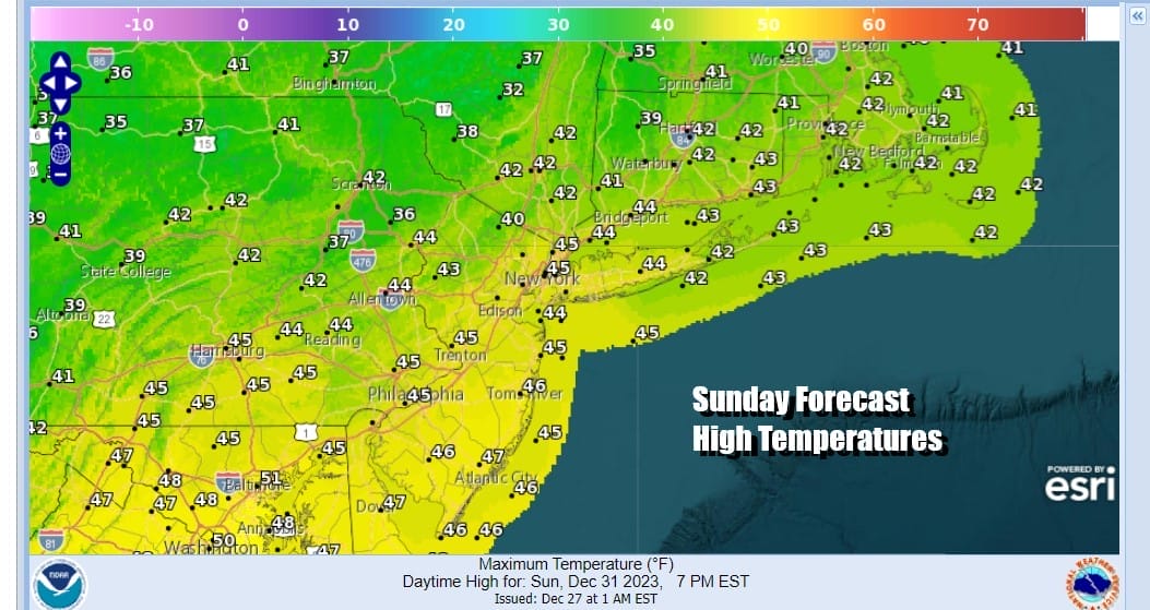
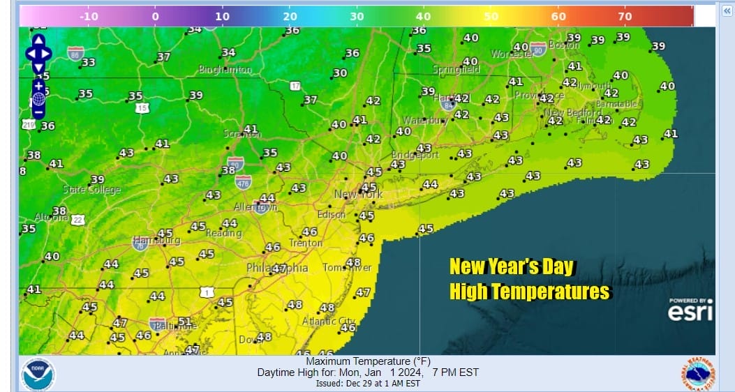
Weak high pressure to our south will build in and keep the northwest flow mostly intact for Sunday, New Year’s Eve. Sunday dayside should be no worse than partly sunny with highs in the low to mid 40s. Night temperatures will be dropping into the 20s inland and lower 30s near the coast. Monday New Years day sees a weak cold front that moves through. That front may come through with clouds and the outside chance for a scattered shower. Highs Monday will be in the low to mid 40s.
Moving through next week, Tuesday and Wednesday look to be dry and chilly but nothing unreasonable for this time of year. The southern part of the jet stream remains active and we will see a low move across the Gufl States and then turn northeast up the East Coast for Thursday into Friday. There is some question of whether this will be close enough to the coast to bring a cold rain northward, and perhaps some snow inland. It is a ways out yet in the long range but we will be watching developments with this system over the weekend.
BE SURE TO DOWNLOAD THE FREE METEOROLOGIST JOE CIOFFI WEATHER APP &
ANGRY BEN’S FREE WEATHER APP “THE ANGRY WEATHERMAN!
MANY THANKS TO TROPICAL TIDBITS FOR THE USE OF MAPS
Please note that with regards to any severe weather, tropical storms, or hurricanes, should a storm be threatening, please consult your local National Weather Service office or your local government officials about what action you should be taking to protect life and property.
(Amazon is an affilate of Meteorologist Joe Cioffi & earns commissions on sales.)


