
Drying Out Next Several Days As Weather Systems Pass to the North & South
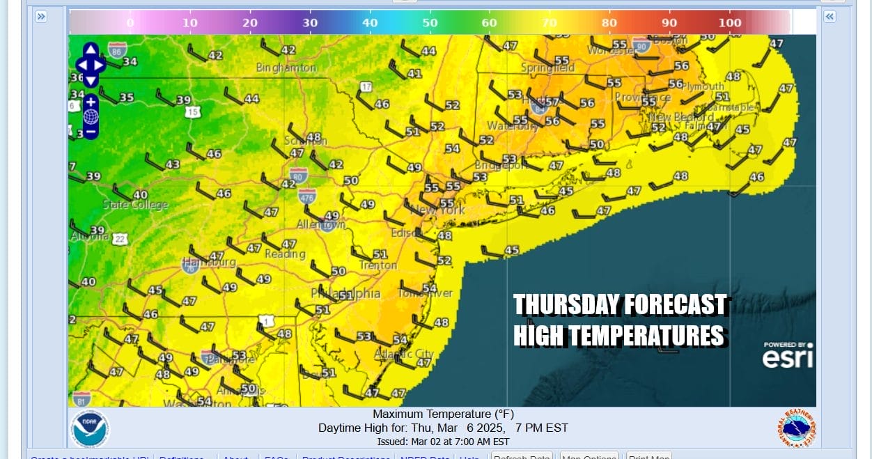
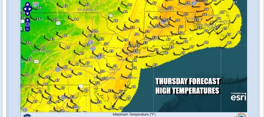
The wind machine is coming back on today and Wind Advisories have been posted for all of Eastern Pennsylvania to Southern New England. The wind will pick up once the upper trough to the west moves through later today. Gusts of 40 to 50 mph are likely to develop after that trough passes. In the meantime we will have a mild day of clouds and some sunshine. Most highs will be in the 50s. Radars will probably show some scattered showers as the day wears on and I would not rule out the chance for an isolated shower or two lhis afternoon.
SATELLITE WITH LIGHTNING STRIKES

WEATHER RADAR

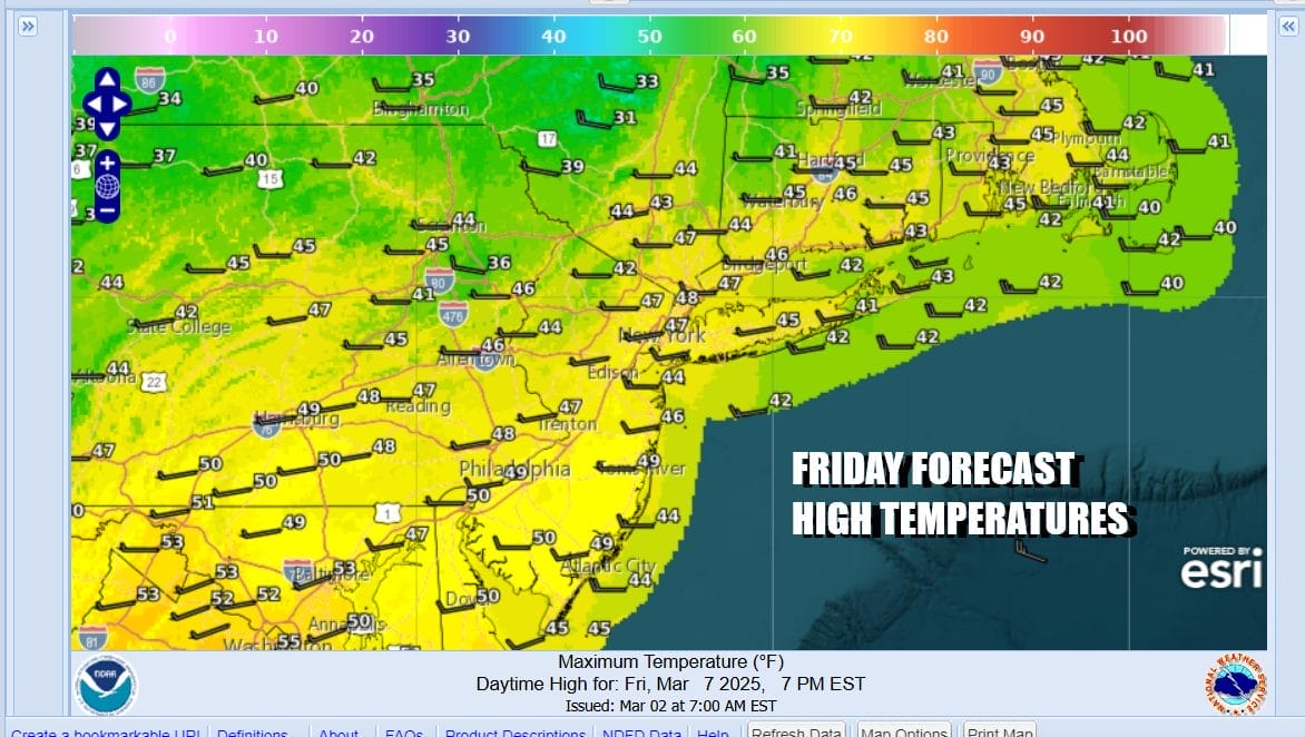
Once that upper trough does pass through the gusty northwest winds will be bringing down some colder air but it will not turn exceptionally cold. Most lows tonight will be in the mid 20s to lower 30s as skies clear. Friday will be windy at least for awhile before winds start to ease some. We will have more in the way of sunshine and highs will be in the upper 40s and lower 50s.
Over the weekend we see a bit of a “split flow” type pattern where there will be a system moving along the Canadian border from west to east, and low pressure moving across the Gulf States from west to east. As has been the case all weekend the two streams stay separate and the moisture from the northern system will pass well to the north and the moisture from the Gulf Coast system will stay way to the south.
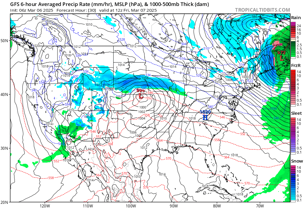
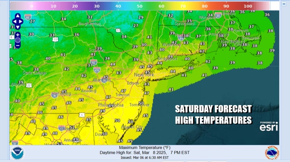
This set up leaves us in a bit of a sweet spot with dry weather conditions through the weekend and into next week. It will not be picture perfect but the weekend will offer some sunshine Saturday. There might be some clouds from a dying system moving to the south. Highs Saturday will be mostly in the 40s.
Sunday will likely be a repeat performance of Saturday with sunshine and some clouds with highs mostly in the 50s. A storm moving across the Gulf States passes well to the south with no issues. Next week we will not only see dry weather conditions but we will also see a nice pre-spring warm up with no rain through mid week. We will see highs Monday in the 50s to near 60, and Tuesday we will see highs in the mid 60s to near 70 degrees!
BE SURE TO DOWNLOAD THE FREE METEOROLOGIST JOE CIOFFI WEATHER APP &
ANGRY BEN’S FREE WEATHER APP “THE ANGRY WEATHERMAN!
MANY THANKS TO TROPICAL TIDBITS FOR THE USE OF MAPS
Please note that with regards to any severe weather, tropical storms, or hurricanes, should a storm be threatening, please consult your local National Weather Service office or your local government officials about what action you should be taking to protect life and property.


