Dry Weather Continues
Dry Weather Continues
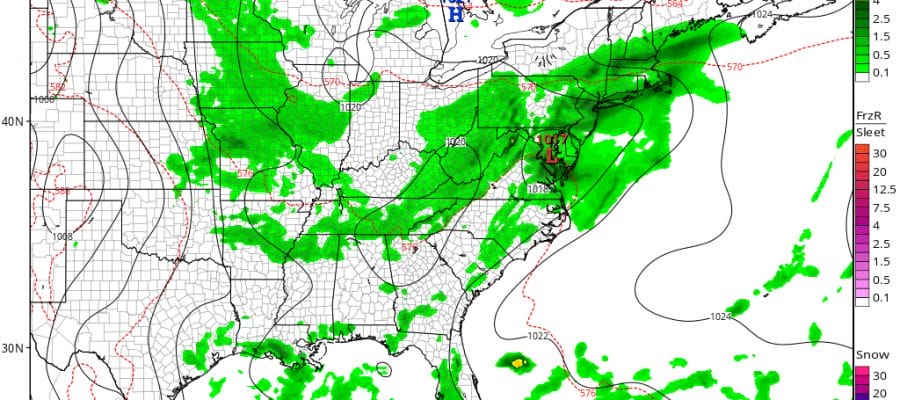
More Humid Midweek With Thunderstorms
We are wrapping up a beautiful day with lots of sunshine and low humidity. Dew points are in the 50s. Temperatures are in the 70s to near 80. This is a really nice mid July day. No issues tonight and no issues Tuesday with clear skies. Lows will be in the 60s with 50s in the cool spots. Tuesday’s highs will be in the mid to upper 80s in most places except a little cooler along the shore. Lots of sunshine if forecast all day Tuesday. Satellite loop shows clouds in the Upper Midwest & Plains which is the next weather system that will be approaching for later in the week.
Dry Weather Continues Satellite Loop

Dry Weather Continues Radar Loop

Dry Weather Continues Local Radar Loops


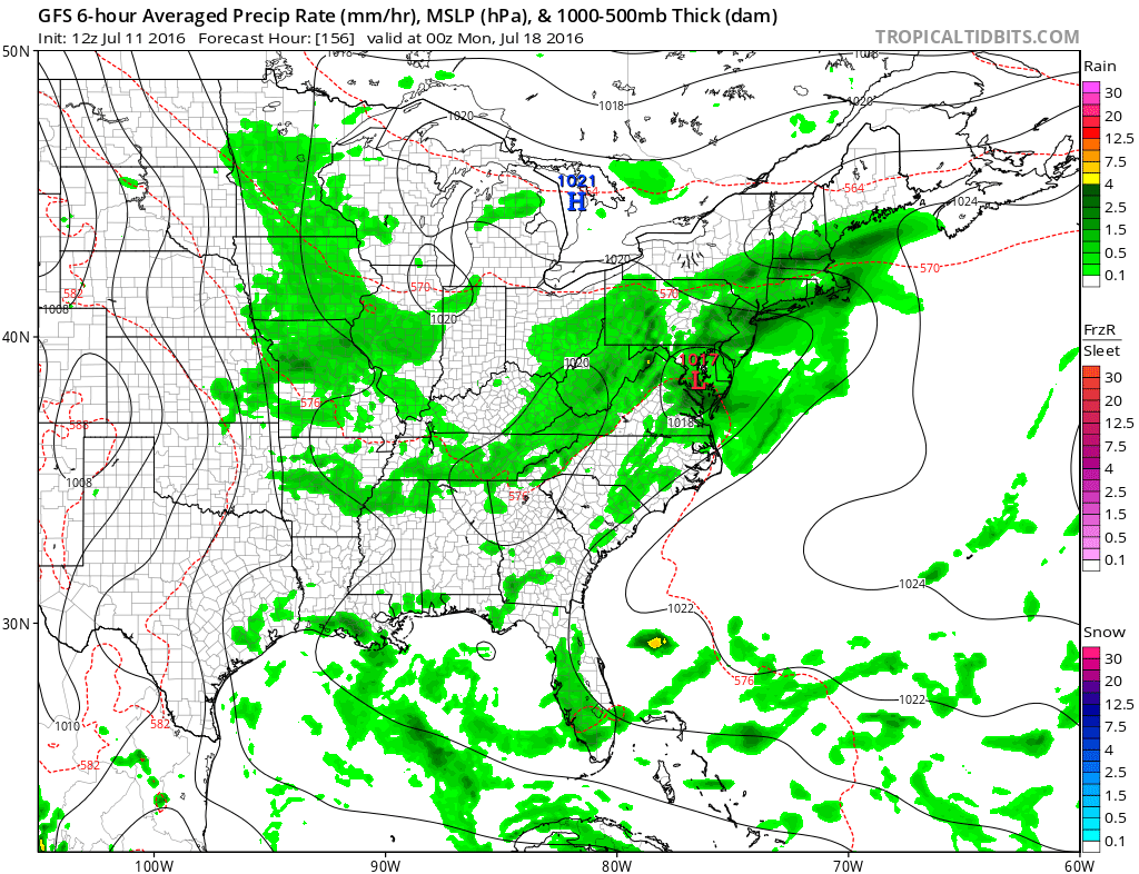
Midweek & Late Week Outlook
Wednesday we will see humidity return and there will be enough moisture around to trigger off some thunderstorms especially inland during the afternoon and evening. Temperatures will be in the 80s. Thursday looks very warm and humid with some sun but some thunderstorms threaten in the evening with the next cold front. Highs will be in the 80s to around 90.

Friday we will dry out with a west or northwest wind so with sunshine we could see temperatures in the 90s though the humidity will be dropping off. For now no serious issues for Saturday however Sunday some models are bringing up moisture and showers. We will see how this plays out as we move through the week.
The Atlantic tropics remain quiet but everything seems to point to a more active period because conditions aloft are far different from what they were last year. Here is the latest JOESTRADAMUS post on this and below is my weather video addressing this.
[brid video=”54209″ player=”6390″ title=”tropical”]
FiOS1 News Weather Forecast For Long Island
FiOS1 News Weather Forecast For New Jersey
FiOS1 News Weather Forecast For Hudson Valley
NATIONAL WEATHER SERVICE SNOW FORECASTS
LATEST JOESTRADAMUS ON THE LONG RANGE
Weather App

Don’t be without Meteorologist Joe Cioffi’s weather app. It is really a meteorologist app because you get my forecasts and my analysis and not some automated computer generated forecast based on the GFS model. This is why your app forecast changes every 6 hours. It is model driven with no human input at all. It gives you an icon, a temperature and no insight whatsoever.
It is a complete weather app to suit your forecast needs. All the weather information you need is right on your phone. Android or I-phone, use it to keep track of all the latest weather information and forecasts. This weather app is also free of advertising so you don’t have to worry about security issues with your device. An accurate forecast and no worries that your device is being compromised.
Use it in conjunction with my website and my facebook and twitter and you have complete weather coverage of all the latest weather and the long range outlook. The website has been redone and upgraded. Its easy to use and everything is archived so you can see how well Joe does or doesn’t do when it comes to forecasts and outlooks.
Just click on the google play button or the apple store button on the sidebar for my app which is on My Weather Concierge. Download the app for free. Subscribe to my forecasts on an ad free environment for just 99 cents a month.
Get my forecasts in the palm of your hand for less than the cost of a cup of Joe!

MENTION JOE CIOFFI AND GET A 5% DISCOUNT


