Dry Sunday But Increasing Risk for Showers Thunderstorms
As Cold Front Approaches Memorial Day

Dry Sunday But Increasing Risk for Showers Thunderstorms
As Cold Front Approaches Memorial Day

We had some showers and one or two rumbles of thunder move through overnight but all of that is now offshore and gone and we can settle in on a nice day overall from Eastern Pennsylvania to Southern New England. Coastal areas have some clouds to work through but they should get out of the way before too long and much of today will feature sunshine. Highs will reach into the 80s inland while the south wind cools things along the immediate coast from New Jersey to Southern and Southeastern New England. We don’t see any shower or thunderstorm issues for today or tonight. Dew points will be rising especially tonight and Monday as we set up for an approaching cold front.
SATELLITE WITH LIGHTNING STRIKES

WEATHER RADAR

There isn’t much to worry over overnight into Monday morning other than some patchy clouds. Most lows will be in the upper 50s to middle 60s. Low pressure today is moving through the Mississippi and Ohio Valleys and heading to the Great Lakes and its trailing cold front is bringing shower and thunderstorms from the Mississippi River east to the Appalachians today.

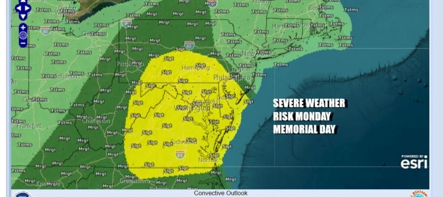
Monday sees severe weather risks shifting eastward but it seems that the area of highest instability will be from Southern New Jersey and Southern Pennsylvania southward while general thunderstorms are forecast for much of the Northeast. It is not an all day rain but as the HRRR model showers there will be bands of showers and thunderstorms moving from west to east during the afternoon and evening Monday.
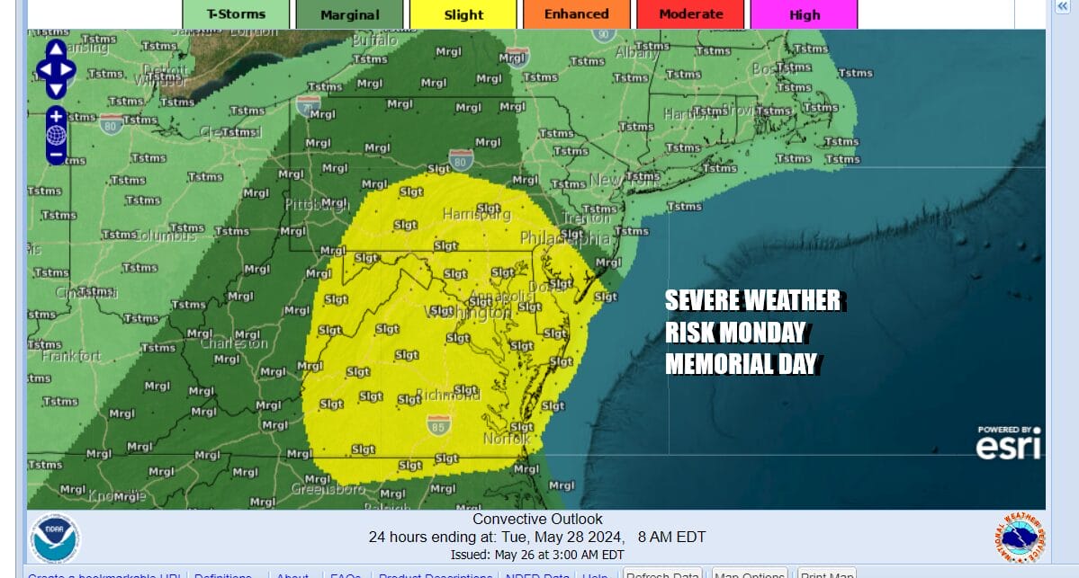
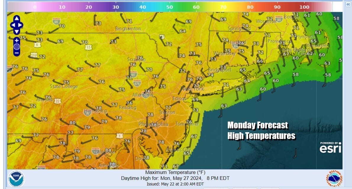
We will be watching to see if the warm sector makes it a little further north than what is being advertised by the Storm Prediction Center. There is a small area of 2 percent tornado risk being indicated for parts of Maryland and Virginia. As far as temperatures go, Monday highs will be mostly in the 70s outside the risk zones and upper 70s and lower 80s inside with rising humidity.
Once this system moves east Monday night we will see improvement Tuesday. Except for maybe some scattered showers or a thunderstorm with a weak front Wednesday, much of the week will feature near or slightly cooler than average temperatures and not much in the way of rain! We continue to hope everyone’s holiday weekend is going well and pay a little extra attention Monday as storms approach.
BE SURE TO DOWNLOAD THE FREE METEOROLOGIST JOE CIOFFI WEATHER APP &
ANGRY BEN’S FREE WEATHER APP “THE ANGRY WEATHERMAN!
MANY THANKS TO TROPICAL TIDBITS FOR THE USE OF MAPS
Please note that with regards to any severe weather, tropical storms, or hurricanes, should a storm be threatening, please consult your local National Weather Service office or your local government officials about what action you should be taking to protect life and property.
(Amazon is an affilate of Meteorologist Joe Cioffi & earns commissions on sales.)


