Dry Into Friday Temperatures Risking Mid & Late Week With Area Wide 90s

Dry Into Friday Temperatures Risking Mid & Late Week With Area Wide 90s
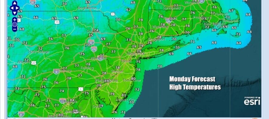
The new week and the next to last week of spring actually looks to be rather nice for the most part with not much in the way of rain. A cold front that passed yesterday is offshore and is actually now rather far south in the Eastern US. High pressure is building in from the Great Lakes and this will mean sunshine today and nothing more than some patchy clouds. There is another upper trough move eastward but it is weak. The upper low in Eastern Canada is keeping things nice and seasonal temperature wise and highs today will be in the middle to upper 70s in most places.
SATELLITE WITH LIGHTNING STRIKES

WEATHER RADAR

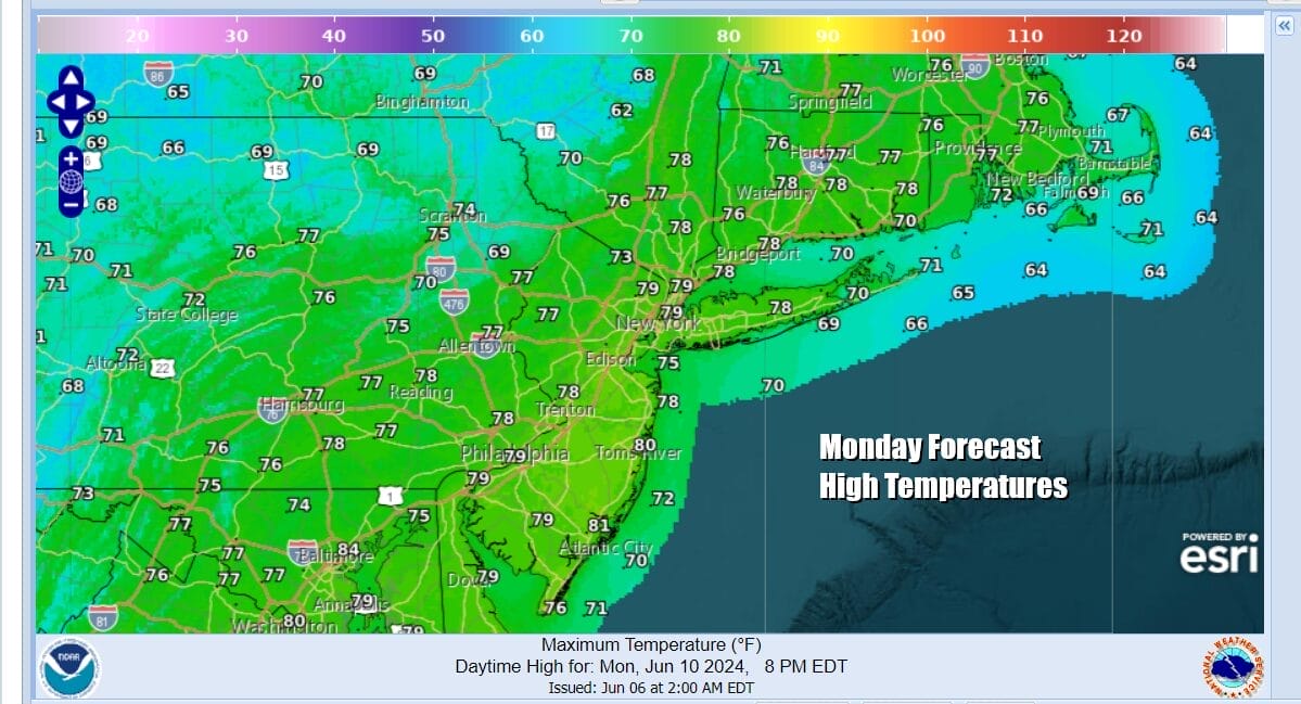
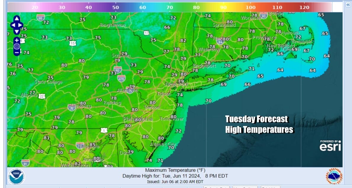
Much of the activity on the radar today will be in Northern NY and Northern New England with no radar issues forecast for Eastern Pennsylvania to Southern New England. Tonight should be partly to mostly clear with lows in the mid 50s to lower 60s. Tuesday looks like a nice day of sunshine and some patchy clouds. Highs will be in the upper 70s to around or just over 80 degrees in some places.
High pressure eventually moves off the Mid Atlantic coast Wednesday and parks itself there into Friday. This should start to the trend of temperatures rising for the second half of the week. It will also keep the tropical moisture flow from the Caribbean to Florida from spreading northward up the Eastern Seaboard. Torrential rains of 10 inches or more are likely for Florida but that system is not an issue for much of the East Coast.

A west southwest flow develops Wednesday and that will allow temperatures to climb. Dew points will be slow to rise so it will be relatively comfortable through Thursday. Friday we will see dew points start to push into the 60s so that may be the one day I would describe as somewhat humid. Wednesday we will see highs reaching into the low and middle 80s with plenty of sunshine.

Thursday will be very warm with sunshine taking highs to the upper 80s to near 90 degrees ins some places. Friday will be hot with sunshine for much of the day. Highs will reach the upper 80s and lower 90s. A cold front is forecast to move through Friday night into early Saturday with some showers and thunderstorms but weather models show this front moving along. If this is indeed the case, the weekend which includes Sunday, Father’s Day looks good with dry weather, sunshine and highs into the 80s.
BE SURE TO DOWNLOAD THE FREE METEOROLOGIST JOE CIOFFI WEATHER APP &
ANGRY BEN’S FREE WEATHER APP “THE ANGRY WEATHERMAN!
MANY THANKS TO TROPICAL TIDBITS FOR THE USE OF MAPS
Please note that with regards to any severe weather, tropical storms, or hurricanes, should a storm be threatening, please consult your local National Weather Service office or your local government officials about what action you should be taking to protect life and property.
(Amazon is an affilate of Meteorologist Joe Cioffi & earns commissions on sales.)


