Upper Trough & Cold Front Moving Through this Morning,
Week Ahead Looks Dry Through Wednesday Hot Late Week

Upper Trough & Cold Front Moving Through this Morning,
Week Ahead Looks Dry Through Wednesday Hot Late Week
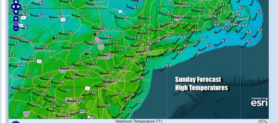
Today’s weather is all about an upper trough and cold front that is passing through the Northeast and Northern Mid Atlantic states. The bulk of the shower activity with this system is in upstate NY and New England as the satellite and radar loops show. This system moves along with some showers possible into midday. They should not amount to much unless you are north and northeast of NYC where rain will be a bit more extensive and last a bit longer. We should see sky conditions improve this afternoon from west to east as clouds give way to partly sunny skies. Most highs today will be in the mid 70s to around 80 degrees.
SATELLITE WITH LIGHTNING STRIKES

WEATHER RADAR

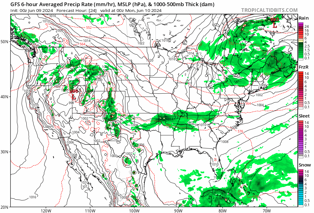
Once this front and trough are offshore high pressure builds into the Eastern US from the Great Lakes. This is a large slow moving high and it will be covering much of the Great Lakes, Northeast and Mid Atlantic region through Wednesday. Then the high moves out to the south and we will see temperatures climb Thursday and Friday. We don’t see much of any rain this week until perhaps later Friday as a cold front brings showers and thunderstorms late in the day.
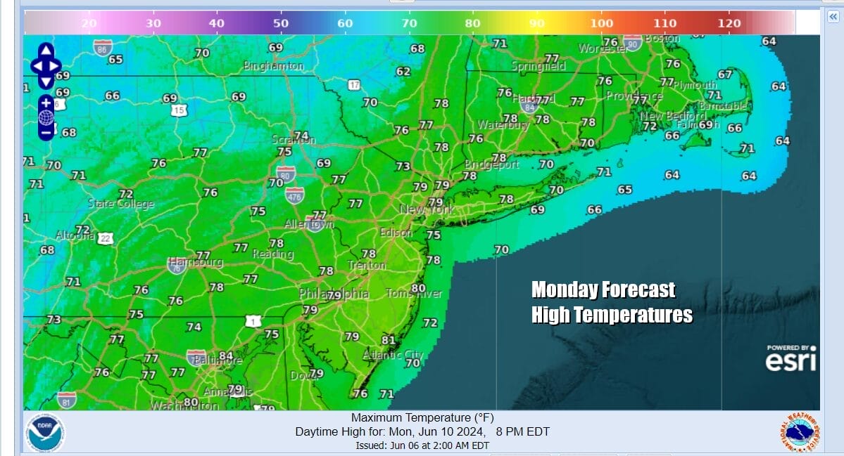
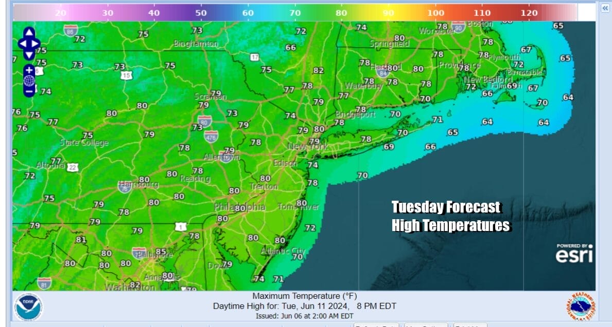
Monday should be a nice day of sunshine, reasonable humidity and seasonal temperatures. Highs Monday will be in the upper 70s to around 80 degrees. Nights will be nice and clear at least for the first part of this week and lows will be in the mid to upper 50s inland and low to mid 60s coast and warmer urban locations. The same holds for Tuesday which will be a day of partly to mostly sunny skies. Temperatures will probably edge a bit higher in the afternoon and highs will reach into the 80s in most inland areas and 70s along the coast with local sea breezes.
Wednesday sees high pressure off the Mid Atlantic coast and the west to southwest wind begins to bring up warmer and eventually more humid air, though that really is going to more of a problem south of the high center. Rain will be moving into Florida and the coastal southeast as low pressure tries to form in the Eastern Gulf of Mexico but this is not going to be an issue for the Northeast and Mid Atlantic states.


Wednesday sees sunshine with rising temperatures as highs reach the low to mid 80s. It should still be reasonably comfortable. Thursday starts the hot weather with sunshine and highs that will reach the upper 80s to some lower 90s. The same will hold for Friday but we do have an approaching weather front and that brings the risk of showers and thunderstorms late Friday as the front nears and passes through. If everything moves along it sets up for nice warm weather for next weekend and Father’s Day.
BE SURE TO DOWNLOAD THE FREE METEOROLOGIST JOE CIOFFI WEATHER APP &
ANGRY BEN’S FREE WEATHER APP “THE ANGRY WEATHERMAN!
MANY THANKS TO TROPICAL TIDBITS FOR THE USE OF MAPS
Please note that with regards to any severe weather, tropical storms, or hurricanes, should a storm be threatening, please consult your local National Weather Service office or your local government officials about what action you should be taking to protect life and property.
(Amazon is an affilate of Meteorologist Joe Cioffi & earns commissions on sales.)


