
Dry Cool Weather Warmer Weekend

MENTION JOE CIOFFI AND GET A 5% DISCOUNT
Now that the cold front is through weather conditions are beginning to improve from west to east. Temperatures have already come off the highs of the day in the 50s. Now we will see skies clear out tonight with temperatures by Wednesday morning in the 30s.
Dry Cool Weather Warmer Weekend Thursday Morning GFS SURFACE MAP
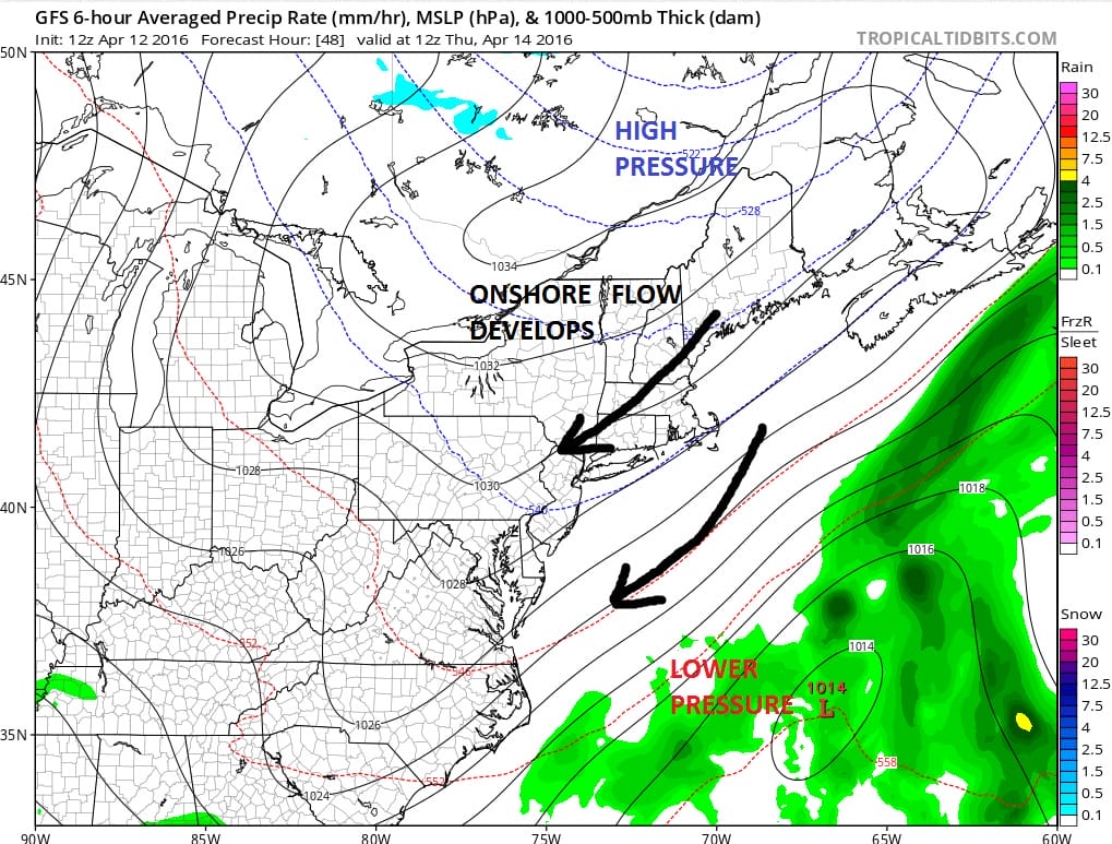
The next three days will be dominated by high pressure to the north and an ocean wind. Initially the air is fairly dry and this should keep things sunny for a time but some clouds are likely to develop during the day on Wednesday. The next 2 days the same high will be locked up in Northern New England and Eastern Canada. This sets up a northeast flow off the ocean for the rest of the week. The one concern will be how much (if any) moisture begins to get involved in the bottom part of the atmosphere. Models are developing low pressure well to the south and east. While it will be breezy at times especially along the coast it should not be especially windy. As we move toward Friday and Saturday morning some overnight low clouds will possibly move in but I’m thinking that most should burn off before too long during the day.
One thing about this northeast flow is that there could be slightly higher than normal tides developing along the New Jersey shore and on Long Island beginning Thursday and lasting into Saturday morning. With the absence of a big coastal storm or even a moderate one, I would think any tidal flooding issues should be minor in nature.
Dry Cool Weather Warmer Weekend Sunday Afternoon GFS Surface Map
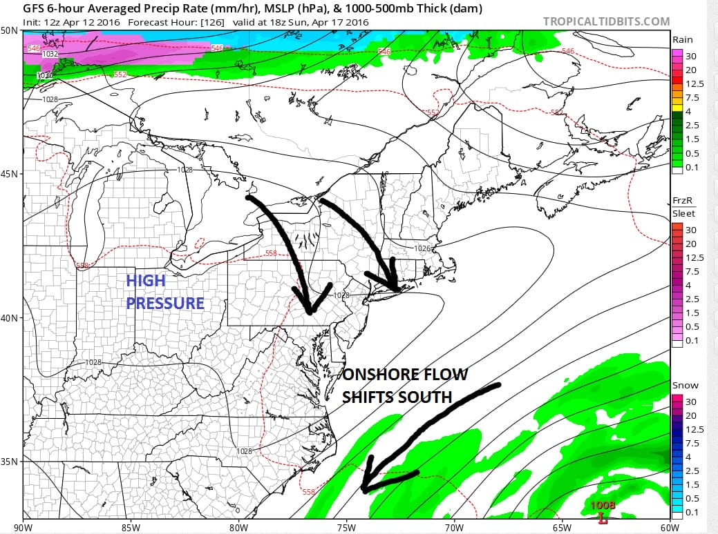
Now with regards to the weekend, it will all hinge on how the high repositions itself in the east. The GFS model and to some extent the Euro model, redevelop the high to the west on Sunday. This shifts the onshore flow southward and turns the winds here more northwestly on Sunday. This should allow temperatures to bounce higher this weekend. I think we could get into the 60s away from the coast on Saturday. Everyone on Sunday should make the 60s to near 70 based on this look.
No big storms are on the horizon through early next week. We could have another day of 70 or better on Monday before a cold front comes through with a few passing showers late in the day.
FiOS1 News Weather Forecast For Long Island
FiOS1 News Weather Forecast For New Jersey
FiOS1 News Weather Forecast For Hudson Valley
NATIONAL WEATHER SERVICE SNOW FORECASTS
LATEST JOESTRADAMUS ON THE LONG RANGE

NOMINATED FOR AN APPY AWARD FOR BEST WEATHER APP!!
Weather App

Don’t be without Meteorologist Joe Cioffi’s weather app. It is really a meteorologist app because you get my forecasts and my analysis and not some automated computer generated forecast based on the GFS model. This is why your app forecast changes every 6 hours. It is model driven with no human input at all. It gives you an icon, a temperature and no insight whatsoever.
It is a complete weather app to suit your forecast needs. All the weather information you need is right on your phone. Android or I-phone, use it to keep track of all the latest weather information and forecasts. This weather app is also free of advertising so you don’t have to worry about security issues with your device. An accurate forecast and no worries that your device is being compromised.
Use it in conjunction with my website and my facebook and twitter and you have complete weather coverage of all the latest weather and the long range outlook. The website has been redone and upgraded. Its easy to use and everything is archived so you can see how well Joe does or doesn’t do when it comes to forecasts and outlooks.
Just click on the google play button or the apple store button on the sidebar for my app which is on My Weather Concierge. Download the app for free. Subscribe to my forecasts on an ad free environment for just 99 cents a month.
Get my forecasts in the palm of your hand for less than the cost of a cup of Joe!
![]()


