Downpours Thunderstorms Threaten All Week Severe Weather Risk Today Tuesday
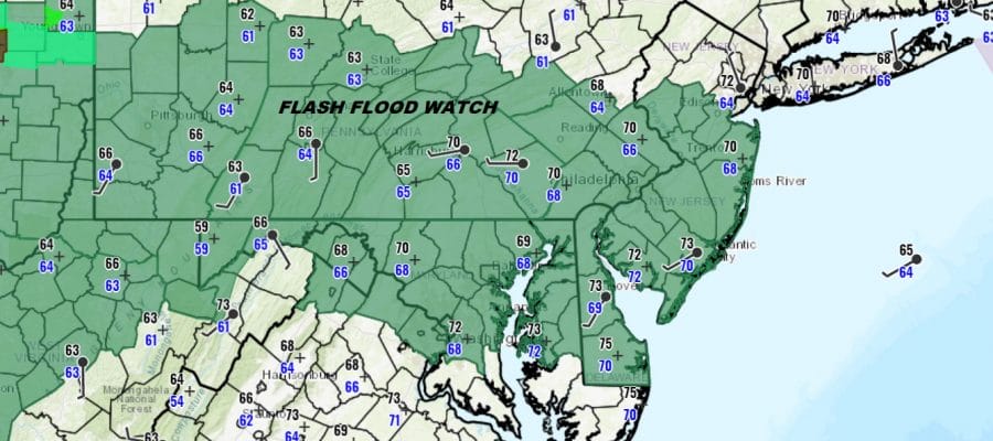
Flash Flood Watch Much of New Jersey West & South
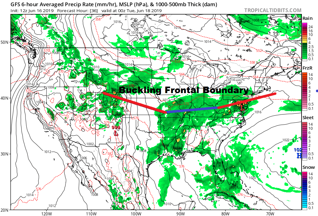
This week it is going to be all about the frontal boundary that likes from roughly New Jersey westward to the Ohio Valley and then southwestward into the Plains. This is a similar pattern to what we saw a few weeks ago. The boundary buckles back and forth and each time it buckles, the boundary moves northward. We get showers and thunderstorms as a wave goes by and then the front sinks southward. Over the course of the week the frontal boundary at best moves about 150 miles or so in either direction. This means chances for Downpours & thunderstorms every day though it doesn’t rain straight through. When it isnt raining it is clouds with perhaps some breaks of sun with temperatures in a range from the 70s to some lower 80s.
SATELLITE

REGIONAL RADAR

Satellite and radars are showing the next impulse of downpours developing across Southwest Pennsylvania and West Virginia and that area is moving eastward. It appears that we will be getting into some of that later today.
LOCAL RADAR NEW YORK CITY

LOCAL RADAR PHILADELPHIA


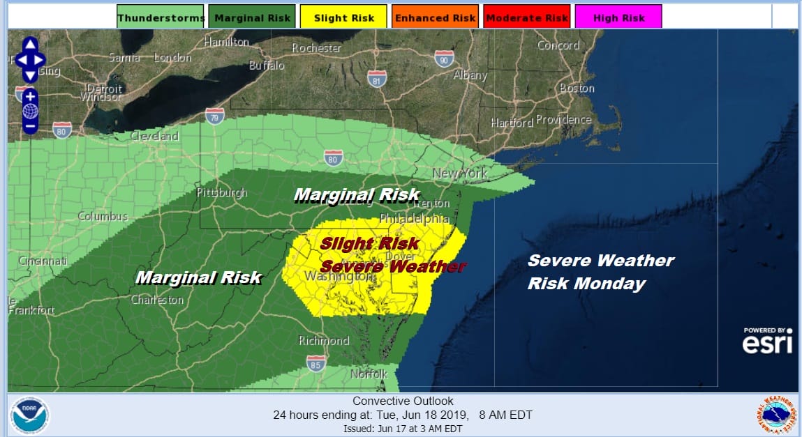
The question of severe weather comes into play here and the Storm Prediction Center does have much of the area in a marginal risk for severe weather over the next couple of days. I think the bigger risk like in the potential for heavy rains. It wouldn’t be a surprise to see some areas receiving several inches or more of rain spread out over the course of this week. Flash Flood Watches are posted from New Jersey & Pennsylvania west and south.

Expect the timing of showers and thunderstorms today to be one where the threat could be there almost at anytime but much of the time it won’t be raining. Thunderstorms will likely develop late today into this evening with the best chances south of NYC. Then sometime overnight there could be other showers and thunderstorms that impact the area.
With thunderstorm risks every day this week, when does this all end? The strongest wave of the series looks to pass here Thursday night and we should start to transition later Friday into a drier air flow for perhaps next weekend. It also will be a cooler air flow with below average temperatures likely. We will explore the longer range later today.
MANY THANKS TO TROPICAL TIDBITS FOR THE USE OF MAPS
Please note that with regards to any tropical storms or hurricanes, should a storm be threatening, please consult your local National Weather Service office or your local government officials about what action you should be taking to protect life and property.


