Frontal Boundary Issues All Week Some Showers Tonight Thunderstorms South Jersey Southward
When we look at the frontal boundary lying east-west across our area you can see the frustration here. Clear skies show up on the satellite north of I-90 in upstate NY. To the south the cloud line lies across Southern New Jersey westward along the Pennsylvania Maryland border and then westward into the Ohio Valley. It is literally a couple of hundred miles wide and we are sitting in the middle of it. The boundary gets kicked northward as weak waves go by only to drop back southward in their aftermath. While they move through we get showers, heavier downpours, and some thunderstorms. Timing is going to be difficult and we will rely on the radars to tell us as short term models are not reliable here.
SATELLITE

REGIONAL RADAR

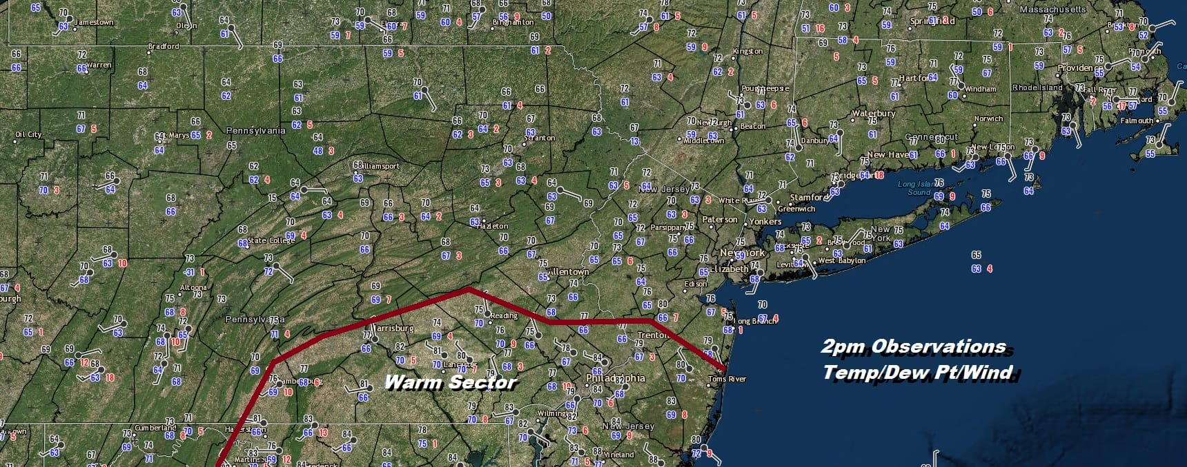
The radar is showing some showers developing this afternoon across Pennsylvania. Keep an eye on the southern flank where some thunderstorms will likely develop. The map above shows where the warm sector is this afternoon and this is the most likely area where we could see severe weather. Temperatures are mostly in the lower 70s except in the warm sector where temperatures have risen into the 80s.
LOCAL RADAR NEW YORK CITY

LOCAL RADAR PHILADELPHIA


We don’t see much change on the overall theme in the weather over the next few days. It is all about that boundary and when it buckles. The forecast for Tuesday and Wednesday are about the same as today. Clouds will be around. Some breaks of sun are possible. Downpours and thunderstorms are also possible. Most highs will be in the mid 70s. to lower 80s.

The wave to pay the most attention to is the one on Thursday as a strong short wave trough will be in play here. A rather deep surface low develops in the Ohio Valley and moves eastward. This to me looks like a setup for severe weather potential on Thursday. The last wave goes by with a strong cold front followed by genuine improvement starting on Friday.
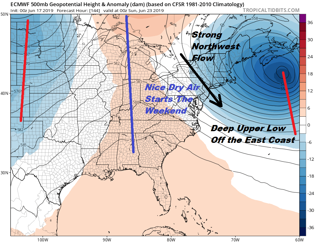
The front could briefly get hung up near us Friday morning but dry air does eventually win out. Gusty northwest winds will bring in dry air from Canada. This should set us up for a nice dry Saturday with low humidity, sunshine, and temperatures in the 70s. Hopefully that ridge to the west hangs around long enough to give us a nice day on Sunday but the next system from the Plains will be moving east by then. It will be all about timing but there is a chance we could squeeze out a nice Sunday as well before showers return.
MANY THANKS TO TROPICAL TIDBITS FOR THE USE OF MAPS
Please note that with regards to any tropical storms or hurricanes, should a storm be threatening, please consult your local National Weather Service office or your local government officials about what action you should be taking to protect life and property.


