Downpours Thunderstorms Morning Commute Thursday
Downpours Thunderstorms Morning Commute Thursday
Watching the satellite and radars tonight we have seen some heavy downpours come and go through parts of the area but to the west across Pennsylvania we are seeing a growing area of downpours and thunderstorms that will be moving through during the early morning hours and into the morning commute on Thursday. The Storm Prediction Center sees a marginal risk of severe weather from the western counties of New Jersey into Eastern Pennsylvania tonight but it is quite possible that some of these developing thunderstorms could hold their strength as they move across New Jersey, NYC, the Hudson Valley, Connecticut & Long Island Thursday morning around daybreak.
EASTERN SATELLITE

REGIONAL RADAR

Regional and local radars show the bands of storms increasing in coverage as they move eastward. The morning commute for some could require some extra travel time so plan accordingly.
LOCAL RADAR NEW YORK CITY

LOCAL RADAR PHILADELPHIA


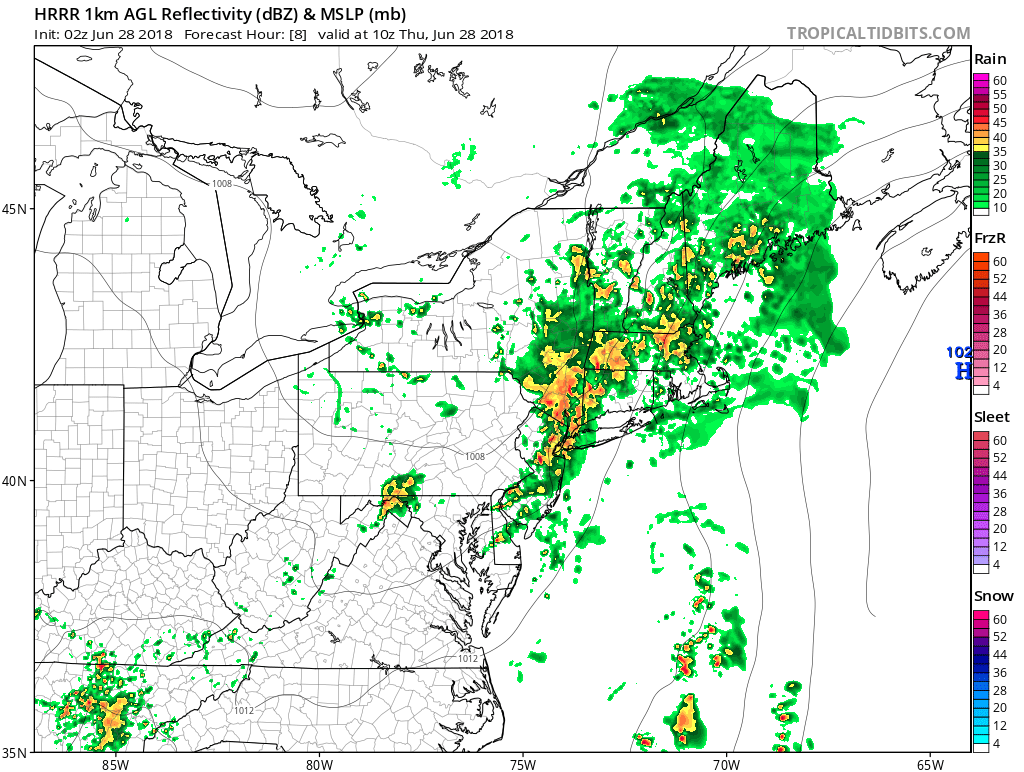
The HRRR model seems very robust with this tonight and at 2am has a rather large area of heavy rain and thunderstorms
HRRR MODEL 3AM THURSDAY JUNE 28, 2018

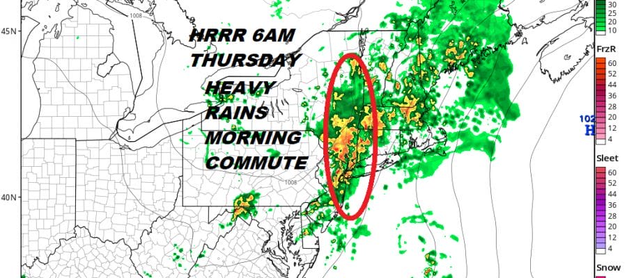
HRRR MODEL 6AM THURSDAY JUNE 28, 2018
By 6am the downpours and thunderstorms seem to narrow a bit but we do see an extensive area of heavy rain from the Hudson Valley to Western Connecticut southward to NYC, and most of New Jersey. At this point they are moving out of Northwest New Jersey. They should clear NYC and the Hudson Valley around 8am or so and the East End of Long Island and Easter Connecticut by 10am. After that there could be another downpour or thunderstorm later in the afternoon and evening with muggy conditions and highs reaching into the 80s. Then it is on to sunshine for Friday as a heatwave begins and takes us through the weekend.
 GET JOE A CIGAR IF YOU LIKE

LATEST JOESTRADAMUS ON THE LONG RANGE


