Developing Storm Brings Humidity Relief Sunday To Northeast & Mid Atlantic

Weather in 5/Joe & Joe Weather Show Latest Podcast
Developing Storm Brings Humidity Relief Sunday To Northeast & Mid Atlantic
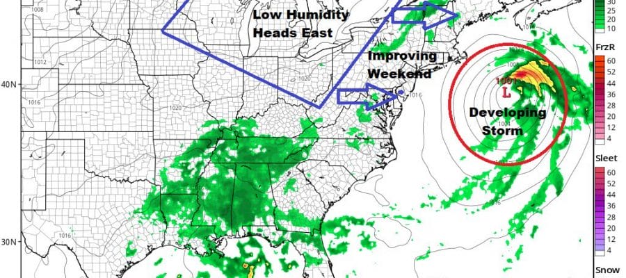
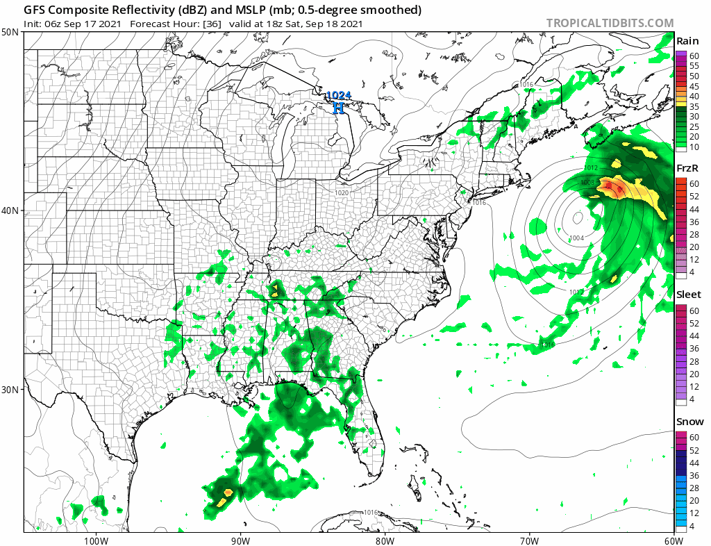
We are sitting in a lot of clouds today thanks to a stalled frontal boundary just to our south & a developing low to the east of Virginia. That system could become a tropical storm but even it if is just a regular non tropical system it is going to strengthen as it heads northeast. That is good news for the Northeast and Middle Atlantic states because it will take a cold front now in the Great Lakes and bring in through here Saturday night. What follows is genuine humidity relief for Sunday and Monday.
SATELLITE

Radars are quiet right now on land but we are seeing echoes on the regional radar. They are arcing back northwestward just offshore as they rotate around the circulation of the developing offshore storm. Late this afternoon and evening a few scattered showers or a thunderstorm or two could develop from Southern New Jersey south into Maryland and Delaware near the stalled front but it should remain quiet everywhere else. Temperatures this afternoon will be in the 70s
WEATHER RADAR

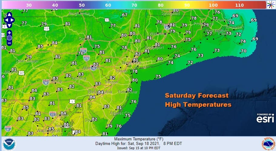
Clouds will begin to move to the east later tonight as the coastal low moves away so look for some overnight clearing from west to east. Some clouds could linger along the coast early Saturday but it should go partly to mostly sunny. It will be a warm humid day with highs into the 80s.
A cold front approaches Saturday evening with a scattered shower or thunderstorm and then dry air follows as skies clear, setting us up for a lovely day on Sunday. Look for sunshine, low humidity, and highs generally in the upper 70s to some lower 80s.
Next week sees a change in the overall pattern as blocking develops over Greenland. This is going to put an end to the long stretches of humid weather and allow cold fronts to come through on a regular basis. Monday and Tuesday will see sunshine as high pressure to the northeast is in control. Humidity will be reasonable and highs both days will be in the upper 70s to lower 80s. A strong upper trough and cold front will arrive on Wednesday which will be a warm humid day followed but the risk for thunderstorms and possibly severe weather late in the day. Highs will be in the 80s. A large dry cool air mass follows to finish off next week and we could see a couple of days of very low humidity and highs that will be only in the upper 60s and lower 70s. We can call this the first true autumn air mass and more will follow as blocking takes hold.
BE SURE TO DOWNLOAD THE FREE METEOROLOGIST JOE CIOFFI WEATHER APP &
ANGRY BEN’S FREE WEATHER APP “THE ANGRY WEATHERMAN!

MANY THANKS TO TROPICAL TIDBITS & F5 WEATHER FOR THE USE OF MAPS
Please note that with regards to any severe weather, tropical storms, or hurricanes, should a storm be threatening, please consult your local National Weather Service office or your local government officials about what action you should be taking to protect life and property.


