
December Climate Like October
A few records went by the boards today as Islip set a record high temperature of 61. Other reporting stations with larger data sets may have fallen just short but we will double check on this later this evening. No big changes in the forecast at all through Sunday. I was working last night and put up the 7 day forecast and had to do a double take because it is almost mid December and the 7 day looked like something out of mid October! When the average high is in the lower 40s and you are hitting low 60s that is a huge departure of 20 degrees above normal which is the far end of the extreme range. More records are likely to go down through Sunday and even on Monday if the next cold front and the next round of showers holds off long enough to allow for some heating ahead of it.

Nothing of importance is happening on the satellite and radar loops this afternoon. Moisture is severely limited. About the only thing to consider is whether some patchy fog will develop tonight in some areas given the warm air mass we are in. I can’t believe here it is mid December and I’m thinking about whether a sea breeze could develop along coastal locations over the next few days impacting temperatures.

The forecast is relatively simple. From now through Sunday we will have sunshine with occasional clouds. Most highs will be in the 60s and some spots will continue to approach and set new records. Sunday may be the hardest day to set records because they are in the upper 60s in many locations and that might be tough to get to those numbers. Nights through Sunday will feature clouds and some patchy fog with lows in the 40s to around 50.
LONG RANGE UPDATE
This afternoon’s model run was an absolute disaster for anyone waiting for a change. All models have backed away from the prior 2 runs. The ridge in the east remains. There is no blocking to speak of anywhere. Neither the European nor the GFS showed anything resembling cold except for the odd day here and there over the next 10 days or longer. I hesitate to even post about this until the next run is out in a few hours for fear of another change! I think the strength of the southeast ridge is just too much to overcome. The models flips on blocking are now beyond ridiculous. Someone on twitter described the gfs as looking at mirages. Im an inclined to agree at this point. It has been very frustrating to say the least. But we will take a look this evening to see what is going on. The models have even backed off on the rain for later next Monday and Monday night as everything shifts well north and west. I wish December climate would return!
YOU TUBE VIDEO ANALYSIS OF LONG RANGE PATTERN
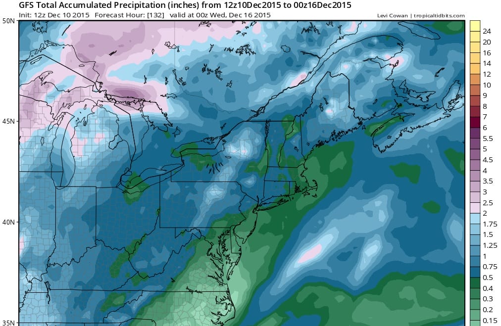
HEAVY RAIN POSSIBLE WITH COLD FRONT ON MONDAY
MODELS DIVERGE ON LONG RANGE OUTLOOK
JOESTRADAMUS HAS THE LATEST ON THE LONG RANGE
LONG ISLAND SHORT TERM FORECAST
NEW JERSEY SHORT TERM FORECAST
NEW YORK CITY SHORT TERM FORECAST
JOESTRADAMUS ON RISING TEMPERATURES AND VIDEO ANALYSIS