
Cool Temperatures And Sunshine Today, Friday & Saturday Look Nice,
Hoping Showers Fall Apart for Sunday

Cool Temperatures And Sunshine Today, Friday & Saturday Look Nice,
Hoping Showers Fall Apart for Sunday
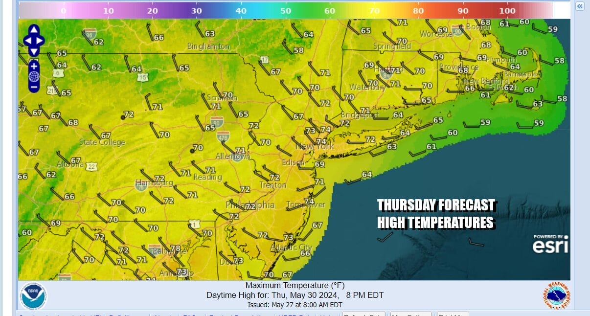
The northerly flow from Canada has brought some cooler air southward and we will be feeling that today. Yesterday we had the second of three upper troughs move through and showers and thunderstorms that were around last night are now moving away to the northeast through Southeast New England, and we look ahead to a day increasing amounts of sunshine. Most highs today will be in the range of 70 to 75 but some cool spots north and northwest of the coast might be closer to the 70 degree mark or even just under. A third upper trough is moving through New England today and offshore but other than some clouds, it should not be an issue.
SATELLITE WITH LIGHTNING STRIKES

WEATHER RADAR

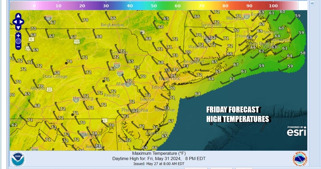
Tonight will be a cool clear night with most lows in warmer urban locations and the coast in the 50s while cooler inland areas will be in the 40s. Sunshine finishes off the work week as high pressure settles overhead. Temperatures will start to tick higher and Friday afternoon highs will be in the middle to a few upper 70s.
We have seen rain on at least one of the two weekend days for 16 consecutive weekends. Earlier this week it seemed that we would break that streak this weekend but now as we look to what is going on, it seems that Saturday is not and issue and is going to be the better of the two weekend days. We have a short wave trough and low pressure coming out of the Plains with some showers and thunderstorms.
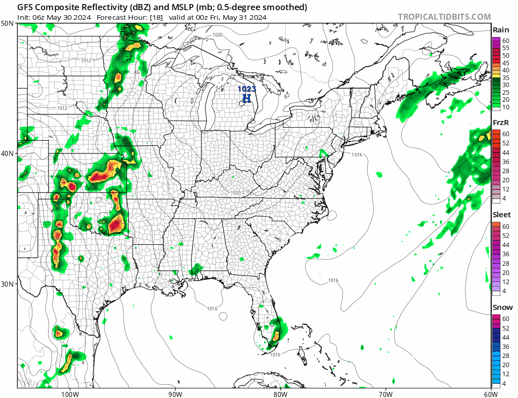
Models right now are having trough with this system and the GFS model shows it moving along and holding together enough to bring the chance for some showers late Saturday night into at least the first part of Sunday. For now we will have to include the chance for some showers for the Sunday time frame, hoping that the weaker models prevail in which case we will gladly take them out of the forecast. Even if it does rain, we are talking about a tenth of an inch or less of rainfall.

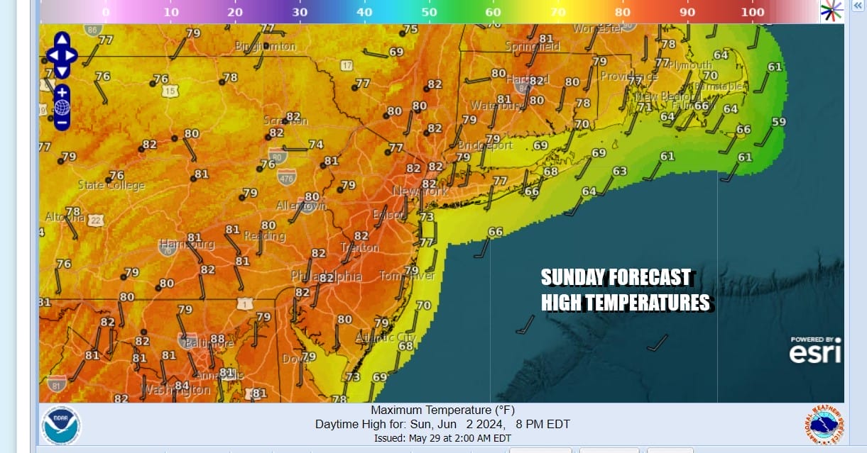
We should warm up into and through the weekend and Saturday will be a mainly sunny day. Temperatures will reach the 70s along the immediate coast before the ocean wind puts a halt on temperatures but highs should reach the 80s inland. Sunday is a bit tricky but if it turns into a more of a cloudy to partly sunny kind of day, highs Sunday should also reach the 80s away from the ocean.
Next week starts dry for the first half and it will be rather warm Monday through Wednesday. We could be no worse than partly sunny on all three days with highs in the 80s. The next important cold front will have a tough time moving east and it may not reach the East Coast until the second half of next week. This at least gives us a stretch of weather where rainfall is minimal.
BE SURE TO DOWNLOAD THE FREE METEOROLOGIST JOE CIOFFI WEATHER APP &
ANGRY BEN’S FREE WEATHER APP “THE ANGRY WEATHERMAN!
MANY THANKS TO TROPICAL TIDBITS FOR THE USE OF MAPS
Please note that with regards to any severe weather, tropical storms, or hurricanes, should a storm be threatening, please consult your local National Weather Service office or your local government officials about what action you should be taking to protect life and property.
(Amazon is an affilate of Meteorologist Joe Cioffi & earns commissions on sales.)


