Cool Breezy Partly Sunny Sunday Low Humidity Into Tuesday
The flow today has become a bit more onshore-ish which means that we have a wind more from the northeast and east. Being that we are on the edge of the frontal boundary to the south it is bringing in some clouds today. We also have a bit of instability thanks to a very weak trough in the upper atmosphere. Between these two factors we will see partly sunny skies today. There will probably be some more sun inland and a few more clouds along the coast.
SATELLITE

REGIONAL RADAR

An onshore flow can sometimes lead to lots of clouds, fog, and showers, but in this case there is a lot of dry air around so while we might see some showers develop on the radars to the east (as is the case offshore) we don’t see any issues here unless a shower sneaks in this in a couple of isolated spots over Long Island and coastal New Jersey. if you get a sprinkle or a shower it shouldn’t last too long. Temperatures today will be cool with highs just in the low to mid 70s.
LOCAL RADAR NEW YORK CITY

LOCAL RADAR PHILADELPHIA


Gradually tonight and Monday the high to the east rebuilds back westward and re-positions itself over Western New England. This re-enforces the dry air over us as skies should clear overnight with lows in the 50s to lower 60s. This sets us up for a nice day on Monday with a fair amount of sunshine, low humidity and highs in the 70s.
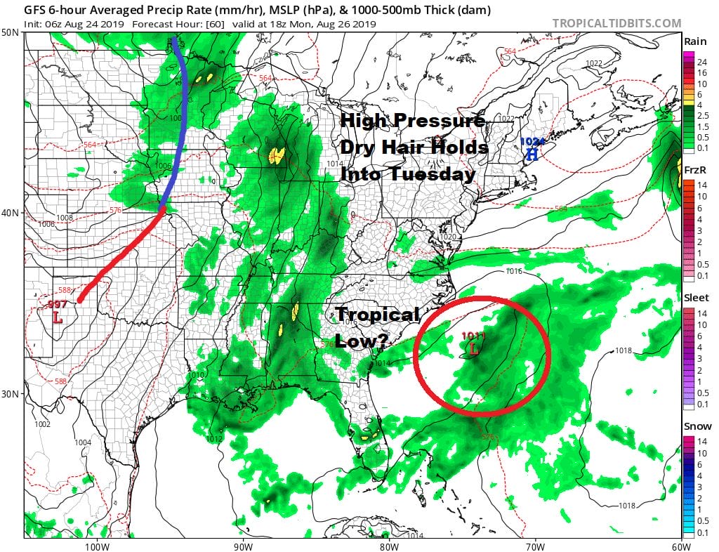
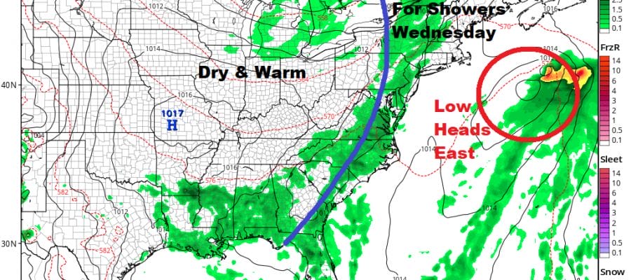
More than likely we will stretch this nice weather into Tuesday with sunshine and some clouds. The cold front to the west will take its time reaching the coast and not getting here until Wedneday. Meanwhile the low to the south off the North Carolina coast may or may not strengthen into a tropical storm. Either way it will move out to the northeast with no real impact here. Highs Tuesday will be in the 70s.
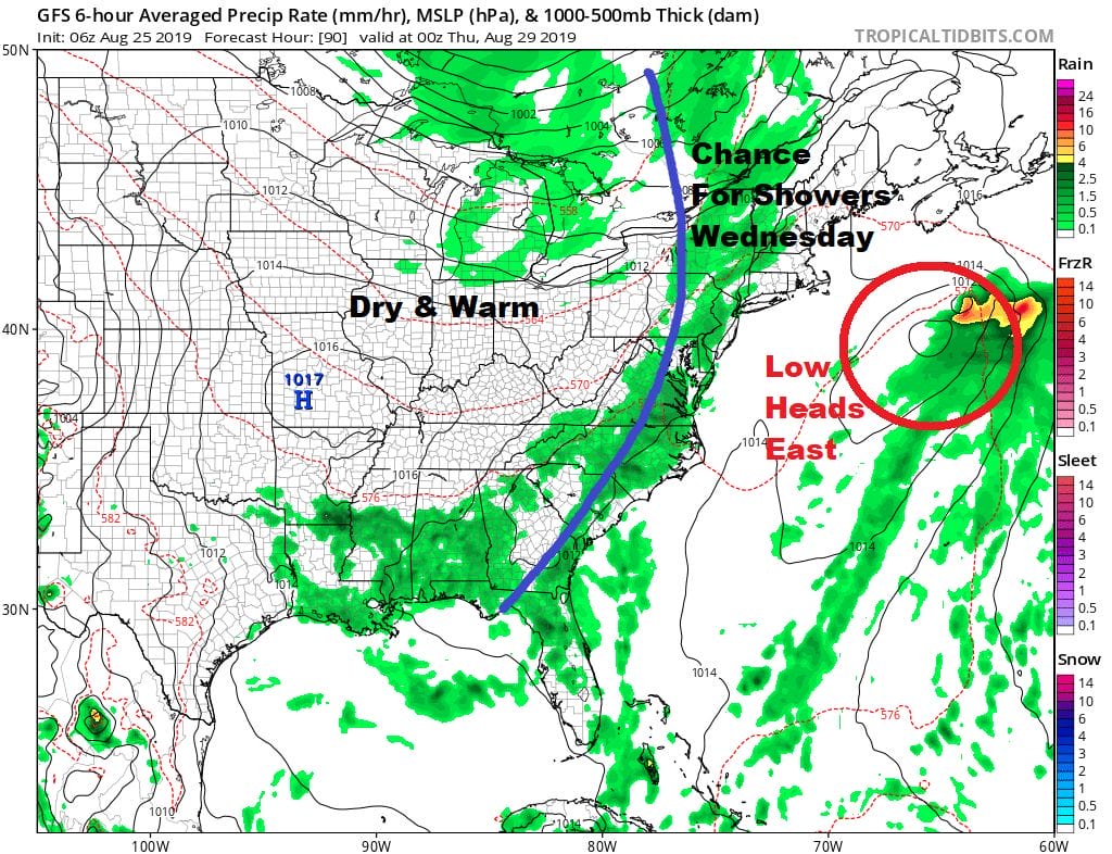
Wednesday sees the next cold front approach with the chance for some late day scattered showers but it will be partly sunny head of it with highs back into the 80s. The humidity will be higher Wednesday. Also note that at this point the offshore system is well out to the east and no factor here. Once the front passes Thursday and Friday look to be warm seasonal late summer days with some sunshine with highs in the low to mid 80s. Another front will pass Friday night with not much fanfare. Right now the Labor Day holiday weekend is shaping up to be a nice weekend with another high going by to our north putting us in a northeast flow, at least some sunshine each day with highs in the 70s.
MANY THANKS TO TROPICAL TIDBITS FOR THE USE OF MAPS
Please note that with regards to any tropical storms or hurricanes, should a storm be threatening, please consult your local National Weather Service office or your local government officials about what action you should be taking to protect life and property.


