
Coldest Air Arrives Cold Rain Ending
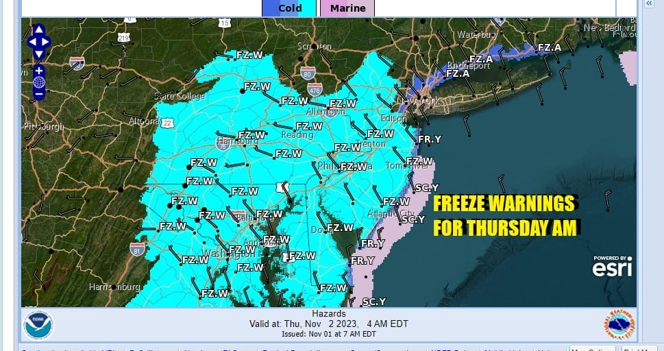
Frosts Freezes Tonight into Thursday Morning

Coldest Air Arrives Cold Rain Ending
Frosts Freezes Tonight into Thursday Morning
Low pressure is developing offshore as it feeds off the energy of a strong upper trough moving into the Northeast. This upper trough represents the coldest of this cold air mass and that is coming in behind the developing low offshore. Fortunately most of the energy is well to the east so we are dealing with a cold rain that will gradually end from west to east by early afternoon. It is possible that some areas could see some sleet or wet snow mixing in especially inland and in elevated areas.
SATELLITE WITH LIGHTNING STRIKES

WEATHER RADAR

Once the rain ends it will be breezy and temperatures will be going no where today as they hold mostly in the low to middle 40s at best and even holding in the 30s inland. Tonight we have freeze warnings up for much of New Jersey west and south. These areas will see the growing season come to an end. Almost everyone will be near or below freezing Thursday morning except for maybe the warmer urban locations which will be near or just above the freezing mark.

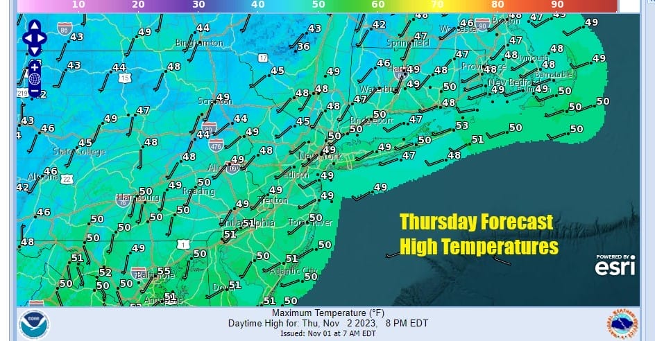
The core of the cold air mass will be overhead Thursday and this will be a day of sunshine. Most highs will be in the 40s to around 50. A west southwest flow begins Thursday and this will allow temperatures to moderate Friday and into the weekend. We will not be going up to record highs however as temperatures will get back to near average for this time of year.
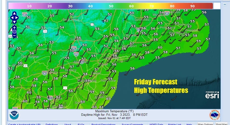
Thursday night into Friday morning we will be cold but the cold will depend on radiational cooling rather than a wide spread cold. We will also be off the lows of Thursday. This sets us up for a nice finish to the week with Friday being a day of sunsine and high temperatures reaching the mid to upper 50s.
it appears that for the first time in 9 weeks we are going to have a weekend with no rain on either weekend day! That is welcome news for everyone who frankly have been sick and tired of the weekends being partially or even totally washed out for two months. A cold front will stall to the north over the weekend so this will lead to some sunshine for both Saturday and Sunday. Highs both days will be in the low to middle 60s. The next chance for showers looks to be Monday night or two Tuesday as another cold front arrives from the west. No major storms are on the horizon at this point in the long range.
BE SURE TO DOWNLOAD THE FREE METEOROLOGIST JOE CIOFFI WEATHER APP &
ANGRY BEN’S FREE WEATHER APP “THE ANGRY WEATHERMAN!
MANY THANKS TO TROPICAL TIDBITS FOR THE USE OF MAPS
Please note that with regards to any severe weather, tropical storms, or hurricanes, should a storm be threatening, please consult your local National Weather Service office or your local government officials about what action you should be taking to protect life and property.
(Amazon is an affilate of Meteorologist Joe Cioffi & earns commissions on sales.)


