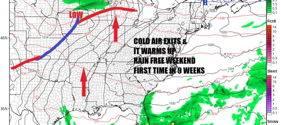
Cold Air Exits Warmer Next Several Days No Rain for the Weekend

Cold Air Exits Warmer Next Several Days No Rain for the Weekend
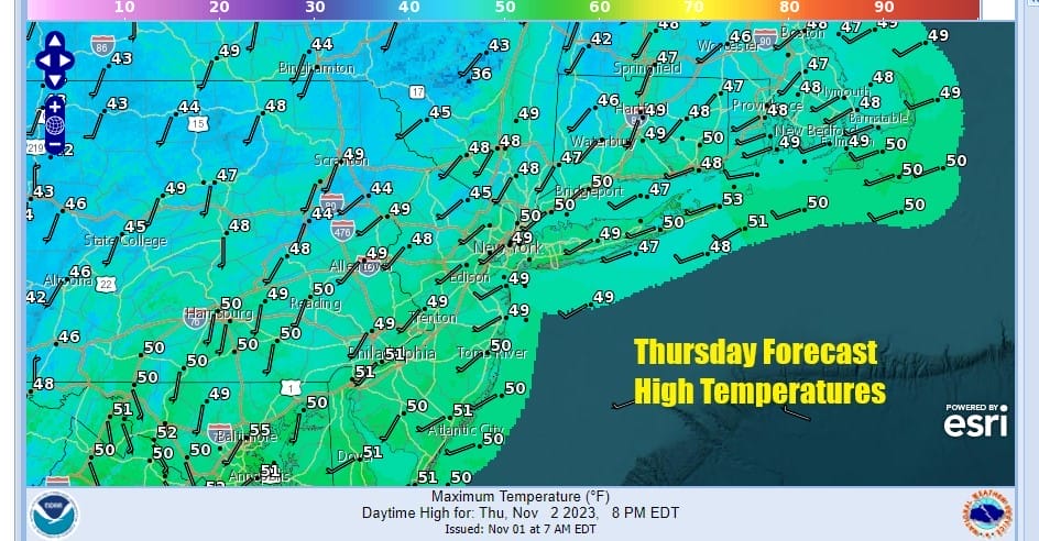
Most lows this morning were in the 20s in Eastern Pennsylvania to Southern New England with the exception of some of the warmer urban centers which hovered just above the freezing mark. The core of this cold air mass is now overhead and it will begin to slide to the east over the next couple of days. We will see lots of sunshine today with highs reaching the upper 40s and lower 50s. There are no issues on the radar and in fact we are about to do something we haven’t done in 9 weeks and that is have a weekend without any rain on either day! Tonight will be a night of clear skies and light winds so widepsread fronts is likely. Most lows will be in th 20s away from warmer urban areas and the warm spots will be in the mid to upper 30s by Friday morning.
SATELLITE WITH LIGHTNING STRIKES

WEATHER RADAR

There isn’t much going on storm wise across the Eastern US as well as the rest of the US. The only exception is the aPacific Northwest where a wave of storm systems are coming ashore. We are in what I would describe as an in and out pattern with weather systems moving along from west to east. Cold air masses come down from Canada and we warm up in between.

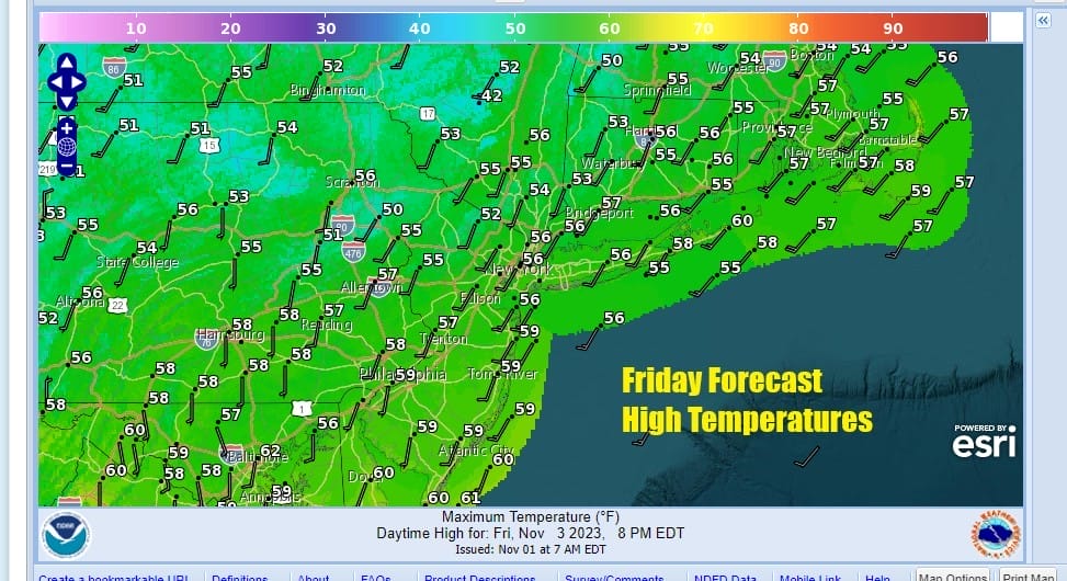
Friday and through the weekend and even into the start of next week we will be in one of those in between periods. Temperatures will start to bounce higher beginning Friday which will be a nice day of no worse than partly sunny skies. After a cold start highs will be in the middle to a few upper 50s.
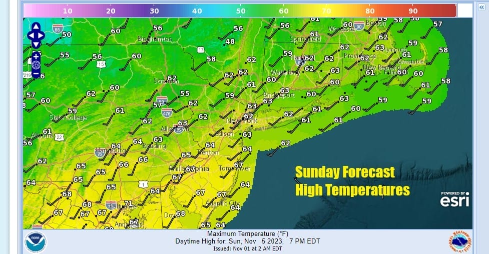
Over the weekend we see no weather issues with sunshine for both Saturday and Sunday or at least it will be no worse than partly sunny for Eastern Pennsylvania to Southern New England. After 8 weekends in a row of rain on at least one of the two weekend days, we have a weekend with no rain on either day. Highs Saturday should reach the upper 50s and lower 60s and the same holds for Sunday where we will see highs in the upper 50s and lower 60s. That is just about where we should be for this time of year.

No major storms are on the horizon as minor weather systems move across the country with cold fronts. One such system arrives next Tuesday with the risk of a shower so that leaves us with a partly sunny Monday and highs Monday will be in the low to mid 60s. Tuesday we will see clouds and the chance for a shower as the front goes by. Colder air should follow for the second half of next week but nothing extreme.
BE SURE TO DOWNLOAD THE FREE METEOROLOGIST JOE CIOFFI WEATHER APP &
ANGRY BEN’S FREE WEATHER APP “THE ANGRY WEATHERMAN!
MANY THANKS TO TROPICAL TIDBITS FOR THE USE OF MAPS
Please note that with regards to any severe weather, tropical storms, or hurricanes, should a storm be threatening, please consult your local National Weather Service office or your local government officials about what action you should be taking to protect life and property.
(Amazon is an affilate of Meteorologist Joe Cioffi & earns commissions on sales.)


