Colder Air To Arrive Sunday Below Average Temperatures All Next Week
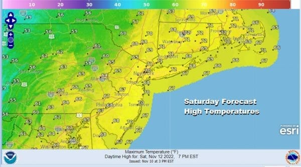
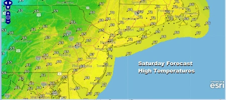
The overnight rains are now gone and we finished up with a solid inch or 2 in most places. Now we have the leftover warm air for today and we will see sunshine and that will mean that highs today will be in the warm low to mid 70s. However it won’t last because we have another cold front that will move through tonight. The clouds with that system are coming into view on the satellite loop however no additional rain is forecast today.
SATELLITE

WEATHER RADAR

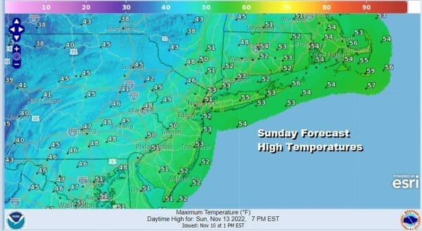
Tonight we will see this second cold front pass through and a wave will develop on that front offshore. There will probably be some showers around overnight but not everyone will see them. Most lows will be in the 40s to around 50. Colder air will arrive Sunday and temperatures probably will not go far off the morning lows in spite of sunshine. Most highs will be in the low to mid 50s but well inland highs will be in the upper 40s. This will also be accompanied by a gusty northwest wind.
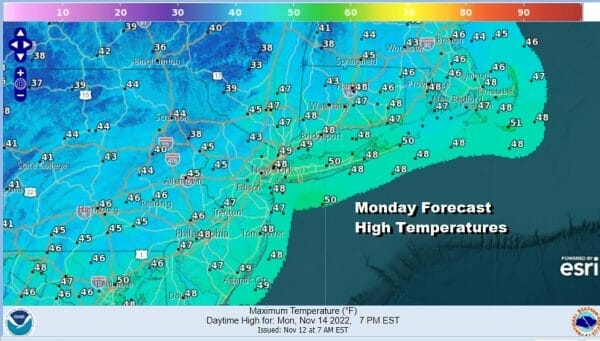
This sets us up for a cold Sunday night and the few remaining areas that have not seen temperatures below freezing will likely see 32 or lower. Most lows inland will be in the 20s and coastal and urban center lows will be in the lower 30s as skies will be mostly clear. Monday we will have sunshine but it will be cold with highs just in the 40s.
We will have another cold night Monday night into Tuesday morning with lows in the 20s to lower 30s. Tuesday look for sunshine early but clouds will arrive as the day wears on. Highs again will just be in the 40s.

Tuesday night into Wednesday we will see low pressure that will move across the South Monday into Tuesday nudge northward up the coast. Colder air will tend to pool inland thanks to a high to the north and a northerly wind. Meanwhile this low doesn’t have much with it but it will have some preciptiation that will probably be at our doorstep late Tuesday or Tuesday evening.
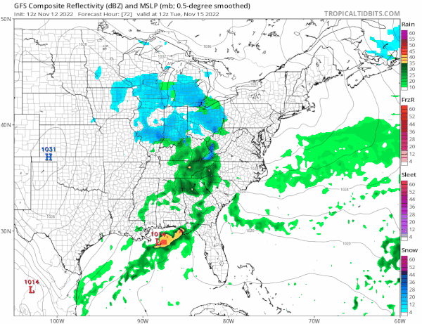
A cold rain arrives Tuesday evening and lasts into Wednesday as this weak system moves through. Some cold air will bleed southward from a high in Eastern Canada and that could produce a little snow in elevated areas mostly in Northeast Pennsylvania to the Catskills in NY to Vermont New Hampshire in Maine. Temperatures Wednesday will be in the 40s. Another low could follow at the end of the week. This one may have colder air to work with in the interior Mid Atlantic states which is why the GFS model shows snow there. Below normal temperatures regardless will be the driving theme this week.
BE SURE TO DOWNLOAD THE FREE METEOROLOGIST JOE CIOFFI WEATHER APP &
ANGRY BEN’S FREE WEATHER APP “THE ANGRY WEATHERMAN!
MANY THANKS TO TROPICAL TIDBITS & F5 WEATHER FOR THE USE OF MAPS
Please note that with regards to any severe weather, tropical storms, or hurricanes, should a storm be threatening, please consult your local National Weather Service office or your local government officials about what action you should be taking to protect life and property.


