Colder Air Moving In Freeze Watch Frost Advisory Tonight Inland

Weather in 5/Joe & Joe Weather Show Latest Podcast
Colder Air Moving In Freeze Watch Frost Advisory Tonight Inland

A cold front is moving across Pennsylvania and we are seeing clouds ahead of that front and there are also some showers on the radar. Those showers will likely weaken as they move east and while there could be a scattered passing shower or sprinkle, the main issue today is cloud cover and that will impact temperatures. Highs this afternoon will be in the low to mid 50s. That sets us up for a cold night tonight into Wednesday morning.
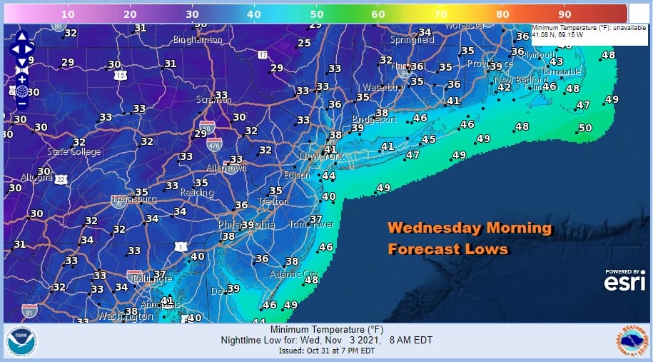
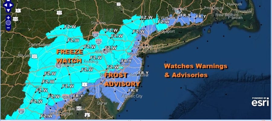
Warmer urban areas and the coast will see lows in the upper 30s and lower 40s but inland it will be a different story as temperatures approach freezing or even go below freezing in some places. Frost advisories are up for much of New Jersey, Southeastern NY, and Coastal Connecticut. A freeze watch is up for Northern New Jersey north and west of Route 287, Much of Eastern Southeastern and South Central Pennsylvania. Skies will be clear tonight.
SATELLITE

WEATHER RADAR

There are no real changes in the outlook going forward for the rest of the week and the weekend. First off Wednesday will be chilly with highs just in the upper 40s and lower 50s with sunshine and that sets up for an even colder night and another round of frosts and freezes Wednesday night into Thursday morning. Lows will be in the upper 30s to near 40 warmer urban centers and the coast and upper 20s and lower 30s inland.

Thursday will be the coldest day this week with sunshine and just some high clouds. Low pressure will be passing by well to the south and east and offshore with no radar issues. Highs Thursday will be just in the 40s to around 50 degrees and that is a solid 10 degrees below average. A cold night follows and then we should see temperatures bounce a little on Friday. It looks to be a sunny day with highs reaching back into the 50s.
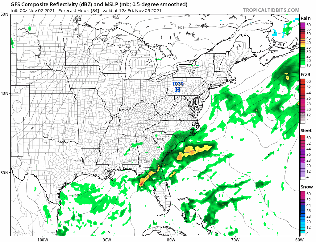
I dont’s see any issues for the weekend as a second wave develops off the Southeast US coast and strengthens as it moves northeastward. It will pass well to the south and east so precipitation is not going to be an issue. This should leave us in a good place with sunshine for both Saturday and Sunday. Perhaps some high clouds come up from the southern system but this should not be a big deal. Highs both days will be in the low to mid 50s. We could stay dry into the middle of next week depending on the action of the next cold front that arrives perhaps Monday night into Tuesday.
BE SURE TO DOWNLOAD THE FREE METEOROLOGIST JOE CIOFFI WEATHER APP &
ANGRY BEN’S FREE WEATHER APP “THE ANGRY WEATHERMAN!

MANY THANKS TO TROPICAL TIDBITS & F5 WEATHER FOR THE USE OF MAPS
Please note that with regards to any severe weather, tropical storms, or hurricanes, should a storm be threatening, please consult your local National Weather Service office or your local government officials about what action you should be taking to protect life and property.


