Colder Air Moves In Overnight Some Snow Wednesday Morning
Winter Weather Advisory Northeast NJ Counties, NYC,
Westchester County in the Lower Hudson Valley, Long Island & Connecticitut
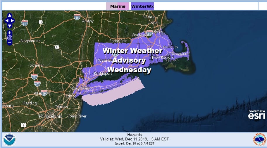
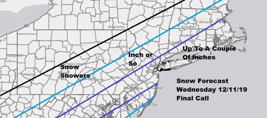
Nothing much has changed since this morning as far as the Winter Weather Advisories are concerned. No additional areas have been added nor have any been taken away. These take effect at 3am Wednesday morning. In the meantime we are seeing rain around this evening and we are waiting for the cold front to pass to the east which it will do so later this evening. My final call snow forecast is for a light event inside a range of 1 to as much as 3 inches in some places.

It is basically a straight line cold front with a flat wave of low pressure that moves along it. I don’t expect any surprises. Temperatures will drop to the lower 30s by morning and hover around or just above freezing. The intensity of the snow will drive accumulation. It would seem that given this is a relatively short duration event, main roads will likely stay wet and I’m not expecting major issues developing out of this.
SATELLITE

REGIONAL RADAR

We have rain going on this evening that is coming through in waves on the regional as well as the local radars. There are some heavier downpours in the mix as well. They are moving to the northeast. Each wave of rain helps the front to settle a bit further to the south.
LOCAL RADAR NEW YORK CITY

LOCAL RADAR PHILADELPHIA


During the early morning hours cold air makes its push southward and we see overrunning precipitation arrive. The NAM model late this afternoon was a bit of a yawn. It really is about a minimal amount of snow over a short period of time. I don’t see room for any upside surprises.

By 1pm the snow is long gone and it will just be breezy and cold for the remainder of the day. Temperatures will be in the 30s. Then we head down to the upper teens to mid 20s Thursday morning under mostly clear skies. Thursday will be a sunny but cold day with highs just into the 30s.

Next on the agenda is a coastal storm developing in the Northeast Gulf of Mexico and shooting right up the coast Friday night into Saturday. We will see a windswept soaking rain with a gusty east wind as low pressure moves north. There is no cold air. The air mass from Thursday moves out very quickly since we have no blocking whatsoever. Rain Friday night into Saturday could be on the order of a couple of inches in some areas especially along the coast. Drier weather follows on Sunday.
BE SURE TO DOWNLOAD THE FREE METEOROLOGIST JOE CIOFFI WEATHER APP &
ANGRY BEN’S FREE WEATHER APP “THE ANGRY WEATHERMAN!
MANY THANKS TO TROPICAL TIDBITS FOR THE USE OF MAPS
Please note that with regards to any severe weather, tropical storms, or hurricanes, should a storm be threatening, please consult your local National Weather Service office or your local government officials about what action you should be taking to protect life and property.


