Colder Air Arrives Snow Wednesday Night Thursday Morning
SHOP THE JOESTRADAMUS STORE
Colder Air Arrives Snow Wednesday Night Thursday Morning

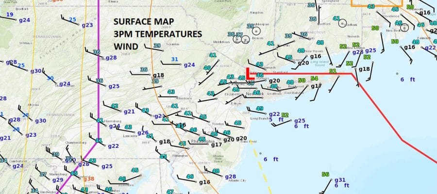
Low pressure is developing to the east and winds have already turned to the northwest. The real cold air is still to our west and there is a line of rain and snow showers ahead of it that is moving east. A few more showers will continue into this evening in some places and there could be a burst of snow in some areas as the cold air arrives. Otherwise it will be windy and colder and temperatures will continue to fall until we hit bottom Wednesday morning in the upper teens to middle 20s.
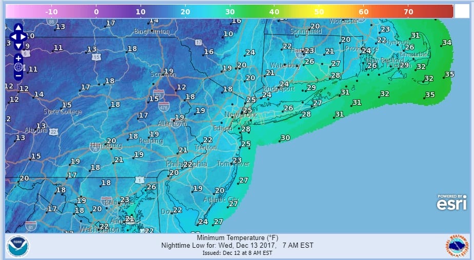
COLDER AIR WEDNESDAY MORNING LOWS
The satellite loop shows quite a bit of cloud cover to the west so it may take awhile for skies to clear out overnight but it should happen after midnight. The radars are still showing some precipitation and snow is now evident in lake effect areas as the lake effect machine revs up. In Northeast New York & New England moderate to heavy snow continues and winter storm warnings continue for much of the area north of Interstate 90.
SATELLITE LOOP

REGIONAL RADAR

LOCAL RADAR NEW YORK CITY

LOCAL RADAR PHILADELPHIA


Wednesday we should see sunshine before cloud arrive later in the day as the next clipper approaches. Temperatures Wednesday will have a tough time with most highs in the upper 20s to lower 30s. Then Wednesday night into Thursday morning the clipper to the west will move across Pennsylvania and then off the New Jersey coast.
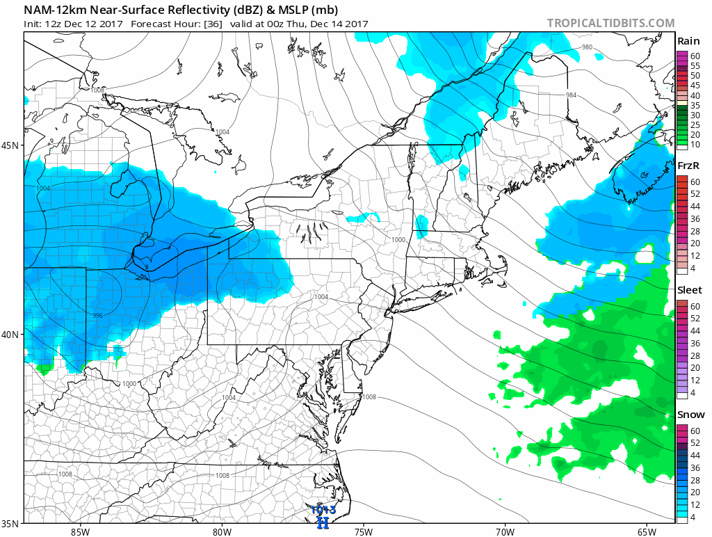
We think this will be a weak system and with support aloft not that strong it is possible that much of this could dry out west of the mountains. 1 to 2 tenths of liquid is being indicated and this translates to a coating to an inch or so in most areas. This suggests a coating to an inch in most places but some areas could see pockets of 1 to 2 inches. This area could shift further south but this looks to be a minor event unless something strange happens.
SNOW FORECAST WEDNESDAY NIGHT INTO THURSDAY MORNING

Snow should arrive after midnight Wednesday night and it should be done by early to mid morning on Thursday. Afterwards it is leftover clouds and some sun with temperatures in the low to mid 30s for highs before dropping into the upper teens to lower 20s. Friday we will see more clouds as another weak clipper swings east. This will trigger off a low to develop just offshore but models have continued to back away from any snow. Temperatures Friday will be quite cold with highs just in the 20s. For the weekend Saturday looks good but cold with sunshine with highs back into the 30s. Sunday is in question as another system approaches with the chance for some precipitation. Snow changing to rain seems to be in the cards here but there is some uncertainty as to how strong or weak a system will be approaching.
 GET JOE A CIGAR IF YOU LIKE

FiOS1 News Weather Forecast For Long Island
FiOS1 News Weather Forecast For New Jersey
FiOS1 News Weather Forecast For Hudson Valley


