Cold Weather Ahead Below Normal Temperatures into Next Week
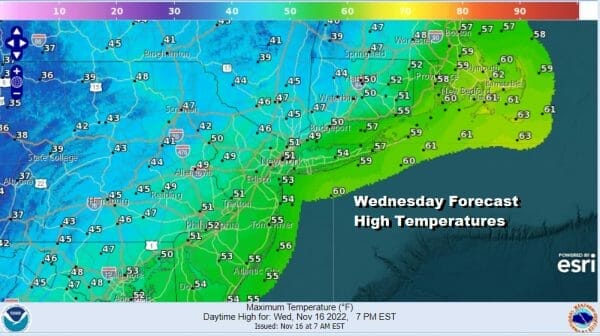
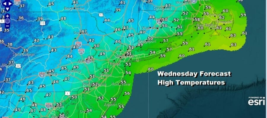
Last night’s weather system that brought some snow to inland areas and rain along the coast is now moving away from the Northeast and we are now going to begin what appears to be a long dry and cold stretch of weather that will take us through the weekend and into next week. Leftover clouds that are around will give way to some sun later today. Temperatures are going to reach the upper 40s and lower 50s as we deal with leftover air from yesterday. Radars shows rain and snow now up into New England and the radars should be silent going forward.
SATELLITE

WEATHER RADAR

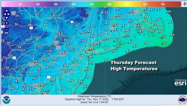
Tonight skies will clear and it will be cold with lows in the 20s in most inland spots and lower 30s in warmer urban areas and along the coast. Thursady we will see sunshine and a few clouds. It will be on the breezy side. Most highs will be in the mid to upper 40s.
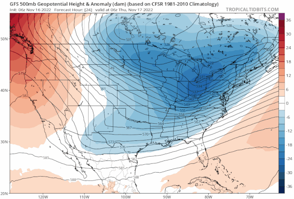
Over the next 6 days we will be under a strong upper flow from Canada with a series of upper trough moving through the Eastern US. The last one of these troughs will move through on Sunday and each one has a re-enforcing shot of cold air. This west to southwest flow aloft is also going to bring a major lake effect snow event for Western NY, Northwest Pennsylvania,and also for North Central NY east of Lake Ontario and north of Syracuse. In these areas the snow will be measured in feet.
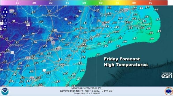
This makes the weather forecast rather easy. The southern part of the jet stream is suppressed so we need not worry about another storm system developing in this pattern. Thursday night will be cold with lows in the 20s and lower 30s. Friday we will see sunshine and a few clouds with highs in the low to mid 40s.
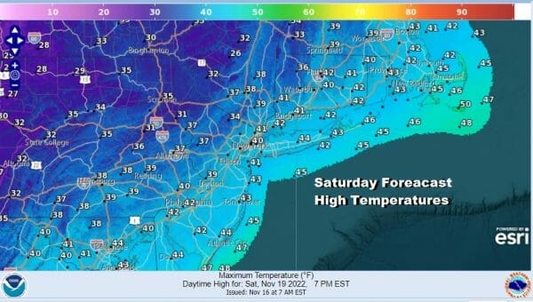
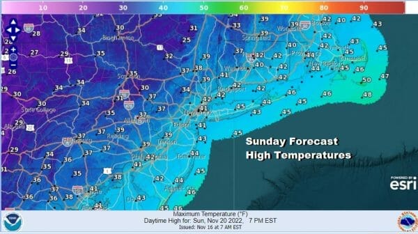
Over the weekend we will have the coldest of the air moving in but we will have sunshine and a few clouds for both Saturday and Sunday. The coldest air will come in during the day Sunday on gust northwest winds. Saturday highs will be in the upper 30s and lower 40s. Sunday highs will probably not get out of the 30s in most places.
Nights will continue to be cold through the weekend with lows in the 20s to lower 30s Saturday night and most lows Sunday night and Monday morning will be in the 20s. Next week the cold pattern relaxes but we don’t see any issues next week as temperatures moderate somewhat. The next chance for any precipitation will probably come late next week or next weekend from what we are seeing at the moment and that leaves us with dry conditions for Thanksgiving day and for travelers on getaway day next Wednesday.
BE SURE TO DOWNLOAD THE FREE METEOROLOGIST JOE CIOFFI WEATHER APP &
ANGRY BEN’S FREE WEATHER APP “THE ANGRY WEATHERMAN!
MANY THANKS TO TROPICAL TIDBITS & F5 WEATHER FOR THE USE OF MAPS
Please note that with regards to any severe weather, tropical storms, or hurricanes, should a storm be threatening, please consult your local National Weather Service office or your local government officials about what action you should be taking to protect life and property.


