Below Average Temperatures Into Monday Dry Through Thanksgiving Day
Storm System Possible Late Next Week
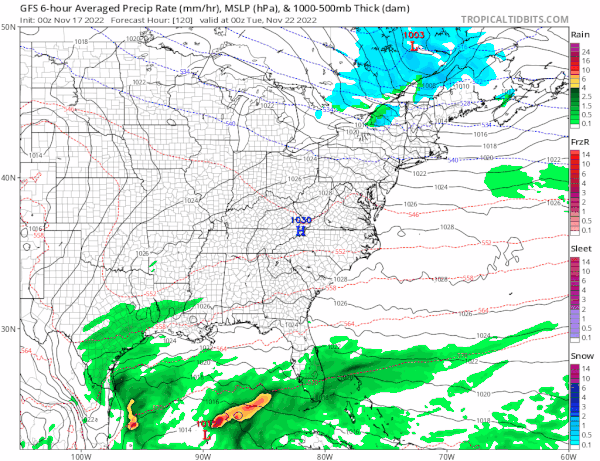
We have entered a cold dry period of weather. A series of upper troughs will be moving across the Great Lakes and Northeast through Sunday. While these troughs will not produce precipitation here they will be re=enforcing the cold with temperatures trending downward the next 4 days. We will see sunshine today with some passing clouds but high temperatures will only be in the low to mid 40s. The satellite loop shows clouds in Upstate NY and New England and by now you know that this set up is going to produce a lake effect snow event in Western and North Central NY where the snow has begun. When it is over, the snow will be measured in feet!
SATELLITE

WEATHER RADAR

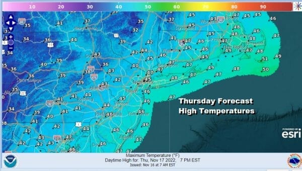
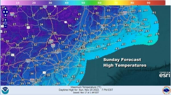
Tonight will be nice and clear here with lows by morning in the 20s inland and around 30 or so in the warmer urban areas and along the coast. Friday we will see sunshine and some clouds again but it is going to be cold. Highs will be mostly in the lower 40s with some inland highs not out of the 30s.
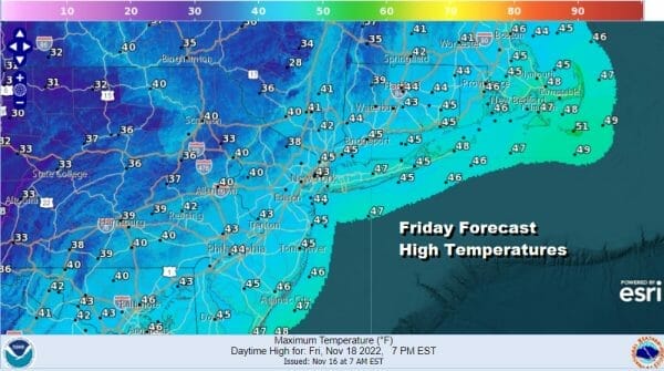
Friday night lows will be in the 20s to near 30 again. Saturday it is basically wash rinse repear with sunshine and some clouds. Highs will be in the upper 30s and lower 40s..
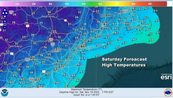
The coldest nights will be Saturday night and Sunday night as lows will be in the 20s with teens in cold spots inland and Sunday will be the coldest day of this stretch as the last upper trough moves through the Northeast US. Sunday highs will be just in the 30s to around 40 everywhere. We will have another day of sunshine and some clouds.
The core of this stream of cold air goes out on Monday so after another cold night Sunday night and Monday morning in the 20s, afternoon highs Monday with some sunshine should be back up into the 40s. Thanksgiving week looks to be dry through Thanksgiving day as temperatures moderate however late next week we will be turning our attention to storminess coming east out of the Plains.
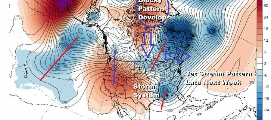
We have a blocky pattern developing in the North Atlantic as a blocking high over Scandinavia pushes into Greenland and forces pressures to rise there. That creates lower pressures to the south and the Plains system will head east rather than turn north toward the Great Lakes and Ohio Valley.
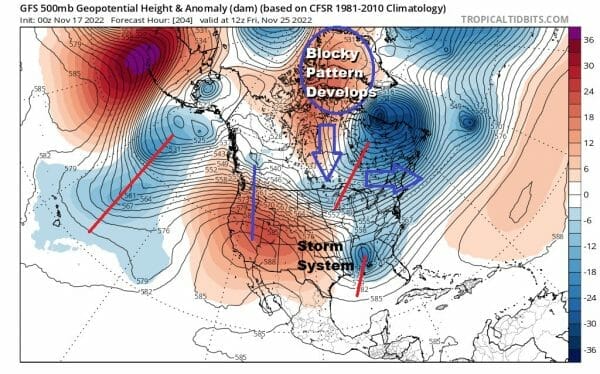
We have a ways to go before we can get a better sense of what could happen in the Northeast and Mid Atlantic. Cold air will be pressing southward late next week in this blocky set up so for now we will go with the idea that we will precipitation late next week and leave it at that for the moment. We can say for sure that Tuesday Wednsday and Thursday will be dry. Temperatures will head back toward seasonal, into the 50s, Tuesday and Wednesday before we see colder air start to bleed southward Thanksgiving Day which will be dry with highs at best in the 40s.
BE SURE TO DOWNLOAD THE FREE METEOROLOGIST JOE CIOFFI WEATHER APP &
ANGRY BEN’S FREE WEATHER APP “THE ANGRY WEATHERMAN!
MANY THANKS TO TROPICAL TIDBITS & F5 WEATHER FOR THE USE OF MAPS
Please note that with regards to any severe weather, tropical storms, or hurricanes, should a storm be threatening, please consult your local National Weather Service office or your local government officials about what action you should be taking to protect life and property.


