Cold Sunny Saturday Showers Later Sunday Windy Cold Monday Into Tuesday

Weather in 5/Joe & Joe Weather Show Latest Podcast
Cold Sunny Saturday Showers Later Sunday Windy Cold Monday Into Tuesday
We had a very cold start to our Saturday and this puts an end to the growing season. Even the larger urban centers around NYC and Philadelphia dropped down to the freezing mark and everyone else saw lows down in the 20s and even a few upper teens were noted in the usual cold spots. Now it is on to a nice sunny Saturday with temperatures that will top out only in the 40s.
SATELLITE

REGIONAL RADAR

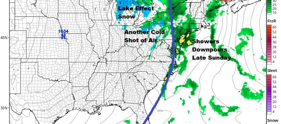
There isn’t much happening regarding the satellite today other than a few passing clouds and there is no precipitation showing up on the radars anywhere in the Northeast or Mid Atlantic states. Skies will start clear tonight but clouds will arrive ahead of the next cold front late tonight. Most lows will be in the 30s to near or just over 40.
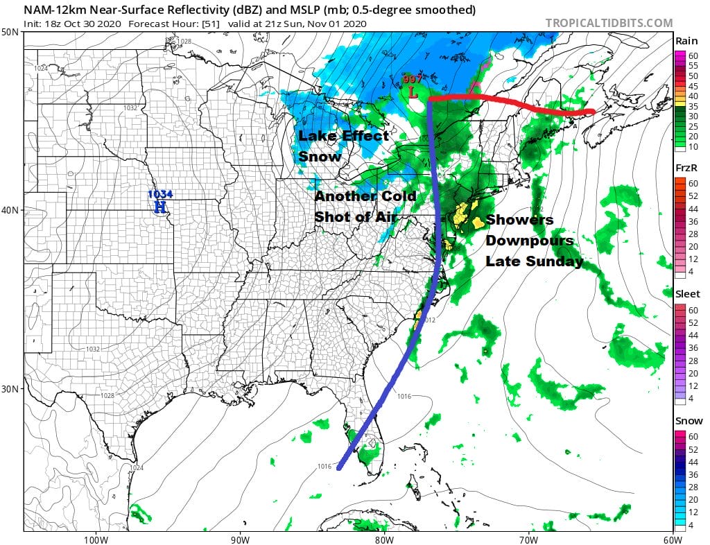
This cold front is connected to a strengthening low in Southeastern Canada and a deep upper trough that is moving through. Look for warmer temperatures in the 50s to near 60 but also there will be showers and downpours during Sunday afternoon and evening. Don’t be shocked if you wind up hearing a rumble or two of thunder.

Once the front moves out, it is going to turn rather windy Sunday night right into Tuesday morning as a storm strengthens in Maine and cold air gets shot southward. Winds from the northwest will gust to 30 to 40 mph at times especially along the coast. Monday we should see in and out clouds and sun with highs just in the 40s. Tuesday high pressure should build in with winds diminishing and sunshine. Highs will be in the 40s to around 50.

The next high goes into a good spot for a warm up and without being plagued by a marine layer. We should see nice weather at least into next Saturday along with warmer temperatures. Highs will be in the 50s to near 60 Wednesday and then in the 60s for Thursday and Friday and probably next Saturday as well. To the south on the lower right you will notice that the GFS is bullish on a tropical system now moving slowly across the Caribbean.

Showers and thunderstorms continue to become better organized and a tropical depression could develop at anytime today or Sunday as it moves westward. If this system becomes a tropical storm it will be named “ETA” and it will tie a new record as the most active season with 28 named storms. The other year this occurred was 2005. We will keep an eye on this one as there will be weakness in the flow longer term that could take this system northward.
BE SURE TO DOWNLOAD THE FREE METEOROLOGIST JOE CIOFFI WEATHER APP &
ANGRY BEN’S FREE WEATHER APP “THE ANGRY WEATHERMAN!
MANY THANKS TO TROPICAL TIDBITS FOR THE USE OF MAPS
Please note that with regards to any severe weather, tropical storms, or hurricanes, should a storm be threatening, please consult your local National Weather Service office or your local government officials about what action you should be taking to protect life and property.


