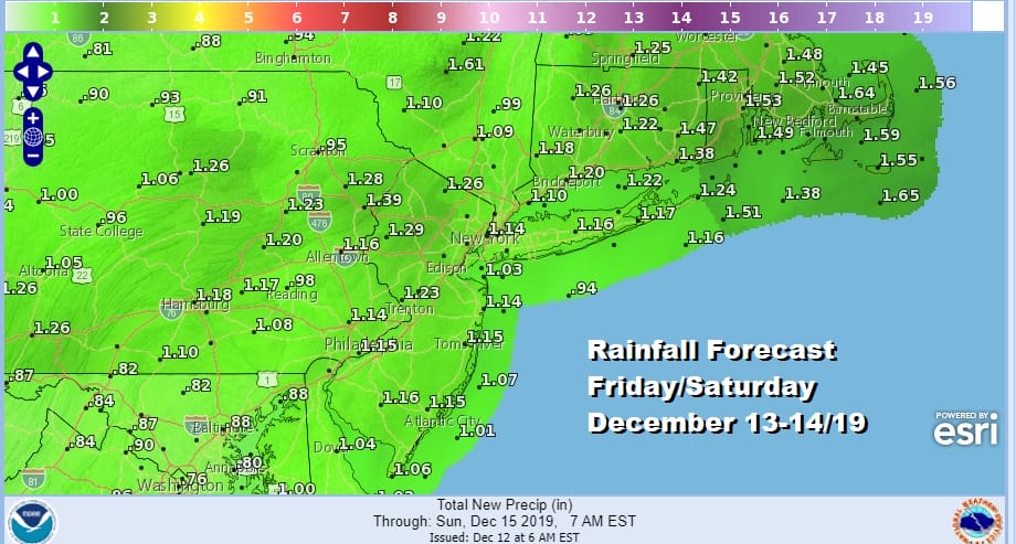
Cold Night Rain Arrives During Friday Into Saturday, Dry Colder Sunday
It was a day of ineffective sunshine and some patchy clouds as temperatures struggled to get above the mid 30s. The satellite picture this evening shows a hole of clear skies from Southern New England down into North Carolina. Clouds are developing off the Southeast coast back to the Gulf States as we set up for rain moving northward up the coast on Friday. Most of tonight should be clear but clouds will move in during the early morning hours. It will be a cold night in the upper teens to mid 20s for the lows. There are no issues on the regional radar at all.
SATELLITE

REGIONAL RADAR

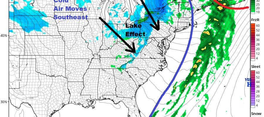
Friday we cloud up quickly with the chance for perhaps a little bit of sleet popping up in a few places. Then a steady rain develops by Friday evening from south to north and it will rain hard into Saturday morning. Then the rain shifts up into New England as low pressure runs up the east side of the Appalachians. Temperatures will rise into the 40s Friday and continue rising through the 40s to near 50 by Saturday morning.
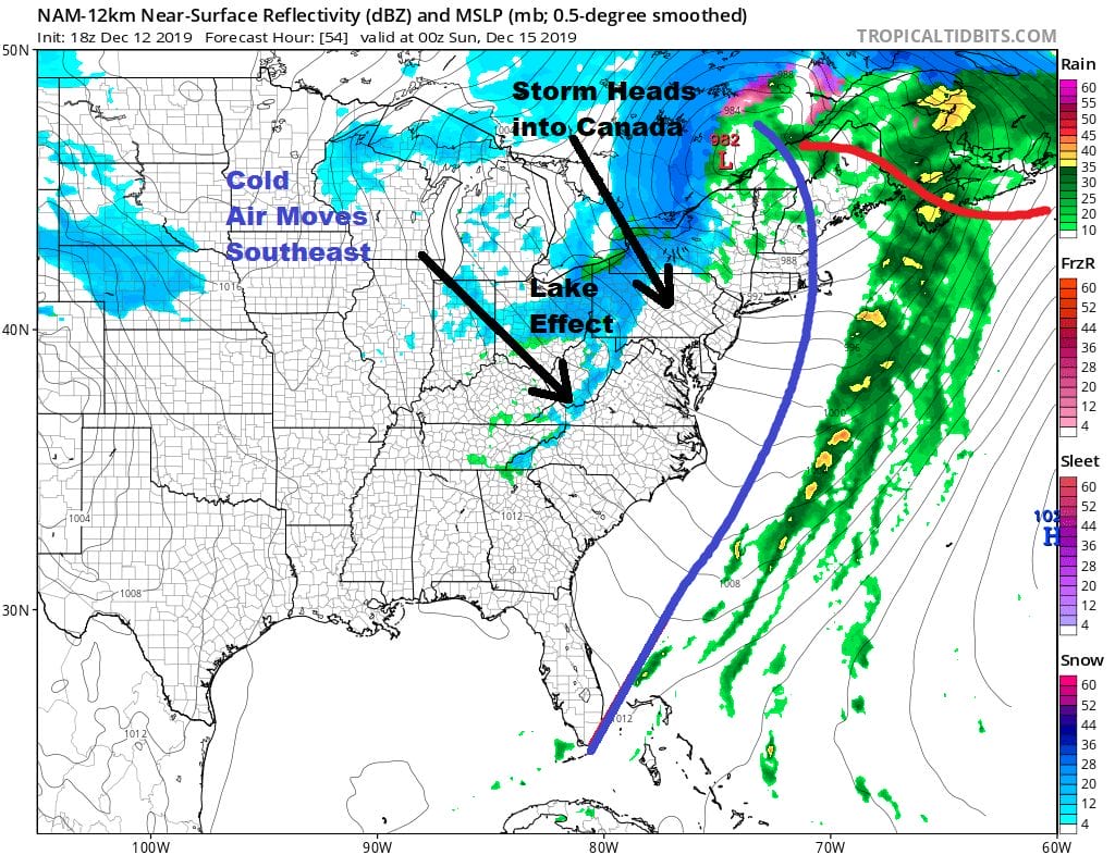
It looks as if weather conditions start to improve slowly on Saturday though there could be another few passing showers around. Then it turns windy Saturday night as our storm system heads into Canada and strengthens. Saturday’s highs will be in the 50s.

Sunday and Monday look like two better days though it will still be rather windy on Sunday with sunshine and clouds with highs in the 40s. Monday look for arriving clouds with highs mostly in the 30s as high pressure moves overhead and starts to weaken and the next weather system swings east out of the Southern Plains. Some snow and sleet could reach areas in Southern New Jersey and Southern Pennsylvania southward by midday Monday ahead of the main low which will be back in the Lower Mississippi Valley.

We will look for that low to head northeast toward West Virginia or Northwest Virginia with a secondary low developing offshore and moving east northeastward. Cold air will be there at the start before it retreats northward. This will be a round of wintry precipitation of snow to ice to rain Monday night into Tuesday. We still aren’t exactly sure about the Sunday storm as it moves to near Newfoundland. This might help to hold cold air in a bit longer in some areas. There is still plenty of time to watch wait and see how this all unfolds.
BE SURE TO DOWNLOAD THE FREE METEOROLOGIST JOE CIOFFI WEATHER APP &
ANGRY BEN’S FREE WEATHER APP “THE ANGRY WEATHERMAN!
MANY THANKS TO TROPICAL TIDBITS FOR THE USE OF MAPS
Please note that with regards to any severe weather, tropical storms, or hurricanes, should a storm be threatening, please consult your local National Weather Service office or your local government officials about what action you should be taking to protect life and property.