Cold Thursday Rain Friday Night Saturday Storm Moves Northward
We are starting our day with temperatures that bottomed in the teens to mid 20s. We have high pressure to the north of us that will bring us lots of sunshine today with just back into the 30s. This shot of cold air while impressive is also going to be moving out as fast as it moved in. There is no blocking whatsoever in the atmosphere and weather systems are progressing rapidly along. The next storm system will arrive on Friday and it will be all rain everywhere including as far north as northern New England.
SATELLITE

REGIONAL RADAR

We will do a repeat performance tonight with clear skies and light winds with lows in the teens to mid 20s. Then clouds roll in on Friday and temperatures begin to move quickly higher as winds go east and southeast. Highs will be in the 40s.
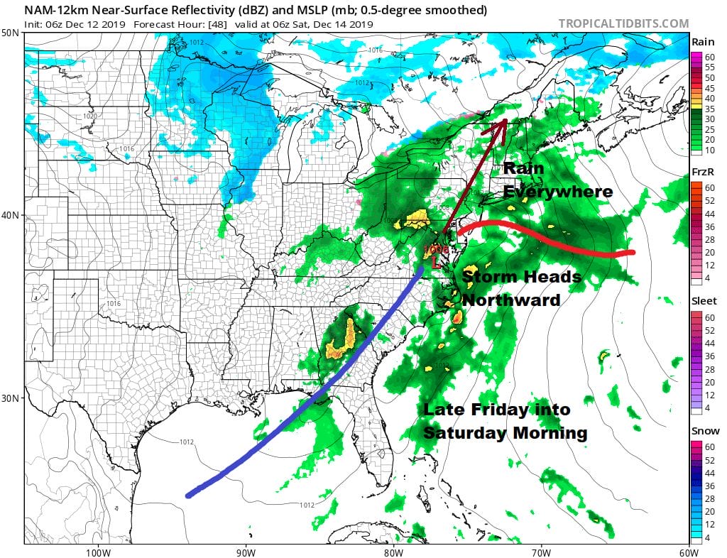
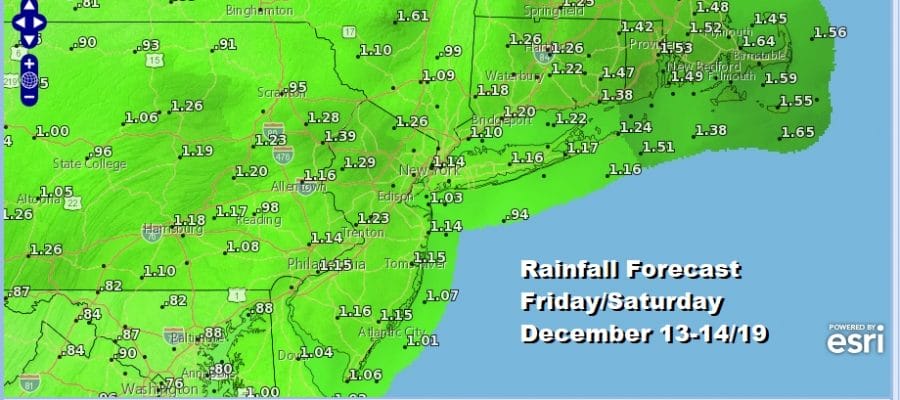
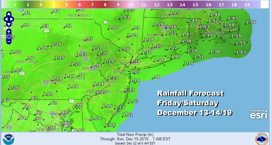
Patches of rain will arrive Friday afternoon and a steadier rain at night and on Saturday Low pressure moves up the coast either just inland or just offshore. It makes no difference either way since the cold air source was long gone. This system should be an inch to an inch and a quarter rain producer.
We should dry out and turn colder Sunday into Monday in a stair step fashion. Some sunshine returns Sunday but with a gusty wind with highs just in the 40s. Then Monday cold air builds into the northeast with a bit of a blocky pattern developing to the northeast and the next low coming out of the Southern Plains.

If the blocky low at 50 North/50 West is stronger than modeled or is at least as strong as the European suggests, we could see snow developing here late in the day Monday or Monday night and either snow inland or snow to ice or some rain along the immediate coast. I think there is actually a better chance this system gets squashed to the south rather than a primary passing well to the northwest

This obviously is an early look at the system for early next week. Lets focus first on Friday night and Saturday’s storm system since that pretty much sets the table for any outcome regarding next Monday night and Tuesday.
BE SURE TO DOWNLOAD THE FREE METEOROLOGIST JOE CIOFFI WEATHER APP &
ANGRY BEN’S FREE WEATHER APP “THE ANGRY WEATHERMAN!
MANY THANKS TO TROPICAL TIDBITS FOR THE USE OF MAPS
Please note that with regards to any severe weather, tropical storms, or hurricanes, should a storm be threatening, please consult your local National Weather Service office or your local government officials about what action you should be taking to protect life and property.


