
Cold Front Pushes East Ending Rain Later Today
& Bringing Sun Tuesday & Wednesday
ust a heads up…my power finally came back after 18 hours but my internet is still down so I am piggybacking off my hotspot on my phone. I should hopefully back to normal later today.
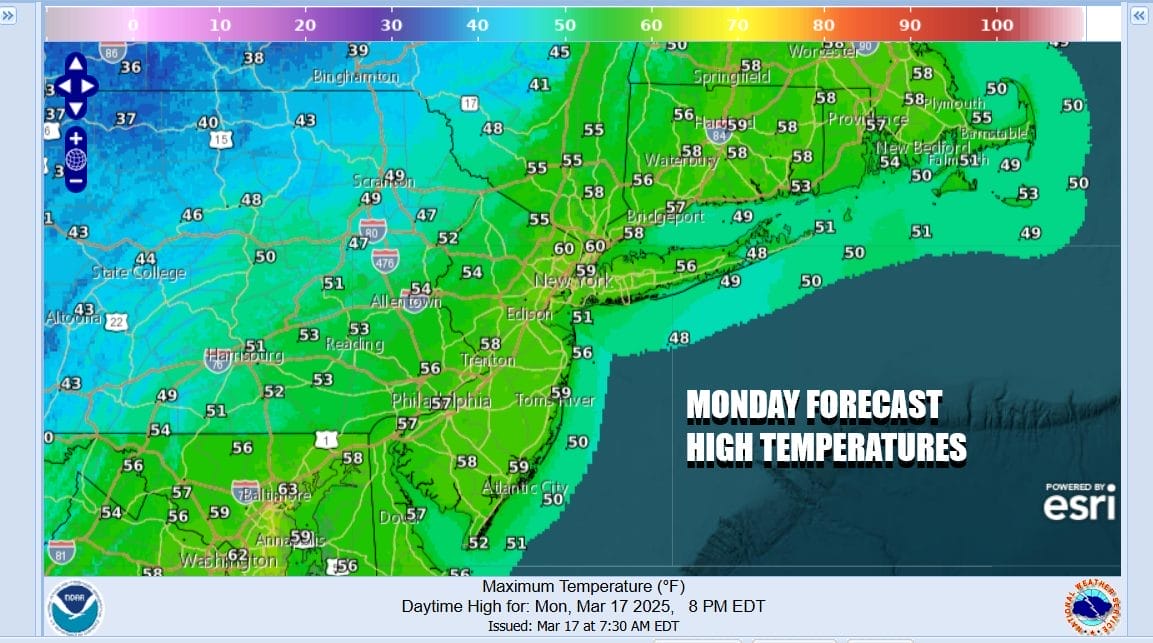
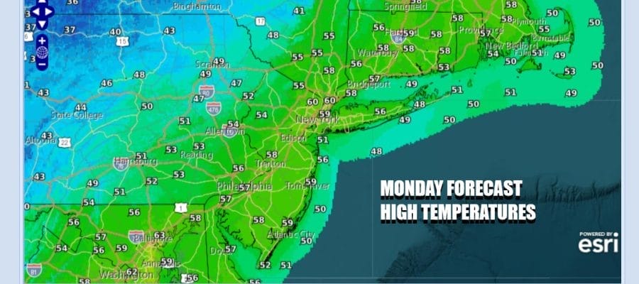
The major storm and severe weather producer in the Eastern US is redeveloping to the east on a slow moving cold front. We still have some work to do today leftover rain and leftover clouds. The heavier rain is over Eastern Long Island and Southeastern New England. Gradually as we move through the day the rain ends from west to east and we may see some decrease in cloud cover from west to east later this afternoon into this evening. Temperatures today will be mostly in the 50s.
SATELLITE WITH LIGHTNING STRIKES


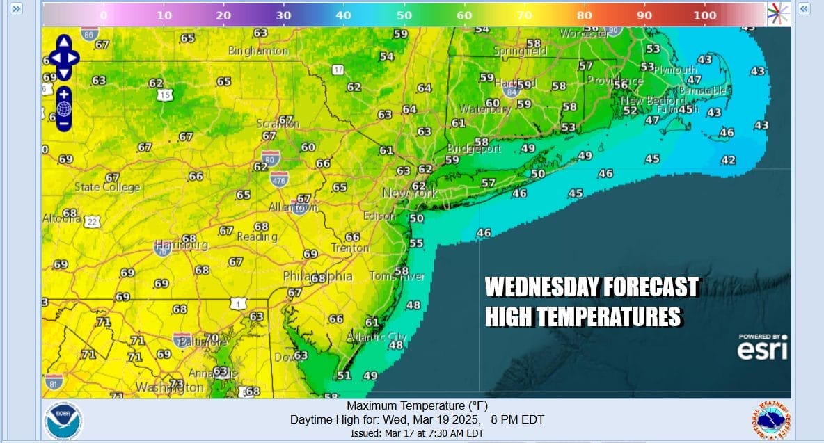
The slow moving front at least prolongs much needed rainfall and most areas are finishing up with anywhere from 3/4 inch to an inch and a half. Some areas in Southeastern New England will finish with 2 inches plus. The next few days will be dry and on the warm side of average. Weak high pressure builds in for Tuesday and Wednesday and another cold front approaches Thursday.

Low pressure develops in the Plains and heads for the Great Lakes this week and that will bring a cold front to the East Coast and the chance for showers or perhaps a thunderstorm or two Thursday. This is not a big deal type cold front like the one from the weekend so we do not see much concern for widespread severe weather issues.
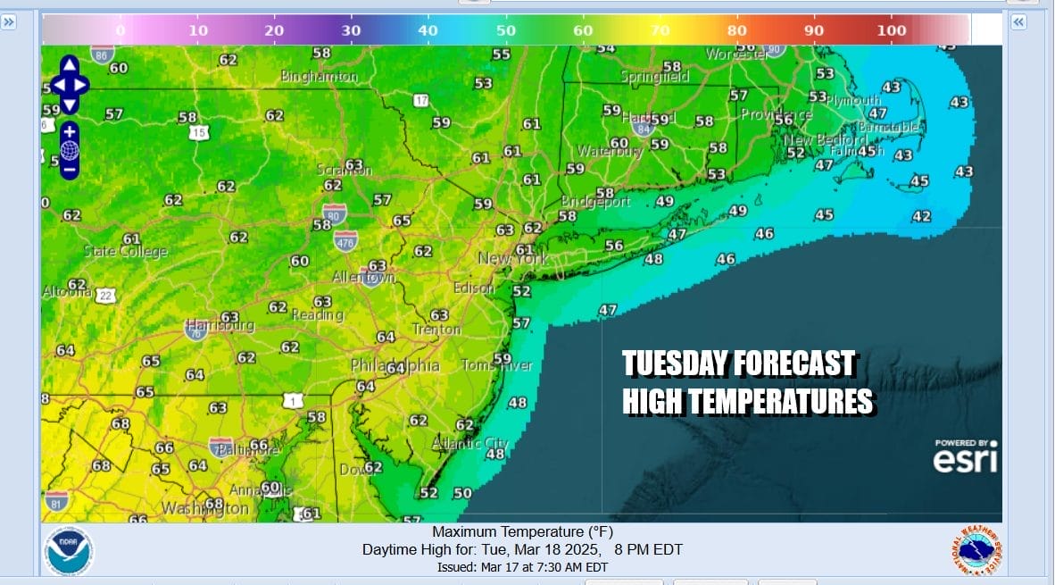
Tuesday is going to be a nice day with sunshine and some passing clouds. Highs will be in the lower 60s in most places. We should squeeze out another nice day Wednesday with sunshine taking highs into the low and middle 60s across Eastern Pennsylvania to Southern New England.
Thursday we look for any sunshine to give way to increasing clouds with highs in the low to middle 60s. Then we look for some showers Thursday night into Friday morning. There could be a thunderstorm or two in the mix but nothing severe. Colder air follows for Friday with leftover clouds and highs just in the 40s.
BE SURE TO DOWNLOAD THE FREE METEOROLOGIST JOE CIOFFI WEATHER APP &
ANGRY BEN’S FREE WEATHER APP “THE ANGRY WEATHERMAN!
MANY THANKS TO TROPICAL TIDBITS FOR THE USE OF MAPS
Please note that with regards to any severe weather, tropical storms, or hurricanes, should a storm be threatening, please consult your local National Weather Service office or your local government officials about what action you should be taking to protect life and property.


