Cold Front Passes With No Rain Colder Weather Next 2 Days
Another Cold Shot Sunday Into Monday

Cold Front Passes With No Rain Colder Weather Next 2 Days
Another Cold Shot Sunday Into Monday

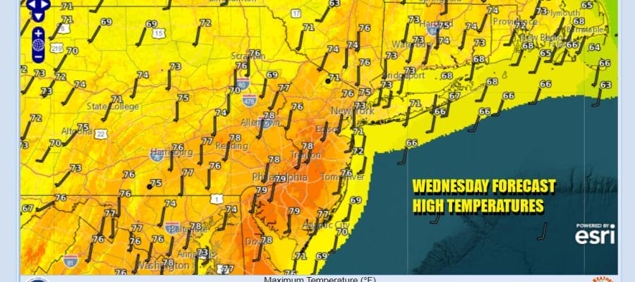
Another day of sunshine and another day of record breaking high temperatures lies ahead for the Northeast and Northern Mid Atlantic states. This is the last day of the very warm conditions as we do have a cold front that will be passing. You may hardly notice it other than a wind shift from the south to the northwest later today and tonight. Otherwise it is a mainly sunny day with highs reaching the upper 70s to lower 80s. The south southwest wind likely knocks a few degrees off the highs near coastal areas. Radars are nice and quiet and are on a long holiday vacation that shows no signs of coming to an end anytime soon.
SATELLITE WITH LIGHTNING STRIKES

WEATHER RADAR

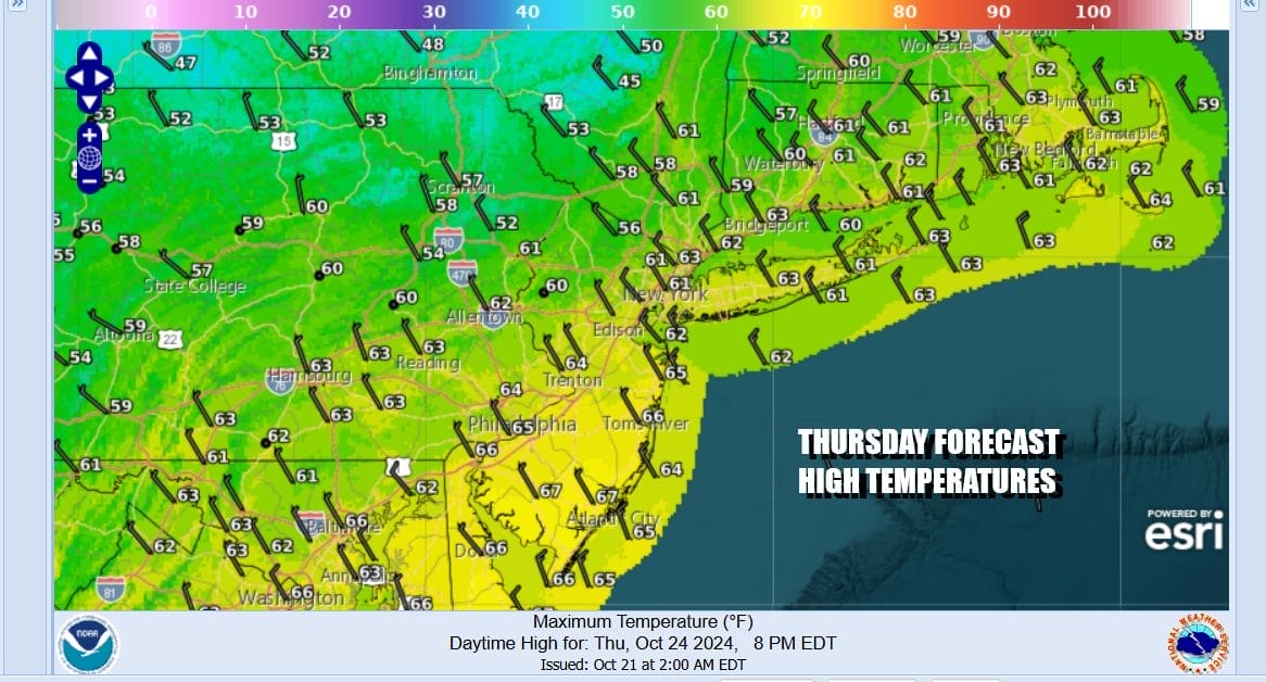
Tonight the front passes through and moves offshore. Temperatures overnight will likely remain in the 50s. Thursday with northwest winds and a new high building in from the north we have cooler air spreading southward. It will be a mainly sunny day but temperatures will be some 15 degrees cooler as highs will be mostly in the low to middle 60s.
This shot of cooler air isn’t anything to write home about and we will see that cool air hang around Friday. It will be another sunny dry day. We will start out the day with morning lows in the mid 30s to lower 40s. Friday afternoon highs will reach the low and middle 60s. No rain is forecast anywhere.

Over the weekend we will see another cold front and another high pressure area behind it. There won’t be much of a warm up ahead of the front which will ease through Friday night and early Saturday. Again you will hardly notice its passage other than a wind shift from the southwest to the northwest. There won’t be any showers with the front as everything is moisture starved.

What is remarkable with this weather pattern is the extent of dry air that covers just about the entire nation. As you watch the loop in motion, except for the Pacific Northwest and a couple of stray disturbances running around, there is no widespread precipitation anywhere. There are also no signs of the pattern breaking down because strong high pressure will build in the Eastern US leading to dry sunny days and another warm up later next week including Halloween.

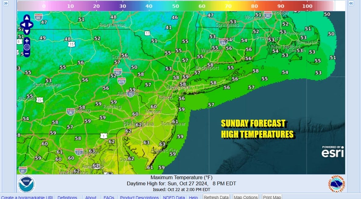
There are no weather issues whatsoever for the weekend. Saturday should be partly to mostly sunny. Highs should reach into the 70s before the cooler air starts to come in during Saturday night. Daytime highs Saturday will reach into the lower 70s in most places and then drop to the mid 30s to lower 40s Sunday morning. Sunday will be nice and sunny but cool with highs in the mid 50s to around 60 or so.
Next week starts off chilly. Monday morning lows will be in the upper 20s and lower 30s inland and mid 30s to near 40 coast and urban areas. Monday dayside will be nice and sunny but chilly with highs just in the 50s. The high moves offshore and another big warm up begins Tuesday. We could be back up close to 80 degrees by Halloween. Another weak front comes through Friday with another dry air mass behind that one. No rain is forecast for the entire week. Many cities in the Eastern US have not seen a drop of rain for the entire month of October and we could see may places set records for not only the driest October on record but the driest month ever!
BE SURE TO DOWNLOAD THE FREE METEOROLOGIST JOE CIOFFI WEATHER APP &
ANGRY BEN’S FREE WEATHER APP “THE ANGRY WEATHERMAN!
MANY THANKS TO TROPICAL TIDBITS FOR THE USE OF MAPS
Please note that with regards to any severe weather, tropical storms, or hurricanes, should a storm be threatening, please consult your local National Weather Service office or your local government officials about what action you should be taking to protect life and property.


