Cold Front Moving Through, Rain Snow Showers
Cold Front Moving Through, Rain Snow Showers
After a day of sunshine and temperatures in the 60s we are beginning to see changes with clouds moving in and arriving showers from the west. The ocean storm which has been sitting offshore for days is now moving away to the east northeast. This allows the storm in the midwest to move east and redevelop over Southern New England.
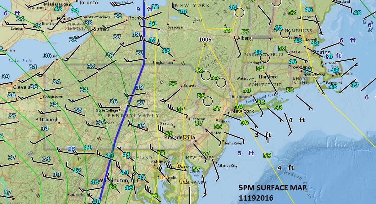
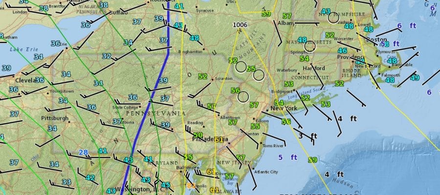
You can see the cold front on the surface map. Actually the front is east of the position observed on the NWS EED Display. Winds have already shifted to the northwest across all of Pennsylvania and are about to shift across New Jersey New York City, The Hudson Valley Long Island and Connecticut.


Radars will be busy overnight and look for rain showers which could change over to snow showers before ending tomorrow morning. Some areas across Northeastern Pennsylvania could see a coating to a couple of inches in spots. Elsewhere in Northwest NJ the Hudson Valley into Northwestern Connecticut, a coating to a inch of snow is possible though if it happens it will be mainly on grassy surfaces and possibly elevation driven to some degree.
The other issue tonight through Monday will be the wind and we will see northwest winds gusting to 40 mph or more at times. During Sunday we will see clouds with only a limited amount of sun breaking through and there will be on and off snow showers. Highs will just be in the low to mid 40s. Monday will be clouds with some sun and the risk for early snow showers. Highs in the upper 30s to lower 40s.
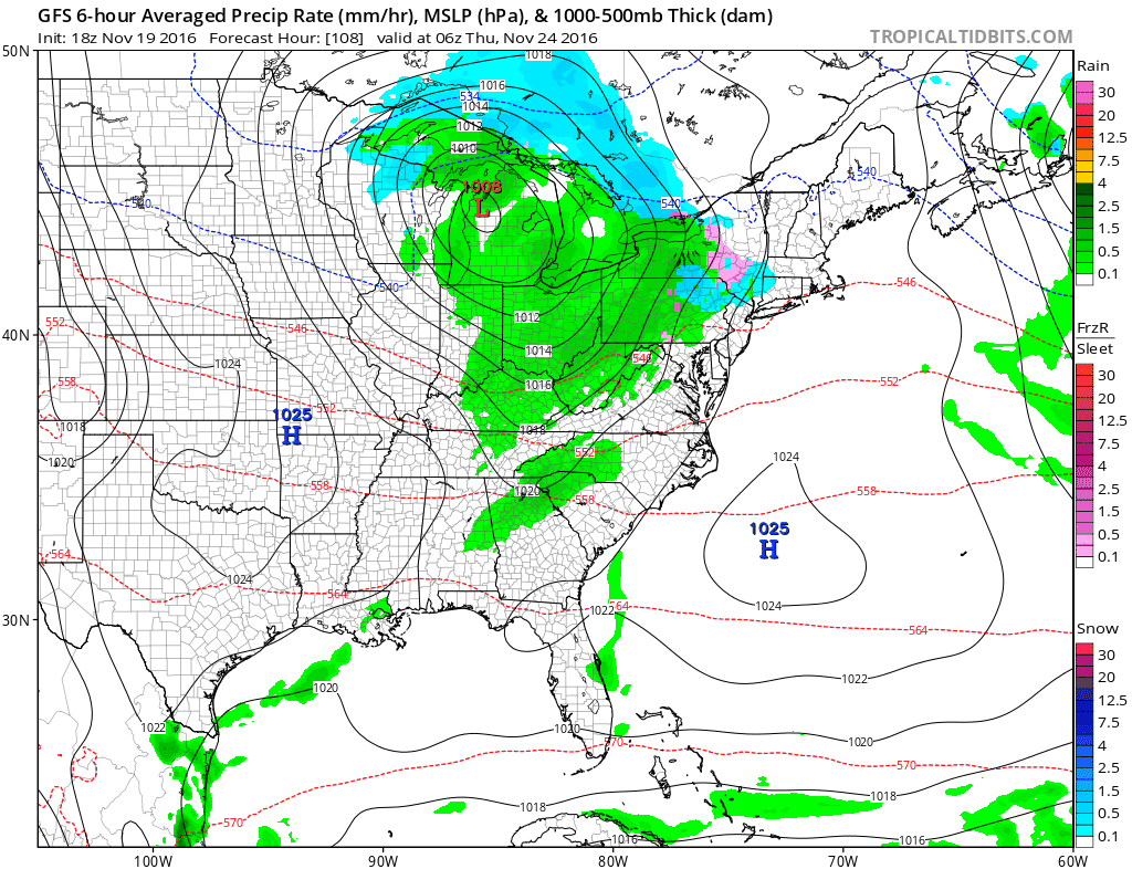
Tuesday and Wednesday look dry. Then low pressure heads to the Southern Great Lakes and redevelops off the New Jersey coast on Thanksgiving day. That sets us up for a cold rain though when precipitation arrives it could start as snow or sleet especially inland. Highs will continue to be in the 40s. Colder and drier air comes in Friday though there could be some snow showers at the end of this as a disturbance drops down from the north.
MANY THANKS TO TROPICAL TIDBITS FOR THE WONDERFUL USE OF THE MAPS
WINTER 2016-2017 FORECAST LINKS
SNOW REMOVAL COMPANIES FOR YOUR WINTER NEEDS
LONG ISLAND ROCKLAND COUNTY Connecticut

![]()

FiOS1 News Weather Forecast For Long Island
FiOS1 News Weather Forecast For New Jersey
FiOS1 News Weather Forecast For Hudson Valley
NATIONAL WEATHER SERVICE SNOW FORECASTS
LATEST JOESTRADAMUS ON THE LONG RANGE
Weather App

Don’t be without Meteorologist Joe Cioffi’s weather app. It is really a meteorologist app because you get my forecasts and my analysis and not some automated computer generated forecast based on the GFS model. This is why your app forecast changes every 6 hours. It is model driven with no human input at all. It gives you an icon, a temperature and no insight whatsoever.
It is a complete weather app to suit your forecast needs. All the weather information you need is right on your phone. Android or I-phone, use it to keep track of all the latest weather information and forecasts. This weather app is also free of advertising so you don’t have to worry about security issues with your device. An accurate forecast and no worries that your device is being compromised.
Use it in conjunction with my website and my facebook and twitter and you have complete weather coverage of all the latest weather and the long range outlook. The website has been redone and upgraded. Its easy to use and everything is archived so you can see how well Joe does or doesn’t do when it comes to forecasts and outlooks.
Just click on the google play button or the apple store button on the sidebar for my app which is on My Weather Concierge. Download the app for free. Subscribe to my forecasts on an ad free environment for just 99 cents a month.
Get my forecasts in the palm of your hand for less than the cost of a cup of Joe!


