Cold Front Arrives A Few Showers
Cold Autumn Weather Tuesday Through Thursday

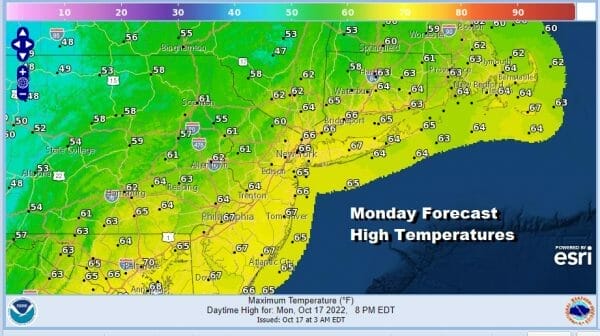
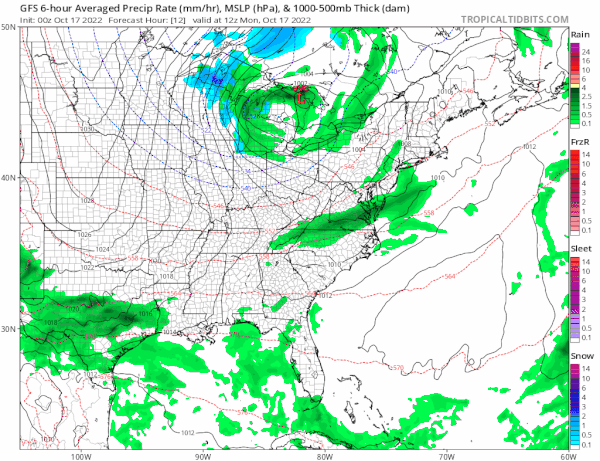
Today will be the transition day as a cold front and upper trough are swinging eastward. On the satellite loop we see clouds coming up from the southwest and moving northeast. They are remaining separate from the upper trough to the west with the colder air so this will at least prevent us from getting any kind of steady rains today. However there will be some showers around today as these two systems interact. Rainfall amounts will be on the light side with higher amounts in Southeastern New England.
SATELLITE

WEATHER RADAR

Since most of the area misses the steady rain to the south which shows up on the radar we will see clouds around today and that will hold temperatures down somewhat. Most highs will be in the low to mid 60s though you can see those cooler temperatures to the northwest and they will start coming in once the upper trough passes.
There will be some showers around tonight before the cold front finally clears the coast and that will happen during the early morning hours and that point any scattered showers will end and skies could start to clear out from west to east toward morning. Most lows along the coast tonight will be in the 40s but inland we will see lows drop into the upper 30s.
Tuesday will be a chilly day with clouds and some sunshine. The upper trough and a spinning low to the northwest will keep the air a bit unstable and there will also be a bit of a northwest breeze. Highs will in the low to mid 50s.

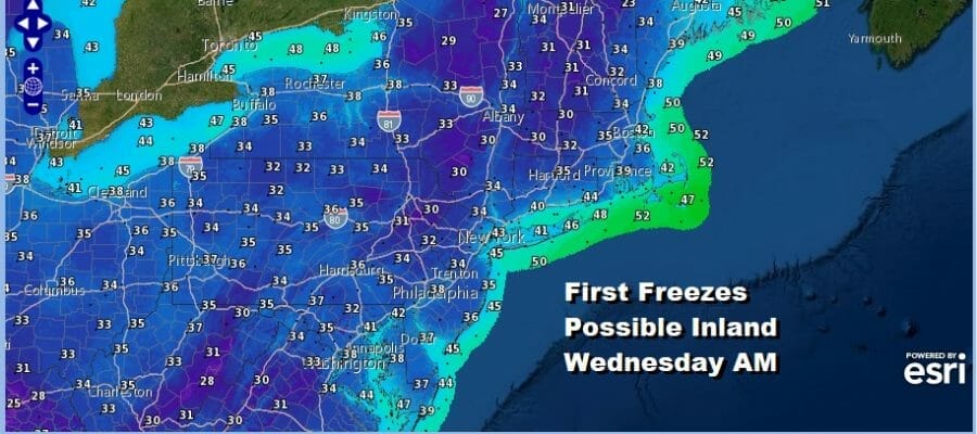
This will lead us to a cold Tuesday night into Wednesday morning. Warmer urban areas as well as coastal areas will probably bottom close to 40 degrees however inland we will see many areas drop to the low and middle 30s and that will mean some areas inland will see their first freezes of the season.

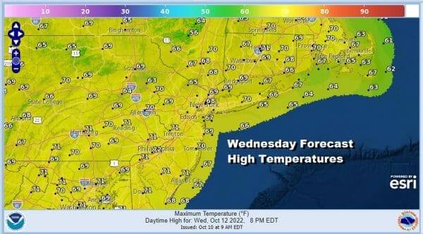
Wednesday will be a chilly day with sunshine and clouds with most highs in the upper 40s to near 50 inland and lower 50s warmer urban centers and along the coast.
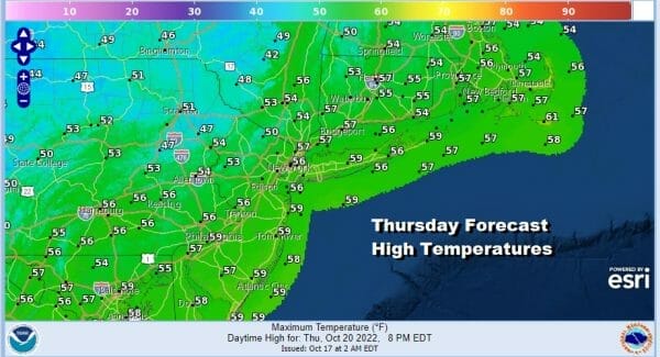
We will do it one more time Wednesday night into Thursday morning with clear skies and again coastal and warmer urban center lows will be around or just over 40 degrees while inland lows again will be in the low to mid 30s. Thursday the core of the cold air will begin to pull out. We will see sunshine Thursday with highs back into the 50s.
The chilly pattern of the last month will relax this weekend and that will allow temperatures to moderate. In addition a ridge will build in the Eastern US which will shield us from cold fronts until sometime early next week. To the east low pressure well offshore should not be an issue so Friday we will see sunshine with highs back to the upper 50s and perhaps a few lower 60s. The weekend will be typical of the time of year as we warm a bit through the 60s. High pressure to the northeast will keep things rain free and we will likely see nights and early mornings with some low clouds and some patchy fog and days with partly to mostly sunny skies. Highs both Saturday and Sunday will be in the middle to upper 60s. No major storms and the tropics are quiet so we are in rather good shape from that respect.
BE SURE TO DOWNLOAD THE FREE METEOROLOGIST JOE CIOFFI WEATHER APP &
ANGRY BEN’S FREE WEATHER APP “THE ANGRY WEATHERMAN!
MANY THANKS TO TROPICAL TIDBITS & F5 WEATHER FOR THE USE OF MAPS
Please note that with regards to any severe weather, tropical storms, or hurricanes, should a storm be threatening, please consult your local National Weather Service office or your local government officials about what action you should be taking to protect life and property.


